Isagarh, is a town in Ashoknagar District of Madhya Pradesh state in central India. It is the administrative headquarters of Isagarh tehsil.
Bansgaon is a town and a Nagar Panchayat in Gorakhpur District in the state of Uttar Pradesh, India. Originally, it is said that the place was occupied by Shrinet Rajputs, who still commemorate their conquest by assembling in the month of Asvina to offer sacrifice (blood) at the ancient temple of Kuldevi (bansgoan).Shrinet Rajputs are originally from Srinagar, Uttarakhand.
Bhandardaha is a census town in Domjur CD Block of Howrah Sadar subdivision in Howrah district in the state of West Bengal, India.
Bidasar is a city and a municipality in Churu district in the state of Rajasthan, India. Bidasar is named after Bidawat Rathores, who descended from Bida, son of Rao Jodha. It is also the birthplace of prominent Bengani's.
Choornikkara is a census town and in Aluva in Ernakulam District in Kerala, India. It is also the headquarters of the Choornikkara gram panchayat
Dakshin Jhapardaha is a census town in Domjur CD Block of Howrah Sadar subdivision in Howrah district in the state of West Bengal, India.
Dhampur is a city and a municipal board in Bijnor district in the state of Uttar Pradesh, India. It is located at 29.51°N 78.50°E, and lies in Northern India.
Dharmapur is a census town in Chinsurah Mogra CD Block in Chinsurah subdivision of Hooghly district in the state of West Bengal, India.
Gothra is a census town in Jhunjhunu district in the Indian state of Rajasthan.
Jourian is a town and a notified area committee in Jammu district in the Indian administered union territory of Jammu and Kashmir.
Khalia is a census town in Bally Jagachha CD Block of Howrah Sadar subdivision in Howrah district in the Indian state of West Bengal. Khalia is under the jurisdiction of Liluah Police Station of Howrah City Police.

Kothavalasa is a town in Vizianagaram district of the Indian state of Andhra Pradesh. It is located in Kothavalasa mandal of Vizianagaram revenue division. It is located 30 km from the city of Visakhapatanam
Kurud is a town and a nagar panchayat in Dhamtari District in the Indian state of Chhattisgarh.
Nallur (Nalloor) is a panchayat town in Kanniyakumari district in the Indian state of Tamil Nadu.
Pipili is a town and a NAC under jurisdiction of Puri district in the Indian state of Odisha. It is famous for designing beautiful Applique handicrafts. It is a town of artisans famous for their colourful fabrics.
Sualkuchi is a census town in Kamrup district in the Indian state of Assam. It is situated on the north bank of the river Brahmaputra, about 35 km from Guwahati, Sualkuchi is a block of Kamrup District. It has large number of cottage industry engaged in handloom, for which it is also known as the "Manchester of Assam".
Santoshpur is a census town in Uluberia II CD Block of Uluberia subdivision in Howrah district in the Indian state of West Bengal.
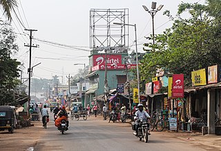
Gudari is a town and a Notified Area Council (N.A.C.) in Rayagada district in the Indian state of Odisha. Gudari got the Status of N.A.C in 1972.It is the 3rd biggest town in Rayagada District followed by Rayagada and Gunupur in 1st and 2nd .As of Latest India census,[3] Gudari has a population of 16,708
Theroor is a panchayat town in Kanniyakumari district in the Indian state of Tamil Nadu.
Shirahatti is a panchayat town in Gadag district in the Indian state of Karnataka.

