
Sakti is a city and a district in the state of Chhattisgarh. The assembly constituency number of District Sakti is 33, Earlier it was the only Education District of Chhattisgarh. There are 245 panchayats and 458 villages under Sakti district. Sakti district was formed on 15 August 2021 And came into complete district existence on 9 September 2022 by then Chief Minister Bhupesh Baghel.

Ambikapur is a city and headquarters of Surguja district in the Indian state of Chhattisgarh. It is one of the oldest cities in the state, in east-central India. Ambikapur is also the divisional headquarters of Surguja Division which consists of the six districts of Surguja, Korea, Manendragarh, Balrampur, Surajpur and Jashpur.

Raigarh district is a district of the central Indian state of Chhattisgarh. Raigarh is the district headquarters.
Korba is a city and an industrial area in Korba District in the Indian state of Chhattisgarh. Korba was part of Bilaspur District before 25 May 1998. It was later designated as a separate district for ease of administration, but is still under Bilaspur Division.

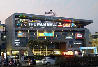
Raigarh is a city in northern Chhattisgarh known as the 'Cultural capital of Chhattisgarh'; Raigarh is famous for its dance form “Kathak” and classical music; Raigarh is also known as Sanskritidhani.

Katni officially Murwara is a city on the banks of the Katni River in Madhya Pradesh, India. It is the administrative headquarters of Katni District. It is in the Mahakoshal region of central India. The city is 90 km (56 mi) from the divisional headquarters of the region, Jabalpur.
Akaltara is a nagar palika and tehsil in Janjgir-Champa district in the state of Chhattisgarh, India. It is the birthplace of a great freedom fighter Thakur Chhedi Lal (Barrister). Akaltara has a member in legislation assembly of Chhattisgarh state, which is now represented by Saurabh Singh of the Bhartiya Janta Party. It is under Janjgir Parliament seat, which is represented by Mrs. Kamla Devi Patle.

Baloda Bazar is a nagar palika parishad in Baloda Bazar district in the Indian state of Chhattisgarh. Its PIN code is 493332. On 15 August 2011, it was declared as a district. Baloda Bazar is also called Cement hub of Chhattisgarh because there are many reputed cement plants like Ambuja Cement Rawan, Nuvoco Cement Sonadih, Nu Vista Cement Risda, Shree Cement Khapradih, UltraTech Cement Hirmi, UltraTech Cement Rawan, Ultratech Cement Kukurdih, etc.
Dharamjaygarh is a town and a nagar panchayat in Raigarh District in the state of Chhattisgarh, India. Major languages spoken are Hindi and Chhattisgarhi, with a little Odia, Bengali and English. Laljeet Singh Rathia is a current MLA of the Dharamjaigarh constituency.
Prithvipur is a town and a nagar parishad in Niwari district in the Indian state of Madhya Pradesh. It is the administrative headquarters of Prithvipur tehsil in the Niwari sub-division of the district.
Rajakhera is a city and a municipality situated near the banks of the Chambal River in Dholpur district in the Eastern part of the Indian state of Rajasthan. Its part of Braj region and the local language has Braj Bhasha dialect. The culture is fused with Rajasthan and its border states.

Sonkatch is a town and a Nagar panchayat in Dewas district in the Indian state of Madhya Pradesh. It's also a Tehsil headquarter of District.
Susner is a town and a Nagar panchayat and Sub division in Agar Malwa district in the Madhya pradesh state of India. Its also a tehsil and a assembly.
Takhatpur is a Nagar Palika in Bilaspur district in the Indian state of Chhattisgarh.

Baloda Bazar - Bhatapara is a district in Chhattisgarh state of India with its headquarters at Baloda Bazar. Before its creation, it was a part of Raipur district. The border of Balodabazar-Bhatapara district touches Bemetara, Mungeli, Bilaspur, Janjgir, Raigarh, Mahasamund and Raipur districts. According to the prevalent tradition in relation to the naming of the Balodabazar in the past, the traders of Gujarat, Haryana, Maharashtra, Orissa, Barar etc. used to gather in the market buffaloes of the city to sell the buffalo, buffalo (Boda). As a result, its name became popular in the name of the bullboda market and in the form of the Baloda Bazar.

Kumarsain, also known as Kumharsain, is a town in Shimla District in the Indian state of Himachal Pradesh. Formerly under the British Raj, it was the capital of princely state of Kumharsain, which was one of the several states of the Punjab States Agency. It is about 80 km from Shimla and famous for apple and cherry orchards.

Lakkhiram Agarwal was an Indian politician from the Bharatiya Janta Party (BJP). He was a member of the Rajya Sabha from 1990 to 2002 representing Madhya Pradesh and later Chhattisgarh. He was the state president of the BJP in Madhya Pradesh from 1990 to 2000, and became the state president of Chhattisgarh BJP after the bifurcation of Madhya Pradesh.
Umesh Nandkumar Patel is an Indian politician, from Chhattisgarh. He is a member of the Indian National Congress and has been the president of the Chhattisgarh Youth Congress Committee since 10 September 2016. He represents the Kharsia constituency in the Chhattisgarh Legislative Assembly.
Raigarh is one of the 90 Legislative Assembly constituencies of Chhattisgarh state in India. It is in Raigarh district. The seat used to be part of Madhya Pradesh Legislative Assembly when Chhattisgarh was part of MP.

Om Prakash Choudhary is an Indian politician serving as the Minister of Finance of Government of Chhattisgarh. He was former Indian Administrative Service Officer, who is currently serving as a member of the Chhattisgarh Legislative Assembly representing Raigarh since 2023. He previously served as the Collector of Raipur district.

