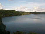
Kiên Giang is a province of Vietnam, located in the Mekong Delta region of southern Vietnam. It is known for fishing and rice farming. The provincial capital is Rạch Giá, 155 mi (249 km) from Ho Chi Minh City. Kiên Giang's area is about 6,299 km² and its population is about 1,634,043, of which 22 percent live in urban areas.

Bạc Liêu province is a province of Vietnam. It is a coastal province, and is situated in the Mekong Delta region of the southern part of the country.
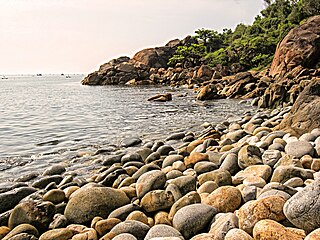
Bình Định is a province of Vietnam. It is located in Vietnam's South Central Coast region. Its Sino-Vietnamese name translates as "pacified" or "subjugated."

Kon Tum province lies in the Central Highlands region of Vietnam and shares borders with Laos and Cambodia. It has an area of 9,934 square km and a population of approximately 530,000. The economy is primarily agricultural.

Đắk Nông, also Ðắc Nông, is a province of Vietnam. It is located in the country's Central Highlands. The provincial capital is Gia Nghĩa.

Ninh Bình is a province of Vietnam, in the Red River Delta region of the northern part of the country. The province is famous for a high density of natural and cultural attractions, including reserved parks in Cúc Phương National Park and Vân Long, grotto caves and rivers in Tràng An, Tam Cốc-Bích Động and Múa Caves, historic monuments in the Hoa Lư ancient capital, Vietnam's largest buddhist worshiping complex, and the Phát Diệm Cathedral with "eclectic architectural style". Thanks to its adjacency to Hanoi, day trips from the capital are easily manageable.

Phú Yên is a coastal province in the South Central Coast of Vietnam. It is the easternmost province of Vietnam's mainland.

Gia Lâm is a district (huyện) of Hanoi, the capital city of Vietnam. Prior to 2003, the district covered the entire area of Long Biên district, which included Long Biên Bridge, Gia Lâm Airport, Gia Lâm railway station, Gia Lâm bus station and the headquarters of Vietnam Airlines.

Kon Ka Kinh National Park is a national park of Vietnam, established by the decision (167/2002/QĐ-TTg) on November 25, 2002 of the then Prime Minister, Phan Văn Khải.

Ayun Pa is a district-level town in Gia Lai Province, in the Central Highlands of Vietnam. It used to be known as Cheo Reo after 1975. Ayun Pa covers an area of 287 km², with a population of 35,058 (2007). The town is situated in the south-eastern part of Gia Lai Province. To the east and north-east is Ia Pa District, to the south-east is Krông Pa District, to the south is Ea H'leo District in Đắk Lắk Province and to the west is Phú Thiện District.

Châu Đức is a rural district of Bà Rịa–Vũng Tàu Province in the Southeast region of Vietnam. As of 2003 the district had a population of 149,707. The district covers an area of 421 km². The district capital lies at Ngãi Giao.

Gia Bình is a rural district of Bắc Ninh Province in the Red River Delta region of Vietnam.

Tây Sơn is a district (huyện) of Bình Định Province in the South Central Coast region of Vietnam. It is known for being the birthplace of the Tây Sơn dynasty.

Sóc Sơn is a district (huyện) of Hanoi, the capital city of Vietnam. Nội Bài International Airport is located in this district.
Mường Tè is a rural district of Lai Châu Province in the Northwest region of Vietnam. As of 2012, the district had a population of 39,921. The district covers an area of 2,679.34 km². The district capital lies at Mường Tè. Mường is equivalent to Mueang.

Yên Bình is a rural district of Yên Bái Province, in the Northeast region of Vietnam. As of 2019, the district had a population of 112,046. The district covers an area of 773.20 km2.
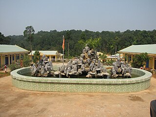
Bù Gia Mập is a rural district (huyện) of Bình Phước Province in the Southeast region of Vietnam. It was established on 11 August 2009 on the land of Phước Long District remaining after the establishment of Phước Long town. At that time, it had a population of 147,967.
Chư Pưh is a rural district (huyện) of Gia Lai Province in the Central Highlands region of Vietnam. It was established in 2009 with the split of Chư Sê District's territory into Chư Pưh District in the southern half and the new Chư Sê District in the northern half. The district's name comes from native languages and is misspelled in Vietnamese orthography.

Nghi Sơn is a district-level town of Thanh Hóa Province in the North Central Coast region of Vietnam.
Nậm Nhùn is a rural district of Lai Châu Province in the Northwest region of Vietnam. As of 2012, the district had a population of 24,165. The district covers an area of 1,388.08 km². The district capital lies at Nậm Nhùn.


![]() listen ) is a province in the Central Highlands of Vietnam. It is the second-largest province of Vietnam. The name comes from the Jarai people, one of the local indigenous groups.
listen ) is a province in the Central Highlands of Vietnam. It is the second-largest province of Vietnam. The name comes from the Jarai people, one of the local indigenous groups.

