Giddalur

Last updated

Giddaluru
Rangaswamy Gundam.jpg
Ranga Swamy Gundam near Giddalur
Location map India Andhra Pradesh EN.svg
Red pog.svg
Giddaluru
Location in Andhra Pradesh, India
India location map.svg
Red pog.svg
Giddaluru
Giddaluru (India)
Coordinates: 15°21′00″N78°55′00″E / 15.3500°N 78.9167°E / 15.3500; 78.9167 Coordinates: 15°21′00″N78°55′00″E / 15.3500°N 78.9167°E / 15.3500; 78.9167
Country India
State Andhra Pradesh
District Prakasam
Mandal Giddaluru
Area
[1]
  Total31.57 km2 (12.19 sq mi)
Population
(2011) [2]
  Total36,150
  Density1,100/km2 (3,000/sq mi)
Languages
  Official Telugu, Urdu
Time zone UTC+5:30 (IST)
PIN
523357
Telephone codecode-08405
Vehicle registration AP–27
Website http://www.giddaluru.org/

Giddaluru is a census town in Prakasam district of the Indian state of Andhra Pradesh. It is the mandal headquarters of Giddaluru mandal in Markapur revenue division. [3]

A census town is a type of town that satisfies certain characteristics, depending on the country in which it is located.

Prakasam district District of Andhra Pradesh in India

Prakasam district is an administrative district in the Coastal Andhra region of the Indian state of Andhra Pradesh. The headquarters of the district are located at Ongole. It is located on the western shore of Bay of Bengal and is bounded by Guntur district on the north, Kurnool district on the west, Kadapa and Nellore districts on the south. A part of north west region also borders the Mahabubnagar district of Telangana. It is the 3rd largest district in the state with an area of 17,626 km2 (6,805 sq mi) and had a population of 3,392,764 as per 2011 census of India.

Andhra Pradesh State in southern India

Andhra Pradesh is one of the 29 states of India. Situated in the south-east of the country, it is the seventh-largest state in India, covering an area of 162,970 km2 (62,920 sq mi). As per the 2011 census, it is the tenth most populous state, with 49,386,799 inhabitants. The largest city in Andhra Pradesh is Visakhapatnam. Telugu, one of the classical languages of India, is the major and official language of Andhra Pradesh.

Contents

Geography

Giddalur is Located in prakasam district of Andhra Pradesh on the Ongole - Nandyal Highway. Giddalur is located at 15°21′00″N78°55′00″E / 15.3500°N 78.9167°E / 15.3500; 78.9167 . [4]

Demographics

As of 2011 Giddalur has population of 35,150 of which 17,728 are males while 17,422 are females. Average Sex Ratio is of 983 against state average of 993. Population of Children with age of 0-6 is 3445 which is 9.80% of total population of Giddaluru. Child Sex Ratio in Giddaluru is around 971 compared to Andhra Pradesh state average of 939. Literacy rate of Giddaluru city is 79.71% higher than state average of 67.02%. [5]

as per survey it was found so many jawaans are there from giddalur .

Education

The primary and secondary school education is imparted by government, aided and private schools, under the School Education Department of the state. [6] [7] The medium of instruction followed by different schools are English, Telugu.

Sports

The primary and secondary school education and sports is imparted by government, aided and private schools, So many Army candidates are from the Giddalur. Having Good Volleyball Team(B. Sumanth's Team) in Surrounding Areas.

Industries

A few ice cream factories are set up around the town giddalur nearby to the town in the place called ramanna kathuva a few people are planning to set up oil factory in the village chinaganipalli which came under giddalur constution.

Related Research Articles

Tadepalligudem city in Andhra Pradesh, India

Tadepalligudem (TPG) is a city in West Godavari district of the Indian state of Andhra Pradesh. It is a municipality and the mandal headquarters of Tadepalligudem mandal in Eluru revenue division.

Kandukur, Prakasam district Town in Andhra Pradesh, India

Kandukur or Kandukuru is a town in Prakasam district of the Indian state of Andhra Pradesh. It is a municipality and the mandal headquarters of Kandukur mandal in Kandukur revenue division.

Narsipatnam Census Town in Andhra Pradesh, India

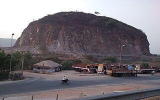
Narsipatnam is a town in Visakhapatnam district of the Indian state of Andhra Pradesh. It is a municipality and also the mandal headquarters of Narsipatnam mandal. The town is spread over an area of 42 km2 (16 sq mi) The resting place of the revolutionary Indian freedom fighter Alluri Sitarama Raju is located in Krishna Devi Peta village of Narsipatnam.

Pamur Census Town in Andhra Pradesh, India

Pamuru is a census town in Prakasam district of the Indian state of Andhra Pradesh. It is the mandal headquarters of Pamur mandal in Kandukur revenue division. This is the border town of Prakasam district. This is near from Nellore than Ongole around 100 km and also near by Kadapa.

Singarayakonda Census town in Andhra Pradesh, India

Singarayakonda is a census town in Prakasam district of the Indian state of Andhra Pradesh. It is the mandal headquarters of Singarayakonda mandal.

Sompeta Census Town in Andhra Pradesh, India

Sompeta is a census town in Srikakulam district of the Indian state of Andhra Pradesh. It is the mandal headquarters of Sompeta mandal in Tekkali revenue division.

Vetapalem Census Town in Andhra Pradesh, India

Vetapalem is a census town in Prakasam district of the Indian state of Andhra Pradesh. It is the mandal headquarters of Vetapalem mandal in Ongole revenue division.

Nagari, Andhra Pradesh Town in Andhra Pradesh, India

Nagari is a town in Chittoor district of the Indian state of Andhra Pradesh. It is the mandal headquarters of Nagari mandal in Chittoor revenue division.

Ibrahimpatnam, Krishna district Census Town in Andhra Pradesh, India

Ibrahimpatnam is a census town in Krishna district of the Indian state of Andhra Pradesh. It is also the mandal headquarters of Ibrahimpatnam mandal. Dr Narla Tata Rao Thermal Power Station, one of the major Thermal power stations of the state is located near the town. Railway Wagon Workshop at Rayanapadu is also located very near to Ibrahimpatnam at a distance of 4 km.

Narasannapeta Census Town in Andhra Pradesh, India

Narasannapeta is a census town in Srikakulam district of the Indian state of Andhra Pradesh. It is the mandal headquarters of Narasannapeta mandal in Srikakulam revenue division. 43 villages are there under the administrative division of Narasannapeta.

Palasa Town in Andhra Pradesh, India

Palasa is a town in Srikakulam district of the Indian state of Andhra Pradesh. It is a municipality and the mandal headquarters of Palasa mandal. It is located near to the National Highway 5 between Srikakulam and Berhampur. Along with its twin town kasibugga, it is often referred to as Palasa-Kasibugga.

Nakkapalle Census Town in Andhra Pradesh, India

Nakkapalle or Nakkapalli is a census town in Visakhapatnam district in the state of Andhra Pradesh in India.

Payakaraopeta Census Town in Andhra Pradesh, India

Payakaraopeta is a Census Town in Visakhapatnam district in the state of Andhra Pradesh in India.sarpanch of payakaraopeta : Dhanisetti Nagamani

Kanigiri Town in Andhra Pradesh, India

Kanigiri is a census town in Prakasam district of the Indian state of Andhra Pradesh. It is the mandal headquarters of kanigiri mandal in Kandukur revenue division.

Podili Census Town in Andhra Pradesh, India

Podili is a census town in Prakasam district of the Indian state of Andhra Pradesh. It is the mandal headquarters of Podili mandal in Kandukur revenue division.

Guntupalli, Krishna district Census Town in Andhra Pradesh, India

Guntupalli is a census town in Krishna district of the Indian state of Andhra Pradesh. It is located in Ibrahimpatnam mandal of Vijayawada revenue division. It is a suburb of Vijayawada.

Vaddeswaram Census Town in Andhra Pradesh, India

Vaddeswaram is a census town in Guntur district of the Indian state of Andhra Pradesh. It is located at a distance of 5 km (3.1 mi) from Krishna River, in Tadepalle mandal of Guntur revenue division.

Gavaravaram Census Town in Andhra Pradesh, India

Gavaravaram is a census town in West Godavari district of the Indian state of Andhra Pradesh. It is located in Eluru mandal of Eluru revenue division. The town is a constituent of Eluru urban agglomeration.

Satrampadu Census Town in Andhra Pradesh, India

Satrampadu is a census town in West Godavari district of the Indian state of Andhra Pradesh. It is located in Eluru mandal of Eluru revenue division. The town is a constituent of Eluru urban agglomeration.

References

  1. "Municipalities, Municipal Corporations & UDAs" (PDF). Directorate of Town and Country Planning. Government of Andhra Pradesh. Archived from the original (PDF) on 28 January 2016. Retrieved 29 January 2016.
  2. "District Census Handbook - Prakasam" (PDF). Census of India. p. 16,17,48. Retrieved 18 January 2015.
  3. "Chittoor District Mandals" (PDF). Census of India. pp. 151, 177. Retrieved 19 June 2015.
  4. Falling Rain Genomics.Giddalur
  5. "Giddalur Census 2011".
  6. "School Education Department" (PDF). School Education Department, Government of Andhra Pradesh. Archived from the original (PDF) on 19 March 2016. Retrieved 7 November 2016.
  7. "The Department of School Education - Official AP State Government Portal | AP State Portal". www.ap.gov.in. Archived from the original on 7 November 2016. Retrieved 7 November 2016.