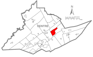
Zion is an unincorporated community and census-designated place (CDP) in Centre County, Pennsylvania, United States.

Tornillo is a census-designated place (CDP) and border town in El Paso County, Texas, United States. The population was 1,568 at the 2010 census. It is part of the El Paso Metropolitan Statistical Area. The Tornillo and Guadalupe, Chihuahua, area is connected by the Tornillo-Guadalupe Bridge.

Berwyn is a census-designated place (CDP) in Chester County, Pennsylvania, United States. Berwyn is located within Tredyffrin and Easttown Townships. The area is part of the Philadelphia Main Line suburbs.
West Middleton is an unincorporated community between Russiaville and Kokomo in western Howard County, Indiana, United States. It is part of the Kokomo, Indiana Metropolitan Statistical Area.
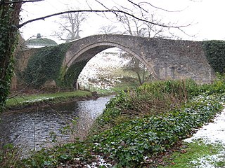
The River Doon is a river in Ayrshire, Scotland. Its course is generally north-westerly, passing near to the town of Dalmellington, and through the villages of Patna, Dalrymple, and Alloway, birthplace of Robert Burns. The source of the Doon is Loch Doon, high in the Galloway Hills.
The Arena de Lachine is a 1,500-seat multi-purpose arena in Lachine, Quebec, Canada. It is home to the Les Maroons de Lachine Tier II Junior "A" ice hockey team of the Quebec Junior AAA Hockey League.
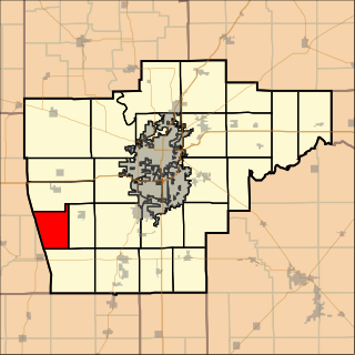
Maxwell Township is located in Sangamon County, Illinois. As of the 2010 census, its population was 193 and it contained 72 housing units. Maxwell Township formed from a portion of Loami Township on an unknown date, but sometime prior to 1921.
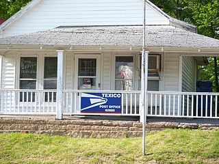
Texico is an unincorporated community in Jefferson County, Illinois, United States. The population was 851 at the 2010 census.
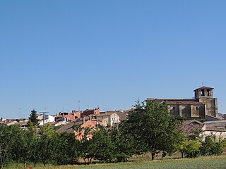
Villafruela is a municipality located in the province of Burgos, Castile and León, Spain. According to the INE, as of January 2022, the municipality has a population of 154 inhabitants.

Choctawhatchee Bay is a bay in the Emerald Coast region of the Florida Panhandle. The bay, located within Okaloosa and Walton counties, has a surface area of 334 square kilometres (129 sq mi). It is an inlet of the Gulf of Mexico, connected to it through East Pass. It also connects to Santa Rosa Sound in Fort Walton Beach, Florida to the west and to St. Andrews Bay in Bay County to the east, via the Gulf Intracoastal Waterway. East Pass is the only outlet of the bay flowing directly into the Gulf of Mexico. The Choctawhatchee River flows into Choctawhatchee Bay, as do several smaller rivers and streams. The Mid-Bay Bridge crosses the bay, connecting the city of Destin to Niceville, Florida. Second bridge across the bay is the Judge Clyde B. Wells Bridge.

The Grand Loop Road is a historic district which encompasses the primary road system in Yellowstone National Park. Much of the 140-mile (230 km) system was originally planned by Captain Hiram M. Chittenden of the US Army Corps of Engineers in the early days of the park, when it was under military administration. The Grand Loop Road provides access to the major features of the park, including the Upper, Midway and Lower geyser basins, Mammoth Hot Springs, Tower Fall, the Grand Canyon of the Yellowstone and Yellowstone Lake.
Weyer is a hamlet in the town of Hamburg in Erie County, New York, United States.
Back Brook is a tributary of Pike Run in Somerset County, New Jersey in the United States. It is located on the east side of Sourland Mountain.
Houston is a ghost town in York County, Nebraska, United States.
Terre Haute is an extinct town in Putnam County, in the U.S. state of Missouri. The GNIS classifies it as a populated place.
Coon Valley Township is a township in Sac County, Iowa, USA.
Indian Slough is a slough, tributary to the Old River, an old channel of the San Joaquin River in California. Its mouth is at an elevation of 7 feet, at its confluence with the Old River. Its source is at its confluence with Kellogg Creek at an elevation of 7 feet at the location 37°54′58″N121°36′18″W.


