Pocono Lake, Pennsylvania | |
|---|---|
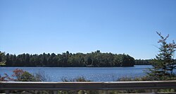 Pocono Lake seen from PA 940 | |
 Pocono Lake  Pocono Lake | |
| Coordinates: 41°06′19″N75°28′34″W / 41.10528°N 75.47611°W | |
| Country | United States |
| State | Pennsylvania |
| County | Monroe |
| Township | Tobyhanna |
| Elevation | 1,749 ft (533 m) |
| Time zone | UTC-5 (Eastern (EST)) |
| • Summer (DST) | UTC-4 (EDT) |
| ZIP codes | 18347, 18350 |
| Area codes | 570 and 272 |
| GNIS feature ID | 1184146 [1] |
Pocono Lake is a subsection of Pocono Pines in Monroe County, Pennsylvania, United States. Pocono Lake is located slightly west of Pocono Pines by Pennsylvania Route 940.
Pocono is a Native American name purported to mean "a stream between two mountains". [2]
The school district is considered below the state average. [3]
In 2014, economic decline caused an increase in the use of SNAP (Supplemental Nutrition Assistance Program) food stamps throughout the region. According to Rev. Luke Richards, pastor of the Pocono Lake Wesleyan Church, "huge needs" are "ever-changing" in the area. [4]
