Barrett Township, Monroe County, Pennsylvania

Last updated
Barrett Township, Pennsylvania
Barrett Township Municipal Building, Barrett Pennsylvania.jpg
Barrett Township Municipal Building
Pennsylvania in United States (US48).svg
Location of Pennsylvania in the United States
Coordinates: 41°13′00″N75°11′59″W / 41.21667°N 75.19972°W / 41.21667; -75.19972 Coordinates: 41°13′00″N75°11′59″W / 41.21667°N 75.19972°W / 41.21667; -75.19972
CountryUnited States
StatePennsylvania
County Monroe
Area
[1]
  Total52.99 sq mi (137.24 km2)
  Land52.38 sq mi (135.66 km2)
  Water0.61 sq mi (1.59 km2)
Elevation
1,407 ft (429 m)
Population
 (2020) [2]
  Total4,053 Decrease2.svg
  Estimate 
(2021) [2]
4,061
  Density77.38/sq mi (29.88/km2)
Time zone UTC-5 (EST)
  Summer (DST) UTC-4 (EDT)
Area code 570
FIPS code 42-089-04320
Website http://www.barretttownship.com

Barrett Township is a township in Monroe County, Pennsylvania, United States. The population was 4,053 at the 2020 census. [3] Two Poconos resort communities, Buck Hill Falls and Skytop, are located within the township. It is located 38 miles from Scranton and 48 miles from Wilkes-Barre. There is one privately owned, public-use airport in Barrett Township, called the Flying Dollar Airport.

Contents

Geography

According to the United States Census Bureau, the township has a total area of 53.2 square miles (138 km2), of which 52.6 square miles (136 km2) is land and 0.6 square miles (1.6 km2) (1.22%) is water.

Transportation

As of 2018, there were 63.42 miles of public roads in Barrett Township, of which 25.40 miles were maintained by the Pennsylvania Department of Transportation (PennDOT) and 38.02 miles were maintained by the township. [4]

PA 191/PA 390 southbound in Barrett Township 2022-08-09 10 20 02 View south along Pennsylvania State Route 191 and Pennsylvania State Route 390 just south of Peterson Road in Barrett Township, Monroe County, Pennsylvania.jpg
PA 191/PA 390 southbound in Barrett Township

Pennsylvania Route 191, Pennsylvania Route 390 and Pennsylvania Route 447 are the numbered highways serving Barrett Township. PA 191 follows a southeast-northwest alignment across southern and western portions of the township. PA 390 follows a southwest-northeast alignment across the middle of the township, including a concurrency with PA 191. Finally, PA 447 follows a southeast-northwest alignment through the center of the township.

Demographics

Historical population
CensusPop.Note
2000 3,880
2010 4,2258.9%
2020 4,053−4.1%
2021 (est.)4,061 [2] 0.2%
U.S. Decennial Census [5]

As of the census [6] of 2010, there were 4,225 people, 2,529 households, and 1,839 families residing in the township. The population density was 79.7 people per square mile (30.8 people/km2). The racial makeup of the township was 91.4% White, 3.9% African American, 0.1% Native American, 0.9% Asian, 1.6% from other races, and 1.9% from two or more races. Hispanic or Latino of any race were 5.2% of the population.

There were 2,529 households, out of which 27% had children under the age of 18 living with them, 48.5% were married couples living together, 8.6% had a female householder with no husband present, and 39.3% were non-families. 28.7% of all households were made up of individuals, and 13.9% had someone living alone who was 65 years of age or older. The average household size was 2.3 and the average family size was 2.9.

In the township the population was spread out, with 20.2% under the age of 18, 6.6% from 18 to 24, 27.4% from 25 to 44, 26.1% from 45 to 64, and 16.0% who were 65 years of age or older. The median age was 45.8 years. For every 100 females, there were 98.8 males. For every 100 females age 18 and over, there were 94.3 males.

The median income for a household in the township was $54,332, and the median income for a family was $59,230. Males had a median income of $37,291 versus $33,474 for females. The per capita income for the township was $27,157. About 7.2% of families and 9.4% of the population were below the poverty line, including 12.4% of those under age 18 and 4.2% of those age 65 or over.

Climate

According to the Trewartha climate classification system, Barrett Township has a Temperate Continental climate (Dc) with warm summers (b), cold winters (o) and year-around precipitation (Dcbo). Dcbo climates are characterized by at least one month having an average mean temperature ≤ 32.0 °F (0 °C), four to seven months with an average mean temperature ≥ 50.0 °F (10 °C), all months with an average mean temperature < 72.0 °F (22 °C) and no significant precipitation difference between seasons. Although most summer days are comfortably humid in Barrett Township, episodes of heat and high humidity can occur with heat index values > 95 °F (35 °C). Since 1981, the highest air temperature has been 95.1 °F (35 °C) on July 15, 1995, and the highest daily average mean dew point was 70.6 °F (21 °C) on August 1, 2006. July is the peak month for thunderstorm activity, which correlates with the average warmest month of the year. The average wettest month is September, which correlates with tropical storm remnants during the peak of the Atlantic hurricane season. Since 1981, the wettest calendar day has been 6.15 inches (156 mm) on September 30, 2010. During the winter months, the plant hardiness zone is 5b, with an average annual extreme minimum air temperature of −12.1 °F (−25 °C). [7] Since 1981, the coldest air temperature has been −22.3 °F (−30 °C) on January 21, 1994. Episodes of extreme cold and wind can occur, with wind chill values < −25 °F (−32 °C). The average snowiest month is January which, correlates with the average coldest month of the year. Ice storms and large snowstorms depositing ≥ 12 inches (30 cm) of snow occur once every couple of years, particularly during nor’easters from December through March.

Climate data for Barrett Twp, Elevation 1,224 ft (373 m), 1981-2010 normals, extremes 1981-2018
MonthJanFebMarAprMayJunJulAugSepOctNovDecYear
Record high °F (°C)63.9
(17.7)
73.4
(23.0)
82.8
(28.2)
89.3
(31.8)
91.6
(33.1)
91.1
(32.8)
95.1
(35.1)
94.1
(34.5)
92.3
(33.5)
84.4
(29.1)
76.6
(24.8)
67.7
(19.8)
95.1
(35.1)
Average high °F (°C)32.7
(0.4)
36.2
(2.3)
44.6
(7.0)
57.7
(14.3)
68.5
(20.3)
76.4
(24.7)
80.0
(26.7)
79.0
(26.1)
71.9
(22.2)
60.5
(15.8)
49.0
(9.4)
37.0
(2.8)
57.9
(14.4)
Daily mean °F (°C)23.6
(−4.7)
26.5
(−3.1)
34.2
(1.2)
46.1
(7.8)
56.4
(13.6)
65.0
(18.3)
69.0
(20.6)
67.9
(19.9)
60.5
(15.8)
49.1
(9.5)
39.6
(4.2)
28.7
(−1.8)
47.3
(8.5)
Average low °F (°C)14.5
(−9.7)
16.7
(−8.5)
23.9
(−4.5)
34.4
(1.3)
44.2
(6.8)
53.5
(11.9)
58.0
(14.4)
56.7
(13.7)
49.2
(9.6)
37.6
(3.1)
30.1
(−1.1)
20.4
(−6.4)
36.7
(2.6)
Record low °F (°C)−22.3
(−30.2)
−13.7
(−25.4)
−6.0
(−21.1)
10.8
(−11.8)
26.9
(−2.8)
33.4
(0.8)
39.0
(3.9)
34.9
(1.6)
28.0
(−2.2)
17.0
(−8.3)
0.2
(−17.7)
−14.1
(−25.6)
−22.3
(−30.2)
Average precipitation inches (mm)3.44
(87)
3.02
(77)
3.70
(94)
4.18
(106)
4.41
(112)
4.75
(121)
4.23
(107)
4.34
(110)
4.85
(123)
4.73
(120)
3.88
(99)
3.91
(99)
49.44
(1,256)
Average snowfall inches (cm)16.2
(41)
11.6
(29)
12.0
(30)
2.9
(7.4)
0.0
(0.0)
0.0
(0.0)
0.0
(0.0)
0.0
(0.0)
0.0
(0.0)
0.1
(0.25)
3.1
(7.9)
9.7
(25)
55.5
(141)
Average relative humidity (%)72.366.963.058.861.470.670.773.274.670.470.273.568.8
Average dew point °F (°C)16.0
(−8.9)
17.0
(−8.3)
22.9
(−5.1)
32.5
(0.3)
43.3
(6.3)
55.2
(12.9)
59.1
(15.1)
59.0
(15.0)
52.4
(11.3)
39.9
(4.4)
30.7
(−0.7)
21.3
(−5.9)
37.5
(3.1)
Source: PRISM [8]

Ecology

According to the A. W. Kuchler U.S. potential natural vegetation types, Barrett Township would have a dominant vegetation type of Appalachian Oak (104) with a dominant vegetation form of Eastern Hardwood Forest (25). [9] The peak spring bloom typically occurs in late-April and peak fall color usually occurs in mid-October. The plant hardiness zone is 5b with an average annual extreme minimum air temperature of −12.1 °F (−25 °C). [7]

Related Research Articles

<span class="mw-page-title-main">Bridgeton Township, Bucks County, Pennsylvania</span> Township in Pennsylvania, United States

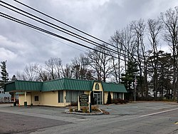
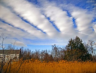
Bridgeton Township is a township in Bucks County, Pennsylvania, United States. The population was 1,277 at the 2010 census. The township was originally a part of adjacent Nockamixon Township, but a division was arranged and signed on May 24, 1890. This accord split an area of Nockamixon which ran west from the banks of the Delaware River to approximately one third the breadth of the original township. This smaller area was named "Bridgeton", as it was the site of Upper Black Eddy-Milford Bridge covered wooden truss bridge built in 1842, which connected the towns of Upper Black Eddy and Milford, New Jersey. The original covered bridge was replaced by a truss bridge in 1933. The township originally contained several tiny hamlets, such as the aforementioned Upper Black Eddy, Narrowsville, and Rupletown. Upper Black's Eddy, as it was originally called, and Raubsville were named for notable landholders, while Narrowsville was named for a particularly thin portion of the Delaware River. With the construction of a centralized post office in Upper Black Eddy, the usage of separate names for the smaller towns ceased in an official capacity, and the everyday errands of residents became centered on the largest of the towns. What little commercial trade exists in the township is now centered solely in Upper Black Eddy, with any evidence of there being any distinctive, smaller villages existing only on outdated road-signs and maps. Ringing Rocks Park is located within the township, as well as state game hunting lands. Bridgeton Township is also home to the Homestead General Store, the oldest continually operating general store on the Delaware Canal.

<span class="mw-page-title-main">East Rockhill Township, Bucks County, Pennsylvania</span> Township in Pennsylvania, United States

East Rockhill Township is a township in Bucks County, Pennsylvania, United States. The original Rockhill Township was established in 1740 and was divided into East and West Rockhill Townships in 1890. The population was 5,706 at the 2010 Census. East Rockhill is part of Pennridge School District. Pennridge Airport is located in East Rockhill Township.

<span class="mw-page-title-main">Lower Southampton Township, Bucks County, Pennsylvania</span> Township in Pennsylvania, United States

Lower Southampton Township is a township in Bucks County, Pennsylvania. The population was 20,599 at the 2020 census.

<span class="mw-page-title-main">Newtown Township, Bucks County, Pennsylvania</span> Township in Pennsylvania, United States

Newtown Township is a township in Bucks County, Pennsylvania, United States. The population was 19,299 at the 2010 census.

<span class="mw-page-title-main">Nockamixon Township, Bucks County, Pennsylvania</span> Township in Pennsylvania, United States

Nockamixon Township is a township in Bucks County, Pennsylvania, United States. The population was 3,441 at the 2010 census.

<span class="mw-page-title-main">Upper Makefield Township, Bucks County, Pennsylvania</span> Township in Pennsylvania, United States

Upper Makefield Township is a township in Bucks County, Pennsylvania, United States. The population was 8,190 at the 2010 census. It has the eighth highest per capita income among Pennsylvania townships. Its multimillion-dollar homes, top-notch public schools and easy commute to New York City, Princeton and Philadelphia led to its ranking as Best Place to Live in the Suburbs in Philadelphia Magazine's Best Places to Live list. Additionally, it has been listed as the Philadelphia area's second-most expensive suburb and the 287th richest neighborhood in the United States, with a mean household income of $306,081. The area has also been listed an alternative to the Hamptons for the summer by New York Magazine.

<span class="mw-page-title-main">Chestnuthill Township, Monroe County, Pennsylvania</span> Place in Pennsylvania, United States

Chestnuthill Township is a township in Monroe County, Pennsylvania, United States. The population was 16,708 at the 2020 census.

<span class="mw-page-title-main">Coolbaugh Township, Monroe County, Pennsylvania</span> Place in Pennsylvania, United States

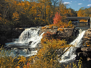
Coolbaugh Township is a township in Monroe County, Pennsylvania, United States. The population was 20,805 at the 2020 census. Tobyhanna State Park is in Coolbaugh Township. Tobyhanna, an unincorporated community, is also located in Coolbaugh Township rather than Tobyhanna Township.

<span class="mw-page-title-main">Eldred Township, Monroe County, Pennsylvania</span> Township in Pennsylvania, United States

Eldred Township is a township in Monroe County, Pennsylvania, United States. The population was 2,594 at the 2020 census.

<span class="mw-page-title-main">Jackson Township, Monroe County, Pennsylvania</span> Place in Pennsylvania, United States

Jackson Township is a township in Monroe County, Pennsylvania, United States. The population was 6,561 at the 2020 census. A portion of Big Pocono State Park a Pennsylvania state park is on Camelback Mountain in Jackson Township.

<span class="mw-page-title-main">Middle Smithfield Township, Monroe County, Pennsylvania</span> Place in Pennsylvania, United States

Middle Smithfield Township is a township in Monroe County, Pennsylvania, United States. The population was 16,014 at the 2020 census.

<span class="mw-page-title-main">Mount Pocono, Pennsylvania</span> Place in Pennsylvania, United States

Mount Pocono is a borough in Monroe County, Pennsylvania. It is located nearly centered in the southernmost county of five in the northeastern corner that are part of the Pocono Mountains. The borough serves as a local highway nexus, and sees a lot of tourist traffic making use of resources in the region. As of the 2020 census, the borough population was 3,083 residents.

<span class="mw-page-title-main">Paradise Township, Monroe County, Pennsylvania</span> Place in Pennsylvania, United States

Paradise Township is a township in Monroe County, Pennsylvania in the Pocono Mountains. The population was 2,898 at the 2020 census.

<span class="mw-page-title-main">Pocono Township, Monroe County, Pennsylvania</span> Place in Pennsylvania, United States

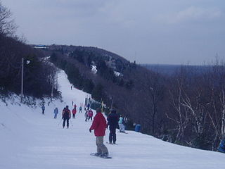
Pocono Township is a township in Monroe County, Pennsylvania. The township's government is located in the village of Tannersville, Pennsylvania, near the site of Camelback Mountain Resort, which is located in the Pocono Mountains and the adjacent Jackson Township. The top of the ski area is within Big Pocono State Park, which is maintained by resort staff. The population was 10,868 at the 2020 census.

<span class="mw-page-title-main">Polk Township, Monroe County, Pennsylvania</span> Place in Pennsylvania, United States

Polk Township is a township in Monroe County, Pennsylvania, United States. The population was 7,473 at the 2020 census.

<span class="mw-page-title-main">Price Township, Monroe County, Pennsylvania</span> Place in Pennsylvania, United States

Price Township is a township in Monroe County, Pennsylvania, United States. The population was 3,675 at the 2020 census.

<span class="mw-page-title-main">Ross Township, Monroe County, Pennsylvania</span> Township in Pennsylvania, United States

Ross Township is a township in Monroe County, Pennsylvania, United States. The population was 5,464 at the 2020 census. Ross Township is one of 16 townships in Monroe County.

<span class="mw-page-title-main">Smithfield Township, Monroe County, Pennsylvania</span> Place in Pennsylvania, United States

Smithfield Township is a township in Monroe County, Pennsylvania, United States. The population was 8,001 at the 2020 census.

<span class="mw-page-title-main">Stroud Township, Monroe County, Pennsylvania</span> Place in Pennsylvania, United States

Stroud Township is a township in Monroe County, Pennsylvania, United States. As of 2020, the township had an estimated population of 19,812.

<span class="mw-page-title-main">Tunkhannock Township, Monroe County, Pennsylvania</span> Township in Pennsylvania, United States

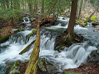
Tunkhannock Township is a township in Monroe County, Pennsylvania, United States. The population was 7,037 at the 2020 census. Tunkhannock Township comprises the communities of Blakeslee and Long Pond. The most noteworthy feature of this township is the Tunkhannock creek, which forms "Long Pond", and is designated by the PA DEP as an Exceptional Value Waters (EV). The Bethlehem Authority, Nature Conservancy, Wildlands Conservancy County of Monroe Open Space Program, and PA Department of Forest and Waters have protected thousands of acres. Tunkhannock Township, PA is home to many species of globally rare, threatened, and endangered plants and animals and has been described as one of the last "great places".

References

  1. "2016 U.S. Gazetteer Files". United States Census Bureau. Retrieved Aug 14, 2017.
  2. 1 2 3 Bureau, US Census. "City and Town Population Totals: 2020—2021". Census.gov. US Census Bureau. Retrieved August 6, 2022.
  3. 2020 United States Census Barrett township, Pennsylvania https://www.census.gov/search-results.html?searchType=web&cssp=SERP&q=Barrett%20township,%20Monroe%20County,%20Pennsylvania
  4. "Barrett Township map" (PDF). PennDOT. Retrieved March 15, 2023.
  5. "Census of Population and Housing". Census.gov. Retrieved June 4, 2016.
  6. "U.S. Census website". United States Census Bureau . Retrieved 2008-01-31.
  7. 1 2 "USDA Interactive Plant Hardiness Map". United States Department of Agriculture . Retrieved September 4, 2019.
  8. "PRISM Climate Group, Oregon State University" . Retrieved September 4, 2019.
  9. "U.S. Potential Natural Vegetation, Original Kuchler Types, v2.0 (Spatially Adjusted to Correct Geometric Distortions)" . Retrieved September 4, 2019.