
Thurston Island is a largely ice-covered, glacially dissected island, 135 nautical miles long and 55 nautical miles wide, lying between Amundsen Sea and Bellingshausen Sea a short way off the northwest end of Ellsworth Land, Antarctica. The island is separated from the mainland by Peacock Sound, which is occupied by the west portion of Abbot Ice Shelf.
The Scaife Mountains is a group of mountains rising west of Prehn Peninsula and between the Ketchum Glacier and Ueda Glacier, at the base of the Antarctic Peninsula.

James Ross Island is a large island off the southeast side and near the northeastern extremity of the Antarctic Peninsula, from which it is separated by Prince Gustav Channel. Rising to 1,630 metres (5,350 ft), it is irregularly shaped and extends 40 nautical miles in a north–south direction.

The Prince Charles Mountains are a major group of mountains in Mac. Robertson Land in Antarctica, including the Athos Range, the Porthos Range, and the Aramis Range. The highest peak is Mount Menzies, with a height of 3,228 m (10,591 ft). Other prominent peaks are Mount Izabelle and Mount Stinear. These mountains, together with other scattered peaks, form an arc about 420 km (260 mi) long, extending from the vicinity of Mount Starlight in the north to Goodspeed Nunataks in the south.
The Scott Mountains are a large number of isolated peaks lying south of Amundsen Bay in Enderby Land of East Antarctica, Antarctica. Discovered on 13 January 1930 by the British Australian New Zealand Antarctic Research Expedition (BANZARE) under Sir Douglas Mawson. He named the feature Scott Range after Captain Robert Falcon Scott, Royal Navy. The term mountains is considered more appropriate because of the isolation of its individual features.
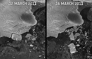
Sulzberger Bay is a bay indenting the front of the Sulzberger Ice Shelf between Fisher Island and Vollmer Island, along the coast of Marie Byrd Land, Antarctica.
The Porthos Range is the second range south in the Prince Charles Mountains of Antarctica, extending for about 30 miles in an east-to-west direction between Scylla Glacier and Charybdis Glacier. First visited in December 1956 by the Australian National Antarctic Research Expeditions (ANARE) southern party under W.G. Bewsher (1956-57) and named after Porthos, a character in Alexandre Dumas, père's novel The Three Musketeers, the most popular book read on the southern journey.

Barilari Bay is a bay 12 nautical miles (22 km) long and 6 nautical miles (11 km) wide, between Cape Garcia and Loqui Point on the west coast of Graham Land. The glaciers Birley, Lawrie, Weir and Bilgeri feed the bay.
Beascochea Bay is a bay, 10 nautical miles (19 km) long and 5 nautical miles (9 km) wide, indenting the Graham Coast of Graham Land, Antarctica, between Kyiv Peninsula and Barison Peninsula, and entered south of Cape Perez. The glaciers Lever, Funk, Cadman, Talev and Butamya feed the bay.
Bigo Bay is a bay 8 nautical miles (15 km) long and 6 nautical miles (11 km) wide, indenting the west coast of Graham Land between Cape Garcia and Magnier Peninsula surmounted by the Magnier Peaks and Lisiya Ridge.
Birley Glacier is a glacier, at least 10 nautical miles (19 km) long, flowing west into the eastern extremity of Barilari Bay north of Vardun Point, on the west coast of Graham Land. First seen and roughly surveyed in 1909 by the French Antarctic Expedition under Jean-Baptiste Charcot, it was re-surveyed in 1935–36 by the British Graham Land Expedition (BGLE) under John Rymill, and later named for Kenneth P. Birley, who contributed toward the cost of the BGLE, 1934–37.
Bryan Coast is that portion of the coast of Antarctica along the south shore of the Bellingshausen Sea between Pfrogner Point and the northern tip of the Rydberg Peninsula. To the west is Eights Coast, and to the east is English Coast.
Mount Chevreux is a mountain, 1,615 metres (5,300 ft) high, standing 5 nautical miles (9 km) southeast of Leroux Bay on the west coast of Graham Land in Antarctica. It was discovered by the French Antarctic Expedition, 1908–10, under Jean-Baptiste Charcot, who named it for Edouard Chevreux, a French zoologist.
Comrie Glacier is a glacier 13 nautical miles (24 km) long, flowing west to enter the head of Bigo Bay on the west coast of Graham Land. It was first sighted and roughly surveyed by the French Antarctic Expedition in 1909. It was resurveyed in 1935–36 by the British Graham Land Expedition (BGLE), and later named for Leslie J. Comrie, founder and first director of the Scientific Computing Service Ltd, London, who, as superintendent of HM Nautical Almanac Office in 1934, greatly assisted the BGLE, 1934–37, by providing advance copies of The Nautical Almanac up to 1937.
Fricker Glacier is a glacier, 10 nautical miles (19 km) long, which lies close north of Tindal Bluff and Monnier Point and flows in a northeasterly direction into the southwest side of Mill Inlet, on the east coast of Graham Land, Antarctica. It was charted by the Falkland Islands Dependencies Survey (FIDS) and photographed from the air by the Ronne Antarctic Research Expedition in 1947, and was named by the FIDS for Karl Fricker, a German Antarctic historian.
McClary Glacier is a glacier 10 nautical miles (19 km) long and 2 nautical miles (4 km) wide on the west coast of Graham Land, Antarctica. It flows southwest along the north side of Butson Ridge into Marguerite Bay between Cape Calmette and the Debenham Islands. The glacier was first roughly surveyed by the British Graham Land Expedition, 1936–37, and resurveyed by the Falkland Islands Dependencies Survey, 1946–50. It was named by the UK Antarctic Place-Names Committee for George B. McClary, father of Nelson McClary, mate on the Port of Beaumont during the Ronne Antarctic Research Expedition, 1947–48.

Hotine Glacier is a glacier 10 nautical miles (19 km) long which is divided at its mouth by Mount Cloos, flowing west into both Deloncle Bay and Girard Bay on Kyiv Peninsula, on the west coast of Graham Land, Antarctica. It was first charted by the Belgian Antarctic Expedition under Gerlache, 1897–99, and was named by the UK Antarctic Place-Names Committee in 1959 for Brigadier Martin Hotine, Director of Overseas Surveys.
Luke Glacier is a glacier at least 15 nautical miles (28 km) long, flowing northwest into the head of Leroux Bay on the west coast of Graham Land, Antarctica. It is surmounted by Mount Chevreux on the south, Mount Perchot on the southwest and Mount Radotina on the northeast. The glacier was first sighted and roughly surveyed in 1909 by the Fourth French Antarctic Expedition. It was resurveyed in 1935–36 by the British Graham Land Expedition and later named for George Lawson Johnston, 1st Baron Luke of Pavenham, Chairman of Bovril Ltd, who contributed toward the cost of the expedition.
Leroux Bay is a bay 9 nautical miles (17 km) long in a northwest–southeast direction and averaging 5 nautical miles (9 km) wide, between Nunez Point and the narrow Magnier Peninsula surmounted by the Magnier Peaks and Lisiya Ridge, along the west coast of Graham Land, Antarctica. The glaciers Chernomen, Luke and Muldava feed the bay.
