The geography of Switzerland features a mountainous and landlocked country located in Western and Central Europe. Switzerland's natural landscape is marked by its numerous lakes and mountains. It is surrounded by five countries: Austria and Liechtenstein to the east, France to the west, Italy to the south and Germany to the north. Switzerland has a maximum north–south length of 220 kilometres (140 mi) and an east–west length of about 350 kilometres (220 mi).

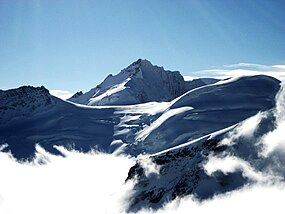
The Alpine region of Switzerland, conventionally referred to as the Swiss Alps, represents a major natural feature of the country and is, along with the Swiss Plateau and the Swiss portion of the Jura Mountains, one of its three main physiographic regions. The Swiss Alps extend over both the Western Alps and the Eastern Alps, encompassing an area sometimes called Central Alps. While the northern ranges from the Bernese Alps to the Appenzell Alps are entirely in Switzerland, the southern ranges from the Mont Blanc massif to the Bernina massif are shared with other countries such as France, Italy, Austria and Liechtenstein.

The Kleine Scheidegg is a mountain pass at an elevation of 2,061 m (6,762 ft), situated below and between the Eiger and Lauberhorn peaks in the Bernese Oberland region of Switzerland. The name means "minor watershed", as it only divides the two arms of the Lütschine river, both converging at Zweilütschinen, while the nearby Grosse Scheidegg divides the Lütschine from the Rychenbach stream.

The Samnaun Alps are a mountain range of the Central Eastern Alps, named after the Swiss municipality of Samnaun. They are located at the border of the Austrian state of Tyrol and the Graubünden canton of Switzerland.

Piz Bernina is the highest mountain in the Eastern Alps, the highest point of the Bernina Range, and the highest peak in the Rhaetian Alps. It rises 4,048 m (13,281 ft) and is located south of Pontresina and near the major Alpine resort of St. Moritz, in the Engadin valley. It is also the most easterly mountain higher than 4,000 m (13,000 ft) in the Alps, the highest point of the Swiss canton of Graubünden, and the fifth-most prominent peak in the Alps. Although the summit lies within Switzerland, the massif is on the border with Italy. The "shoulder" known as La Spedla is the highest point in the Italian Lombardy region.

The Weissmies 4,013 m (13,166 ft) is a mountain in the Pennine Alps in the canton of Valais in Switzerland near the village of Saas-Fee. It is the easternmost four-thousander of its range.

The Bietschhorn is a mountain in canton Wallis to the south of the Bernese Alps in Switzerland. The northeast and southern slopes of the mountain are part of the Jungfrau-Aletsch Protected Area listed as a UNESCO World Heritage Site that also includes the Jungfrau and the Aletsch Glacier. The Bietschhorn is located on the south side of the Lötschental valley and form part of the UNESCO World Heritage Region at the north end of the Bietschtal valley and Baltschiedertal valley. Most climbers approach the mountain from either the Bietschhornhütte or the Baltschiederklause.

The Strahlhorn is a mountain of the Swiss Pennine Alps, located south of Saas-Fee and east of Zermatt in the canton of Valais. It lies on the range that separates the Mattertal from the Saastal and is located approximately halfway between the Rimpfischhorn and the Schwarzberghorn.
The Dent d'Hérens is a mountain in the Pennine Alps, lying on the border between Italy and Switzerland. The mountain lies a few kilometres west of the Matterhorn.

Zervreilasee is a reservoir located south-west of Vals in the canton of Graubünden, Switzerland.

Monte Leone is the highest mountain of the Lepontine Alps and is located on the border between Switzerland and Italy. The mountain stands on the extreme west of the Lepontine Alps, a few kilometres east of Simplon Pass.

The Lagginhorn is a mountain in the Pennine Alps in Switzerland. It lies a few kilometres north of the slightly higher Weissmies and also close to the slightly lower Fletschhorn on the north.

The Fiescher Glacier is a valley glacier on the south side of the Bernese Alps in the canton of Valais, Switzerland. 16 km (9.9 mi) in length, it is the second longest glacier in the Alps. The glacier covers an area of 33 km2 (13 sq mi).

The Breithorn, is a mountain of the Bernese Alps, located on the border between the Swiss cantons of Bern and Valais. It is part of the border between Lauterbrunnental and the Lötschental. It lies approximately halfway between the Tschingelhorn and the Grosshorn. The Rock-Tower of the Subpeak Kleines Breithorn is located south of the Main Peak.

The Vorab is a mountain of the Glarus Alps, located on the border between the cantons of Glarus and Graubünden. The summit is also named Bündner Vorab to distinguish it from a lower summit named Glarner Vorab. A glacier runs down its eastern face where the valley continues a moderate inclination down towards Flims, where it can be seen for example from Caumasee. It cannot be seen from the adjacent municipalities on the south though. The northwestern face however consists of a sheer drop towards Elm.

The Hollandia Hut is a mountain hut of the Swiss Alpine Club, located east of Blatten in the canton of Valais. The hut lies at a height of 3,240 metres above sea level, just above the Lötschenlücke, the glacier pass connecting the Lötschental from the Aletsch Glacier. All accesses to the hut involve glacier crossing.

The Gletscherhorn is a mountain of the Oberhalbstein Alps, located between the valleys of Bergalga and Maroz, in the canton of Graubünden. It is situated north-west of Piz Duan.