Łojew is a village in the administrative district of Gmina Łochów, within Węgrów County, Masovian Voivodeship, in east-central Poland. It lies approximately 4 kilometres (2 mi) north-east of Łochów, 25 km (16 mi) north-west of Węgrów, and 63 km (39 mi) north-east of Warsaw.

Mińsk County is a unit of territorial administration and local government (powiat) in Masovian Voivodeship, east-central Poland. It was (re)created on January 1, 1999, as a result of the Polish local government reforms passed in 1998. Its administrative seat and largest town is Mińsk Mazowiecki, which lies 39 kilometres (24 mi) east of Warsaw. The county contains three other towns: Sulejówek, 21 km (13 mi) west of Mińsk Mazowiecki, Halinów, 16 km (10 mi) west of Mińsk Mazowiecki, and Kałuszyn, 17 km (11 mi) east of Mińsk Mazowiecki.

Ostrów Mazowiecka County is a unit of territorial administration and local government (powiat) in Masovian Voivodeship, east-central Poland. It came into being on January 1, 1999, as a result of the Polish local government reforms passed in 1998. Its administrative seat and largest town is Ostrów Mazowiecka, which lies 89 kilometres (55 mi) north-east of Warsaw. The only other town in the county is Brok, lying 12 km (7 mi) south of Ostrów Mazowiecka.
Gmina Miedzna is a rural gmina in Węgrów County, Masovian Voivodeship, in east-central Poland. Its seat is the village of Miedzna, which lies approximately 9 kilometres (6 mi) north-east of Węgrów and 80 km (50 mi) east of Warsaw.
Gmina Sadowne is a rural gmina in Węgrów County, Masovian Voivodeship, in east-central Poland. Its seat is the village of Sadowne, which lies approximately 30 kilometres (19 mi) north of Węgrów and 76 km (47 mi) north-east of Warsaw.
Gmina Stoczek is a rural gmina in Węgrów County, Masovian Voivodeship, in east-central Poland. Its seat is the village of Stoczek, which lies approximately 18 kilometres north-west of Węgrów and 70 km north-east of Warsaw.

Gmina Wyszków is an urban-rural gmina in Wyszków County, Masovian Voivodeship, in east-central Poland. Its seat is the town of Wyszków, which lies approximately 53 kilometres (33 mi) north-east of Warsaw.

Jasiorówka is a village in the administrative district of Gmina Łochów, within Węgrów County, Masovian Voivodeship, in east-central Poland. It lies approximately 3 kilometres (2 mi) north of Łochów, 27 km (17 mi) north-west of Węgrów, and 62 km (39 mi) north-east of Warsaw.

Jerzyska is a village in the administrative district of Gmina Łochów, within Węgrów County, Masovian Voivodeship, in east-central Poland. It lies approximately 5 kilometres (3 mi) north-west of Łochów, 31 km (19 mi) north-west of Węgrów, and 60 km (37 mi) north-east of Warsaw.

Kalinowiec is a village in the administrative district of Gmina Łochów, within Węgrów County, Masovian Voivodeship, in east-central Poland. It lies approximately 11 kilometres (7 mi) south-east of Łochów, 15 km (9 mi) north-west of Węgrów, and 65 km (40 mi) north-east of Warsaw.

Łazy is a village in the administrative district of Gmina Łochów, within Węgrów County, Masovian Voivodeship, in east-central Poland. It lies approximately 8 kilometres (5 mi) north-west of Łochów, 33 km (21 mi) north-west of Węgrów, and 58 km (36 mi) north-east of Warsaw.

Łosiewice is a village in the administrative district of Gmina Łochów, within Węgrów County, Masovian Voivodeship, in east-central Poland. It lies approximately 6 kilometres (4 mi) north of Łochów, 28 km (17 mi) north-west of Węgrów, and 65 km (40 mi) north-east of Warsaw.

Nadkole is a village in the administrative district of Gmina Łochów, within Węgrów County, Masovian Voivodeship, in east-central Poland.

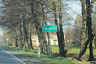
Ogrodniki is a village in the administrative district of Gmina Łochów, within Węgrów County, Masovian Voivodeship, in east-central Poland. It lies approximately 6 kilometres (4 mi) north-east of Łochów, 26 km (16 mi) north-west of Węgrów, and 65 km (40 mi) north-east of Warsaw.

Ostrówek is a village in the administrative district of Gmina Łochów, within Węgrów County, Masovian Voivodeship, in east-central Poland. It lies approximately 5 kilometres (3 mi) north-east of Łochów, 24 km (15 mi) north-west of Węgrów, and 64 km (40 mi) north-east of Warsaw.

Pogorzelec is a village in the administrative district of Gmina Łochów, within Węgrów County, Masovian Voivodeship, in east-central Poland. It lies approximately 6 kilometres (4 mi) west of Łochów, 31 km (19 mi) north-west of Węgrów, and 57 km (35 mi) north-east of Warsaw.


