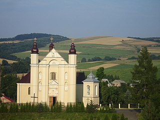
Nowotaniec is a village in south-eastern Poland, inhabited by about 430 (2002), in the Pogórze Bukowskie mountains. Situated in the Subcarpathian Voivodeship, previously in the Krosno Voivodeship (1975–1998) and the Sanok district, Bukowsko subdistrict, located near the towns of Medzilaborce and Palota.

Tyrawa Wołoska is a village in East Małopolska in the Lesser Beskid mountains of Poland.
Gmina Bircza is a rural gmina in Przemyśl County, Subcarpathian Voivodeship, in south-eastern Poland. Its seat is the village of Bircza, which lies approximately 24 kilometres (15 mi) south-west of Przemyśl and 51 km (32 mi) south-east of the regional capital Rzeszów.
Gmina Brzozów is an urban-rural gmina in Brzozów County, Subcarpathian Voivodeship, in south-eastern Poland. Its seat is the town of Brzozów, which lies approximately 38 kilometres (24 mi) south of the regional capital Rzeszów.
Gmina Lubień Kujawski is an urban-rural gmina in Włocławek County, Kuyavian-Pomeranian Voivodeship, in north-central Poland. Its seat is the town of Lubień Kujawski, which lies approximately 29 kilometres (18 mi) south of Włocławek and 79 km (49 mi) south-east of Toruń.
Gmina Grybów is a rural gmina in Nowy Sącz County, Lesser Poland Voivodeship, in southern Poland. Its seat is the town of Grybów, although the town is not part of the territory of the gmina.
Gmina Zakliczyn is an urban-rural gmina in Tarnów County, Lesser Poland Voivodeship, in southern Poland. Its seat is the town of Zakliczyn, which lies approximately 25 kilometres (16 mi) south-west of Tarnów and 68 km (42 mi) east of the regional capital Kraków.
Gmina Lesko is an urban-rural gmina in Lesko County, Subcarpathian Voivodeship, in south-eastern Poland. Its seat is the town of Lesko, which lies approximately 67 kilometres (42 mi) south of the regional capital Rzeszów.
Gmina Olszanica is a rural gmina in Lesko County, Subcarpathian Voivodeship, in south-eastern Poland. Its seat is the village of Olszanica, which lies approximately 9 kilometres (6 mi) east of Lesko and 71 km (44 mi) south-east of the regional capital Rzeszów.
Gmina Komańcza is a rural gmina in Sanok County, Subcarpathian Voivodeship, in south-eastern Poland, on the Slovak border. Its seat is the village of Komańcza, which lies approximately 25 kilometres (16 mi) south-west of Sanok and 76 km (47 mi) south of the regional capital Rzeszów.
Gmina Tyrawa Wołoska is a rural gmina in Sanok County, Subcarpathian Voivodeship, in south-eastern Poland. Its seat is the village of Tyrawa Wołoska, which lies approximately 12 kilometres (7 mi) east of Sanok and 57 km (35 mi) south-east of the regional capital Rzeszów.
Gmina Zagórz is an urban-rural gmina in Sanok County, Subcarpathian Voivodeship, in south-eastern Poland. Its seat is the town of Zagórz, which lies approximately 6 kilometres (4 mi) south-east of Sanok and 61 km (38 mi) south of the regional capital Rzeszów.
Słonne Mountains Landscape Park is a protected area in south-eastern Poland, established in 1992, covering an area of 513.92 square kilometres (198.43 sq mi). It lies in the Słonne Mountains in the Eastern Carpathians.
Stróże Małe is a village in the administrative district of Gmina Sanok, within Sanok County, Subcarpathian Voivodeship, in south-eastern Poland. It lies approximately 3 kilometres (2 mi) west of Sanok and 56 km (35 mi) south of the regional capital Rzeszów.

Tyrawa Solna is a village in the administrative district of Gmina Sanok, within Sanok County, Subcarpathian Voivodeship, in south-eastern Poland. It lies approximately 9 kilometres (6 mi) north-east of Sanok and 51 km (32 mi) south-east of the regional capital Rzeszów.

Hołuczków is a village in the administrative district of Gmina Tyrawa Wołoska, within Sanok County, Subcarpathian Voivodeship, in southeastern Poland. It is approximately 4 kilometres (2 mi) northwest of Tyrawa Wołoska, 11 km (7 mi) northeast of Sanok, and 54 km (34 mi) southeast of the regional capital Rzeszów.
Lachawa is a former village in the administrative district of Gmina Tyrawa Wołoska, within Sanok County, Subcarpathian Voivodeship, in south-eastern Poland. It lies approximately 8 kilometres (5 mi) north of Tyrawa Wołoska, 16 km (10 mi) north-east of Sanok, and 51 km (32 mi) south-east of the regional capital Rzeszów.
Rakowa is a village in the administrative district of Gmina Tyrawa Wołoska, within Sanok County, Subcarpathian Voivodeship, in south-eastern Poland. It lies approximately 4 kilometres (2 mi) south-east of Tyrawa Wołoska, 14 km (9 mi) east of Sanok, and 60 km (37 mi) south-east of the regional capital Rzeszów.
Rozpucie is a village in the administrative district of Gmina Tyrawa Wołoska, within Sanok County, Subcarpathian Voivodeship, in south-eastern Poland. It lies approximately 4 kilometres (2 mi) north-east of Tyrawa Wołoska, 15 km (9 mi) north-east of Sanok, and 56 km (35 mi) south-east of the regional capital Rzeszów.

Siemuszowa is a village in the administrative district of Gmina Tyrawa Wołoska, within Sanok County, Subcarpathian Voivodeship, in south-eastern Poland. It lies approximately 5 kilometres (3 mi) north-west of Tyrawa Wołoska, 10 km (6 mi) north-east of Sanok, and 54 km (34 mi) south-east of the regional capital Rzeszów.