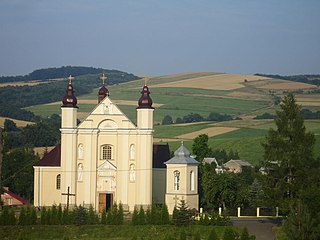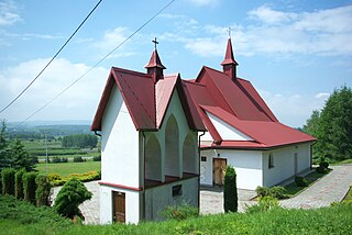
Sanok is a town in the Subcarpathian Voivodeship of south-eastern Poland with 38,397 inhabitants, as of June 2016. Located on the San River and around 52 km south of Przemyśl, Sanok lies directly by the Carpathian Mountains.

Sanok County is a unit of territorial administration and local government (powiat) in Subcarpathian Voivodeship, south-eastern Poland, on the Slovak border. It came into being on January 1, 1999, as a result of the Polish local government reforms passed in 1998. Its administrative seat and largest town is Sanok, which lies 56 kilometres (35 mi) south of the regional capital Rzeszów. The only other town in the county is Zagórz, lying 6 km (4 mi) south-east of Sanok.

Nowotaniec is a village in south-eastern Poland, inhabited by about 430 (2002), in the Pogórze Bukowskie mountains. Situated in the Subcarpathian Voivodeship, previously in the Krosno Voivodeship (1975–1998) and the Sanok district, Bukowsko subdistrict, located near the towns of Medzilaborce and Palota.

Tarnawa Dolna is a village in the administrative district of Gmina Zagórz, within Sanok County, Subcarpathian Voivodeship, in south-eastern Poland. It lies approximately 5 kilometres (3 mi) south of Zagórz, 9 km (6 mi) south of Sanok, and 65 km (40 mi) south of the regional capital Rzeszów.

Gmina Bukowsko is a rural gmina in Sanok County, Subcarpathian Voivodeship, in south-eastern Poland. Its seat is the village of Bukowsko, which lies approximately 14 kilometres (9 mi) south-west of Sanok and 62 km (39 mi) south of the regional capital Rzeszów.
Gmina Sanok is a rural gmina in Sanok County, Subcarpathian Voivodeship, in south-eastern Poland. Its seat is the town of Sanok, although the town is not part of the territory of the gmina.

Bykowce is a village in the administrative district of Gmina Sanok, within Sanok County, Subcarpathian Voivodeship, in south-eastern Poland. It lies approximately 5 kilometres (3 mi) east of Sanok and 58 km (36 mi) south of the regional capital Rzeszów.
Dobra is a village in the administrative district of Gmina Sanok, within Sanok County, Subcarpathian Voivodeship, in south-eastern Poland. It lies approximately 12 kilometres (7 mi) north-east of Sanok and 50 km (31 mi) south-east of the regional capital Rzeszów.
Jędruszkowce is a village in the administrative district of Gmina Sanok, within Sanok County, Subcarpathian Voivodeship, in south-eastern Poland. It lies approximately 10 kilometres (6 mi) west of Sanok and 53 km (33 mi) south of the regional capital Rzeszów.

Jurowce is a village in the administrative district of Gmina Sanok, within Sanok County, Subcarpathian Voivodeship, in south-eastern Poland. It lies approximately 8 kilometres (5 mi) north-west of Sanok and 50 km (31 mi) south of the regional capital Rzeszów.

Markowce is a village now in Tysmenytsia Raion in Ivano-Frankivsk Oblast of western Ukraine that was in the administrative district of Gmina Sanok, within Sanok County, Subcarpathian Voivodeship, in south-eastern Poland. It lies approximately 8 kilometres (5 mi) west of Sanok and 55 km (34 mi) south of the regional capital Rzeszów.

Międzybrodzie is a village in the administrative district of Gmina Sanok, within Sanok County, Subcarpathian Voivodeship, in south-eastern Poland. It lies approximately 7 kilometres (4 mi) north-west of Sanok and 50 km (31 mi) south of the regional capital Rzeszów.
Pisarowce is a village in the administrative district of Gmina Sanok, within Sanok County, Subcarpathian Voivodeship, in south-eastern Poland. It lies approximately 9 kilometres (6 mi) west of Sanok and 53 km (33 mi) south of the regional capital Rzeszów.
Płowce is a village in the administrative district of Gmina Sanok, within Sanok County, Subcarpathian Voivodeship, in south-eastern Poland. It lies approximately 4 kilometres (2 mi) west of Sanok and 56 km (35 mi) south of the regional capital Rzeszów.
Prusiek is a village in the administrative district of Gmina Sanok, within Sanok County, Subcarpathian Voivodeship, in south-eastern Poland. It lies approximately 7 kilometres (4 mi) west of Sanok and 57 km (35 mi) south of the regional capital Rzeszów.

Sanoczek is a village in the administrative district of Gmina Sanok, within Sanok County, Subcarpathian Voivodeship, in south-eastern Poland. It lies approximately 5 kilometres (3 mi) west of Sanok and 55 km (34 mi) south of the regional capital Rzeszów.
Srogów Dolny is a village in the administrative district of Gmina Sanok, within Sanok County, Subcarpathian Voivodeship, in south-eastern Poland. It lies approximately 7 kilometres (4 mi) north-west of Sanok and 50 km (31 mi) south of the regional capital Rzeszów.

Mokre is a village in the administrative district of Gmina Zagórz, within Sanok County, Subcarpathian Voivodeship, in south-eastern Poland. It lies approximately 11 kilometres (7 mi) south-west of Zagórz, 12 km (7 mi) south of Sanok, and 66 km (41 mi) south of the regional capital Rzeszów.
The Eparchy of Volodymyr–Brest was an eparchy of the Ruthenian Uniate Church from 1596 until 1795. It was situated in the Polish–Lithuanian Commonwealth between the rivers Bug and Styr on territory that is today located in parts of the modern states of Ukraine and Belarus. The eparchy was a suffragan of the Metropolis of Kiev, Galicia and all Ruthenia.

Maksymilian Rylo, O.S.B.M. was the Eparch of Chełm–Belz in the Ruthenian Uniate Church from 1756 to 1785. He was the Administrator of the Eparchy of Przemyśl, Sambir and Sanok from 1780 to 1785 and an Eparchial Bishop of the same Ruthenian Catholic Eparchy of Przemyśl, Sambir and Sanok from 1785 until his death in 1793.


