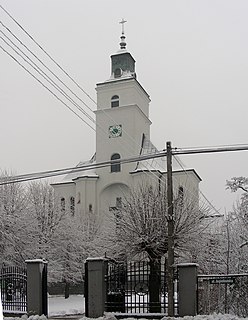
Gmina Czerniewice is a rural gmina in Tomaszów Mazowiecki County, Łódź Voivodeship, in central Poland. Its seat is the village of Czerniewice, which lies approximately 19 kilometres (12 mi) north-east of Tomaszów Mazowiecki and 50 km (31 mi) east of the regional capital Łódź.
Gmina Rzeczyca is a rural gmina in Tomaszów Mazowiecki County, Łódź Voivodeship, in central Poland. Its seat is the village of Rzeczyca, which lies approximately 21 kilometres (13 mi) north-east of Tomaszów Mazowiecki and 61 km (38 mi) east of the regional capital Łódź.
Gmina Nieporęt is a rural gmina in Legionowo County, Masovian Voivodeship, in east-central Poland. Its seat is the village of Nieporęt, which lies approximately 9 kilometres (6 mi) east of Legionowo and 24 km (15 mi) north of Warsaw.
Gmina Cegłów is a rural gmina in Mińsk County, Masovian Voivodeship, in east-central Poland. Its seat is the village of Cegłów, which lies approximately 13 kilometres (8 mi) east of Mińsk Mazowiecki and 51 km (32 mi) east of Warsaw.
Gmina Jakubów is a rural gmina in Mińsk County, Masovian Voivodeship, in east-central Poland. Its seat is the village of Jakubów, which lies approximately 8 kilometres (5 mi) north-east of Mińsk Mazowiecki and 45 km (28 mi) east of Warsaw.
Gmina Kałuszyn is an urban-rural gmina in Mińsk County, Masovian Voivodeship, in east-central Poland. Its seat is the town of Kałuszyn, which lies approximately 17 kilometres (11 mi) east of Mińsk Mazowiecki and 56 km (35 mi) east of Warsaw.

Gmina Mińsk Mazowiecki is a rural gmina in Mińsk County, Masovian Voivodeship, in east-central Poland. Its seat is the town of Mińsk Mazowiecki, although the town is not part of the territory of the gmina.
Gmina Siennica is a rural gmina in Mińsk County, Masovian Voivodeship, in east-central Poland. Its seat is the village of Siennica, which lies approximately 10 kilometres (6 mi) south-east of Mińsk Mazowiecki and 44 km (27 mi) south-east of Warsaw.

Gmina Czosnów is a rural gmina in Nowy Dwór Mazowiecki County, Masovian Voivodeship, in east-central Poland. Its seat is the village of Czosnów, which lies approximately 7 kilometres (4 mi) south-east of Nowy Dwór Mazowiecki and 26 km (16 mi) north-west of Warsaw.
Gmina Zakroczym is an urban-rural gmina in Nowy Dwór Mazowiecki County, Masovian Voivodeship, in east-central Poland. Its seat is the town of Zakroczym, which lies approximately 5 kilometres (3 mi) west of Nowy Dwór Mazowiecki and 36 km (22 mi) north-west of Warsaw.
Gmina Stare Babice is a rural gmina in Warsaw West County, Masovian Voivodeship, in east-central Poland. Its seat is the village of Stare Babice, which lies approximately 6 kilometres (4 mi) north-east of Ożarów Mazowiecki and 11 km (7 mi) west of Warsaw.

Wólka Mlęcka is a village in the administrative district of Gmina Dobre, within Mińsk County, Masovian Voivodeship, in east-central Poland. It lies approximately 6 kilometres (4 mi) south-west of Dobre, 13 km (8 mi) north of Mińsk Mazowiecki, and 43 km (27 mi) east of Warsaw.

Lubomin is a village in the administrative district of Gmina Stanisławów, within Mińsk County, Masovian Voivodeship, in east-central Poland. It lies approximately 4 kilometres (2 mi) south of Stanisławów, 8 km (5 mi) north of Mińsk Mazowiecki, and 38 km (24 mi) east of Warsaw.

Pustelnik is a village in the administrative district of Gmina Stanisławów, within Mińsk County, Masovian Voivodeship, in east-central Poland. It lies approximately 6 kilometres (4 mi) west of Stanisławów, 14 km (9 mi) north-west of Mińsk Mazowiecki, and 33 km (21 mi) east of Warsaw.

Stanisławów is a village in Mińsk County, Masovian Voivodeship, in east-central Poland. It is the seat of the gmina called Gmina Stanisławów. It lies approximately 12 kilometres (7 mi) north of Mińsk Mazowiecki and 39 km (24 mi) east of Warsaw.

Suchowizna is a village in the administrative district of Gmina Stanisławów, within Mińsk County, Masovian Voivodeship, in east-central Poland. It lies approximately 3 kilometres (2 mi) south-west of Stanisławów, 10 km (6 mi) north of Mińsk Mazowiecki, and 37 km (23 mi) east of Warsaw.

Wólka Czarnińska is a village in the administrative district of Gmina Stanisławów, within Mińsk County, Masovian Voivodeship, in east-central Poland. It lies approximately 2 kilometres (1 mi) south of Stanisławów, 10 km (6 mi) north of Mińsk Mazowiecki, and 38 km (24 mi) east of Warsaw.

Wólka Piecząca is a village in the administrative district of Gmina Stanisławów, within Mińsk County, Masovian Voivodeship, in east-central Poland. It lies approximately 5 kilometres (3 mi) north-east of Stanisławów, 15 km (9 mi) north of Mińsk Mazowiecki, and 41 km (25 mi) east of Warsaw.


