
Narromine (/næroʊmaɪn/) is a rural Australian town located approximately 40 kilometres (25 mi) west of Dubbo in the Orana region of New South Wales. The town is at the centre of Narromine Shire. The 2016 census recorded a population of 3,528. Narromine holds strong historical ties to the Australian Military, as it was the location of RAAF No.19 Inland Aircraft Fuel Depot (IAFD) during World War II. The base contributed to the preparation of troops through a training organisation known as the Empire Air Training Scheme (EATS). The town was one of twelve locations for the No.5 Elementary Flying Training School RAAF in 1940.

Forbes is a town in the Central West region of New South Wales, Australia, located on the Newell Highway between Parkes and West Wyalong. At the 2021 census, Forbes had a population of 9,319. Forbes is probably named after Sir Francis Forbes, first Chief Justice of NSW.

The Lachlan River is an intermittent river that is part of the Murrumbidgee catchment within the Murray–Darling basin, located in the Southern Tablelands, Central West, and Riverina regions of New South Wales, Australia.

Cowra is a small town in the Central West region of New South Wales, Australia. It is the largest population centre and the council seat for the Cowra Shire, with a population of 9,863.

Hillston is a township in western New South Wales, Australia, in Carrathool Shire, on the banks of the Lachlan River. It was founded in 1863 and at the 2021 census had a population of 1,547.

Binda is a village in the Southern Tablelands region of New South Wales, Australia in Upper Lachlan Shire.
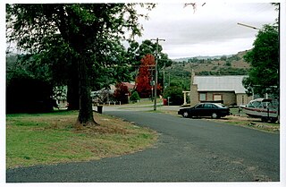
Neville is a small village in the south-east of New South Wales, Australia, in Blayney Shire. It is 60 km south west of Bathurst or about 16 km south-east of Mandurama. It is 940 metres above sea level and has a population of about 100.

Burrinjuck was an electoral district of the Legislative Assembly in the Australian state of New South Wales from 1950 to 2015.

The Lachlan Valley Railway Society is an Australian rail preservation society based in the New South Wales Central Western town of Cowra. It was established in 1974 to preserve and operate former New South Wales Government Railways locomotives and rolling stock. It operates regular heritage train tours to a variety of locations across New South Wales.

The Central West is a region in central New South Wales, Australia. The region is situated west of Sydney, which stretches from Lithgow in the east and to as far west as Lake Cargelligo, on the Lachlan River. The Central West is known for its attractions such as the Jenolan Caves, near Oberon and also wineries, as well as rural farmland and natural landscapes. The region includes major towns like, Bathurst, Orange, Mudgee, Lithgow, Parkes and Cowra. It has an area of 63,262 square kilometres (24,426 sq mi). The region also includes the sub-region known as the Central Tablelands, located in the eastern part of the region. The region known as the Orana, which includes the area surrounding Dubbo is typically classed as being a part of the Central West also.

The Cowra Shire is a local government area in the Central West region of New South Wales, Australia. The Shire is located adjacent to the Lachlan River, the Mid-Western Highway and the Lachlan Way.
Maude is a village on the north bank of the Murrumbidgee River in New South Wales, Australia. It is in between Hay and Balranald in Hay Shire. It is 55 kilometres downstream from Hay and 25 kilometres upstream from the junction of the Lachlan River with the Murrumbidgee. At the 2006 census, it had a population of 161. It consists of a general store, hotel, post office and caravan park. It is surrounded by market gardens supplied with water from Maude Weir, a popular spot for anglers looking for yellow belly, redfin and Murray cod.

Jugiong is a locality and town on the banks of the Murrumbidgee River near its confluence with Jugiong Creek. in the Hilltops Council Local Government area, New South Wales, Australia. It is situated just off the Hume Highway, by road, about 30 kilometres southwest from Bookham and 40 kilometres northeast from Gundagai.
Belubula was an electoral district of the Legislative Assembly in the Australian state of New South Wales from 1904 to 1913. The electorate included much of the modern Cabonne Council and Cowra Shire and was named after the Belubula River, which flows through the town of Canowindra. In 1913 it was largely absorbed into Lyndhurst.

Eugowra is a town in the Central West region of New South Wales, Australia. The town is split between Forbes Shire and Cabonne Shire local government area, 341 kilometres (212 mi) west of the state capital, Sydney. At the 2016 census, Eugowra had a population of 779.

Lachlan Valley Way is a New South Wales country road running from Booligal to north of Yass. It was named after the Lachlan River, and follows its southern bank for the majority of its length.
Wyangala is a small village in the Lachlan Valley, near the junction of the Abercrombie and Lachlan Rivers, just below the Wyangala Dam wall. It is in the South West Slopes of New South Wales, Australia, and about 320 km (200 mi) west of the state capital, Sydney. The name is also used for the surrounding rural locality, which includes the site of the former mining village of Mount McDonald.

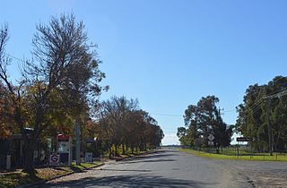
Morongla Creek is a small town in Cowra Shire, New South Wales, Australia. It has a population of about 40 people and is 13 km south of Cowra by road. Other nearby districts and/or villages are: Neila Creek, Cocomingla, Cucumgilliga, Wattamondara, Koorawatha and Noonbinna.
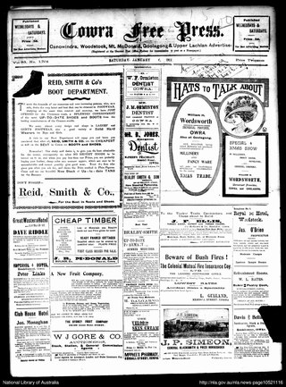
The Cowra Free Press was a semi-weekly English language newspaper published from 1878 to 1937 in Cowra, New South Wales, Australia.

The Lachlan River railway bridge is a heritage-listed former railway bridge which carried the Blayney–Demondrille railway line over the Lachlan River at Cowra, Cowra Shire, New South Wales, Australia. It was designed by John Whitton in his capacity as Engineer-in-Chief for Railways. The bridge was built from 1886 to 1887 by contractors Fishburn & Co. It is also known as the Cowra Rail Bridge over Lachlan River and the Cowra Lattice Railway Bridge. The property is owned by Transport Asset Holding Entity, an agency of the Government of New South Wales. It was added to the New South Wales State Heritage Register on 2 April 1999.

