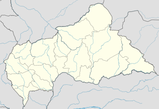
Alindao Airport is an airstrip serving Alindao, a small town in the Basse-Kotto prefecture of the Central African Republic. The runway is 2 kilometres (1.2 mi) southwest of the town.

Bakouma Airport is an airstrip serving Bakouma, a village in the Mbomou prefecture of the Central African Republic. The airstrip is 2 kilometres (1 mi) east of the village along the RR18 road.

M'Boki Airport is an airport serving Obo, a village in the Haut-Mbomou prefecture of the Central African Republic. The runway is 3 kilometres (2 mi) northwest of the village.

Batangafo Airport is an airport serving Batangafo, a city on the Ouham River in the Ouham prefecture of the Central African Republic. The airport is on the northeastern edge of the city, just off the RN4 road.

Birao Airport is a rural airstrip serving Birao, a village in the Vakaga prefecture of the Central African Republic. The runway is 10 kilometres (6.2 mi) southwest of the village.

Bocaranga Airport is an airstrip serving Bocaranga, a town in the Ouham-Pendé prefecture of the Central African Republic.

Bouca Airport is an airstrip serving Bouca, a village in the Ouham prefecture of the Central African Republic.

Bozoum Airport is an airstrip serving Bozoum, a town in the Ouham-Pendé prefecture of the Central African Republic. The runway is 6 kilometres (4 mi) west-northwest of the town, on the opposite side of the Ouham River.

Carnot Airport is an airstrip serving Carnot, a city in the Mambéré-Kadéï prefecture of the Central African Republic. The runway is on the western edge of the city.

Ouadda Airport is a rural airstrip serving Ouadda, a village in the Haute-Kotto prefecture of the Central African Republic. The runway is 6 kilometres (3.7 mi) south of the village, just off the RN5 road.

Ouanda Djallé Airport is an airstrip serving Ouanda Djallé, a village in the Vakaga prefecture of the Central African Republic. The airstrip lies alongside the RN5 road that runs northwest out of the village.

Rafaï Airport is an airstrip serving Rafaï, a village in the Mbomou prefecture of the Central African Republic. Rafaï village lines the RN2 road, and the runway is located mid-village just off the road.

Sibut Airport is an airstrip serving Sibut, a city in the Kémo prefecture of the Central African Republic. The airstrip is 2 kilometres (1.2 mi) southwest of the town. It was built after January 2014 and replaces a long closed airport east of Sibut.

Yalinga Airport is a rural airstrip 1 kilometre (0.6 mi) northeast of Yalinga, a hamlet in the Haute-Kotto prefecture of the Central African Republic.

Bossembélé Airport was an airstrip located within Bossembélé, a town in the Ombella-M'Poko prefecture of the Central African Republic. Mature trees now overhang the former runway.

Gamboula Airport is an airstrip serving Gamboula, a town in the Mambéré-Kadéï prefecture of the Central African Republic. The airstrip is 3 kilometres (2 mi) northeast of the town, alongside the RN6 road.

Kaga Bandoro Airport is an airstrip serving Kaga Bandoro, a town in the Nana-Grébizi prefecture of the Central African Republic. The runway is just south of the town.

Kembé Airport is an airstrip serving Kembé, a village in the Basse-Kotto prefecture of the Central African Republic. The runway is just west of the village.
San Gerónimo Airport is an airstrip serving Algarrobo, a Pacific coastal city in the Valparaíso Region of Chile. The airstrip is 4.6 kilometres (2.9 mi) inland from the coast.

Machaneng Airport is a military airstrip on the northeast side of Machaneng, a town in the Central District of Botswana. The runway is 11 kilometres (6.8 mi) west of the Limpopo River, locally Botswana's border with South Africa.


