Warri Airport, also known as Osubi Airstrip, is an airport serving the city of Warri in Delta State, Nigeria. It is about 10 kilometres (6.2 mi) northeast of the city.

Alindao Airport is an airstrip serving Alindao, a small town in the Basse-Kotto prefecture of the Central African Republic. The runway is 2 kilometres (1.2 mi) southwest of the town.
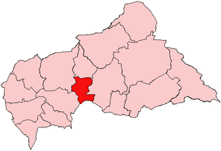
Bakouma Airport is an airstrip serving Bakouma, a village in the Mbomou prefecture of the Central African Republic. The airstrip is 2 kilometres (1 mi) east of the village along the RR18 road.
Birao Airport is a rural airstrip serving Birao, a village in the Vakaga prefecture of the Central African Republic. The runway is 10 kilometres (6.2 mi) southwest of the village.
Bocaranga Airport is an airstrip serving Bocaranga, a town in the Ouham-Pendé prefecture of the Central African Republic.
Bouca Airport is an airstrip serving Bouca, a village in the Ouham prefecture of the Central African Republic.
Bozoum Airport is an airstrip serving Bozoum, a town in the Ouham-Pendé prefecture of the Central African Republic. The runway is 6 kilometres (4 mi) west-northwest of the town, on the opposite side of the Ouham River.
Carnot Airport is an airstrip serving Carnot, a city in the Mambéré-Kadéï prefecture of the Central African Republic. The runway is on the western edge of the city.
Gordil Airport is an airstrip serving Gordil, a village in the Vakaga prefecture of the Central African Republic. The airstrip is 5 kilometres (3.1 mi) southeast of Gordil alongside the RN8 road in the northern part of Manovo-Gounda St. Floris National Park.
Ouadda Airport is a rural airstrip serving Ouadda, a village in the Haute-Kotto prefecture of the Central African Republic. The runway is 6 kilometres (3.7 mi) south of the village, just off the RN5 road.
Ouanda Djallé Airport is an airstrip serving Ouanda Djallé, a village in the Vakaga prefecture of the Central African Republic. The airstrip lies alongside the RN5 road that runs northwest out of the village.
Rafaï Airport is an airstrip serving Rafaï, a village in the Mbomou prefecture of the Central African Republic. Rafaï village lines the RN2 road, and the runway is located mid-village just off the road.
Yalinga Airport is a rural airstrip 1 kilometre (0.6 mi) northeast of Yalinga, a hamlet in the Haute-Kotto prefecture of the Central African Republic.
Gounda Airport was a rural airstrip in the Bamingui-Bangoran prefecture of the Central African Republic.
Koumala Airport was a rural airstrip in the Bamingui-Bangoran prefecture of the Central African Republic.
Bossembélé Airport was an airstrip located within Bossembélé, a town in the Ombella-M'Poko prefecture of the Central African Republic. Mature trees now overhang the former runway.

Baigua Airport was an agricultural airstrip near the hamlet of Baigue, in the La Altagracia Province of the Dominican Republic. Baigue is 7 kilometres (4.3 mi) southeast of Higüey.
Gamboula Airport is an airstrip serving Gamboula, a town in the Mambéré-Kadéï prefecture of the Central African Republic. The airstrip is 3 kilometres (2 mi) northeast of the town, alongside the RN6 road.
Kaga Bandoro Airport is an airstrip serving Kaga Bandoro, a town in the Nana-Grébizi prefecture of the Central African Republic. The runway is just south of the town.
Kembé Airport is an airstrip serving Kembé, a village in the Basse-Kotto prefecture of the Central African Republic. The runway is just west of the village.