Manovo-Gounda St. Floris National Park

Last updated
Manovo-Gounda St. Floris National Park
Central African Republic relief location map.jpg
Red pog.svg
Location Central African Republic
Coordinates 9°0′N21°30′E / 9.000°N 21.500°E / 9.000; 21.500
Area17,400 km2 (6,700 sq mi)
Established1979
TypeNatural
Criteriaix, x
Designated1988 (12th session)
Reference no. 475
Region Africa
Endangered 1997present

Manovo-Gounda St. Floris National Park (French : Parc national du Manovo-Gounda St Floris) is a national park and UNESCO World Heritage Site located in the Central African Republic prefecture Bamingui-Bangoran, near the Chad border. It was inscribed to the list of World Heritage Sites in 1988 as a result of the diversity of life present within it. [1]

Contents

Notable species include black rhinoceroses, elephants, Sudan cheetahs, leopards, red-fronted gazelles, and buffalo, giraffes, lions; a wide range of waterfowl species also occurs in the northern floodplains.

The site is under threat due to its rare wildlife dying and animals species being wiped out. The western black rhinoceros that was indigenous to the Central African Republic has gone extinct in 2011. The site was added to the List of World Heritage in Danger after reports of illegal grazing and poaching by heavily armed hunters, who may have harvested as much as 80% of the park's wildlife. The shooting of four members of the park staff in early 1997 and a general state of deteriorating security brought all development projects and tourism to a halt. [2]

The government of the Central African Republic proposed to assign site management responsibility to a private foundation. The preparation of a detailed state of conservation report and rehabilitation plan for the site was recommended by the World Heritage Committee at its 1998 session. People are working on breeding programs to revive the natural wildlife.

Location

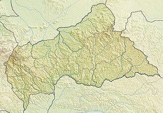
The park occupies most of the eastern end of Bamingui-Bangoran province in the north of the country. The park's northern boundary is the international border with Chad on the Aouk (Bahr) and Kameur Rivers. The eastern border is the Vakaga River, the western border is the Manovo River about 40 km (25 mi) east of N'Délé, and the southern border is the ridge of the Massif des Bongo. The Ndéle-Birao road runs through the park.

See also

Related Research Articles

<span class="mw-page-title-main">Virunga National Park</span> National park in the Democratic Republic of the Congo

Virunga National Park is a national park in the Albertine Rift Valley in the eastern part of the Democratic Republic of the Congo. It was created in 1925. In elevation, it ranges from 680 m (2,230 ft) in the Semliki River valley to 5,109 m (16,762 ft) in the Rwenzori Mountains. From north to south it extends approximately 300 km (190 mi), largely along the international borders with Uganda and Rwanda in the east. It covers an area of 8,090 km2 (3,120 sq mi).

<span class="mw-page-title-main">Taï National Park</span> National park in Ivory Coast

Taï National Park is a national park in Côte d'Ivoire that contains one of the last areas of primary rainforest in West Africa. It was inscribed as a World Heritage Site in 1982 due to the diversity of its flora and fauna. Five mammal species of the Taï National Park are on the Red List of Threatened Species: pygmy hippopotamus, olive colobus monkeys, leopards, chimpanzees, and Jentink's duiker.

<span class="mw-page-title-main">Niokolo-Koba National Park</span> National park in Senegal

The Niokolo-Koba National Park is a World Heritage Site and natural protected area in south eastern Senegal near the Guinea border. It is served by Niokolo-Koba Airport, an unpaved airstrip.

<span class="mw-page-title-main">Garamba National Park</span> National Park in the Democratic Republic of the Congo

Garamba National Park is a national park in the north-eastern Democratic Republic of the Congo covering nearly 5,200 km2 (2,000 sq mi). It is among Africa's oldest parks and was designated a World Heritage Site by UNESCO in 1980 for its protection of critical habitat for northern white rhinoceroses, African elephants, hippopotamuses, and giraffes. Garamba National Park has been managed by African Parks in partnership with the Institut Congolais pour la Conservation de la Nature since 2005.

<span class="mw-page-title-main">Protected areas of Madagascar</span>

This list of national parks of Madagascar includes all officially recognized protected areas as of 2015. The protected areas network of Madagascar is managed by the Madagascar National Parks Association (PNM-ANGAP). The network includes three types of protected areas: Strict Nature Reserves, National Parks and Wildlife Reserves. At the 2003 IUCN World Parks Congress in Durban, the Malagasy President, Marc Ravalomanana, announced an initiative to more than triple the area under protection from approximately 4,200,791 acres (17,000.00 km2) to over 14,826,322 acres (60,000.00 km2). This "Durban Vision", as it has been dubbed, involved broadening the definition of protected areas in the country and legislation has been passed to allow the creation of four new categories of protected area: Natural Parks, Natural Monuments, Protected Landscapes, and Natural Resource Reserves. As well as allowing these new objectives for protected areas management, the new legislation also provided for entities other than PNM-ANGAP to manage protected areas, such as government ministries, community associations, NGOs and other civil society organizations, and the private sector.

Gordil Airport is an airstrip serving Gordil, a village in the Vakaga prefecture of the Central African Republic. The airstrip is 5 kilometres (3.1 mi) southeast of Gordil alongside the RN8 road in the northern part of Manovo-Gounda St. Floris National Park.

Akourousoulba or Akoursoulbak is a village in the Bamingui-Bangoran Prefecture in the northern Central African Republic.

Krakoma is a village in the Bamingui-Bangoran Prefecture in the northern Central African Republic.

Pata, also known as Kpata, is a village in the Bamingui-Bangoran prefecture in the northern Central African Republic.

<span class="mw-page-title-main">Réunion National Park</span> French national park in Réunion

Réunion National Park is a National Park of France located on the island of Réunion, an overseas department in the western Indian Ocean. Established on 5 March 2007, the park protects the endemic ecosystems of Les Hauts, Réunion's mountainous interior, and covers around 42% of the island. Notable endemic species include the Réunion cuckooshrike and the Reunion Island day gecko.

Under UNESCO’s Man and the Biosphere Programme (MAB), there are 70 biosphere reserves recognized as part of the World Network of Biosphere Reserves in African states as of 2016. These are distributed across 28 countries. While biosphere reserves in West African, East African, Central African and Southern African countries are organised in the AfriMAB regional network, biosphere reserves in Northern African countries are organised in the ArabMAB, UNESCO's regional MAB network.

<span class="mw-page-title-main">Wildlife of the Central African Republic</span>

The wildlife of the Central African Republic is in the vast natural habitat in the Central African Republic (CAR) located between the Congo Basin's rain forests and large savannas, where the human density was smaller than 0.5 per km2 prior to 1850. The forest area of 22.755 million, considered one of the richest storehouses of wildlife spread over national parks, hunting reserves and community hunting areas, experienced an alarming loss of wildlife because of greed for ivory and bushmeat exploitation by hunters – mostly Arab slavers from across the borders of the Central African Republic with Chad and Sudan.

The Bamingui-Bangoran National Park complex is a national park and biosphere reserve located in the northern region of the Central African Republic. It makes up part of the Guinea-Congo Forest biome. The Vassako Bolo Strict Nature Reserve is in the midst of the park.

The Vassako Bolo Strict Nature Reserve is an 860-square-kilometre (330 sq mi) nature reserve within Bamingui-Bangoran National Park and Biosphere Reserve in the northern region of the Central African Republic. It is located near the town of N'Délé, Bamingui-Bangoran prefecture. It was gazetted in 1960.

Gula, also spelled Goula, is an ethnic group who lives in Central African Republic, Chad, and Sudan. In the Central African Republic, they live in the northern regions of Vakaga, Bamingui-Bangoran, and Haute-Kotto.

References

  1. "Manovo-Gounda St Floris National Park". UNESCO World Heritage Centre. Retrieved 2022-01-23.
  2. "21 COM VIII.A.4 - Decision". UNESCO World Heritage Centre. Retrieved 2022-01-23.

Further reading

Attribution

As of this edit, this article uses content from "Manovo-Gounda St. Floris National Park, Central African Republic" , which is licensed in a way that permits reuse under the Creative Commons Attribution-ShareAlike 3.0 Unported License, but not under the GFDL. All relevant terms must be followed.