Gorsley

Last updated

Gorsley Common
Village
GorsleyChristChurch.jpg
Christ Church, Gorsley
Gloucestershire UK location map.svg
Red pog.svg
Gorsley Common
Coordinates: 51°55′47″N2°28′00″W / 51.92979°N 2.46680°W / 51.92979; -2.46680
Country Flag of England.svg  England
Region South West England
County Gloucestershire

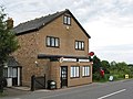
Gorsley is a small village in the Forest of Dean district of Gloucestershire, forming part of the civil parish of Gorsley and Kilcot in the South West England. [1] Nearby Gorsley Common and Little Gorsley are both in Herefordshire.

Contents

Location and amenities

Gorsley is 4.7 km (2.9 mi) west of Newent, [2] 10 km (6.2 mi) east of Ross-on-Wye [3] and about 19 km (12 mi) south of Ledbury. [4] The village is near junction 3 of the M50, one of the first motorways built in Britain in 1960. The slip roads on the junction end in right angled turns which often surprise motorists used to the more gradual, modern junction designs.

The Anglican church parish is combined with Cliffords Mesne. [5] [6] A stone Baptist chapel opened in 1852. [7]

Gorsley limestone is named for the area. [8] Stone from area quarries were used to build Victorian era buildings. [9] Victorian maps show a number of quarries and lime kilns in the area.

The village pub is The Roadmaker, originally named The New Inn. It is owned and run by four ex-British Army Ghurka soldiers. [10] [11]

Related Research Articles

<span class="mw-page-title-main">Dymock</span> Human settlement in England

Dymock is a village and civil parish in the Forest of Dean district of Gloucestershire, England, about four miles south of Ledbury. In 2014 the parish had an estimated population of 1,205.

<span class="mw-page-title-main">Herefordshire and Gloucestershire Canal</span>

The Herefordshire and Gloucestershire Canal is a canal in the west of England, which ran from Hereford to Gloucester, where it linked to the River Severn. It was opened in two phases in 1798 and 1845, and closed in 1881, when the southern section was used for the course of the Ledbury and Gloucester Railway. It is the subject of an active restoration scheme.

<span class="mw-page-title-main">A48 road</span> Trunk road in Great Britain

The A48 is a trunk road in Great Britain running from the A40 at Highnam, 3 miles (4.8 km) west of Gloucester, England, to the A40 at Carmarthen, Wales. Before the Severn Bridge opened on 8 September 1966, it was a major route between England and South Wales. For most of its route, it runs almost parallel to the M4 motorway. During times of high winds at the Severn Bridge, the A48 is used as part of the diversion route and is still marked as a Holiday Route.

<span class="mw-page-title-main">Newent</span> Human settlement in England

Newent is a market town and civil parish in the Forest of Dean in Gloucestershire, England. The town is 11 miles (18 km) north-west of Gloucester. Its population was 5,073 at the 2001 census, rising to 5,207 in 2011, The population was 6,777 at the 2021 Census. Once a medieval market and fair town, its site had been settled at least since Roman times. The first written record of it appears in the 1086 Domesday Book.

<span class="mw-page-title-main">M50 motorway (Great Britain)</span> Motorway in England

The M50 is a dual two-lane motorway in Worcestershire, Gloucestershire, and Herefordshire, England. Sometimes referred to as the Ross Spur, it is a 22 miles (35 km) connection of the M5 motorway to a point near Ross-on-Wye, where it joins the A40 road continuing westward into Wales. The motorway was fully opened in 1962.

<span class="mw-page-title-main">Forest of Dean District</span> Non-metropolitan district in England

Forest of Dean is a local government district in west Gloucestershire, England, named after the Forest of Dean. Its council is based in Coleford. Other towns and villages in the district include Blakeney, Cinderford, Drybrook, English Bicknor, Huntley, Littledean, Longhope, Lydbrook, Lydney, Mitcheldean, Newnham and Newent.

<span class="mw-page-title-main">A417 road</span> Major road in England

The A417 is a main road in England running from Streatley, Berkshire to Hope under Dinmore, Herefordshire. It is best known for its section between Cirencester and Gloucester where it has primary status and forms part of the link between the major settlements of Swindon and Gloucester.

<span class="mw-page-title-main">May Hill</span> Hill in Gloucestershire, England

May Hill is a prominent English hill between Gloucester and Ross-on-Wye. Its summit, on the western edge of Gloucestershire and its northern slopes in Herefordshire, is distinguishable by a clump of trees on its summit, which forms an official Site of Special Scientific Interest. It is reached by three public footpaths, two as parts of the Gloucestershire Way and Wysis Way.

<span class="mw-page-title-main">St Briavels</span> Village and civil parish in Gloucestershire, England

St Briavels, is a medium-sized village and civil parish in the Royal Forest of Dean in west Gloucestershire, England; close to the England-Wales border, and 5 miles (8 km) south of Coleford. It stands almost 800 feet (240 m) above sea level on the edge of a limestone plateau above the valley of the River Wye, above an ancient meander of the river. To the west, Cinder Hill drops off sharply into the valley. It is sheltered behind the crumbling walls of the 12th century St Briavels Castle.

<span class="mw-page-title-main">Huntley, Gloucestershire</span> Human settlement in England

Huntley, Gloucestershire, is a village on the A40 located seven miles (11 km) west of Gloucester. It is in the north of the Forest of Dean.

<span class="mw-page-title-main">Aston Ingham</span> Village in Herefordshire, England

Aston Ingham is a village in south-eastern Herefordshire, England, near Newent and about 7 miles (11 km) east of Ross-on-Wye. The population of the village at the 2011 census was 398. There is a church, dedicated to St John the Baptist, which has been a Grade II* listed building since 17 March 1987.

<span class="mw-page-title-main">Ledbury railway station</span> Railway station in Herefordshire, England

Ledbury railway station is located on the outskirts of the town of Ledbury, on the Worcester to Hereford line in the English Midlands. It has regular services to Birmingham, plus several direct trains a day to London Paddington.

<span class="mw-page-title-main">Mitcheldean</span> Human settlement in England

Mitcheldean is a market town in the Forest of Dean in Gloucestershire, England.

<span class="mw-page-title-main">A466 road</span> Road in England and Wales

The A466, also known as the Wye Valley Road, is a road from Hereford, England to Chepstow, Wales via Monmouth, Tintern and the Wye Valley.

<span class="mw-page-title-main">Cliffords Mesne</span>

Cliffords Mesne is an English village in Gloucestershire, two miles south-west of the town of Newent. It became the home of the autobiographical author Winifred Foley from the mid-1970s, after the success of her first book of Gloucestershire reminiscences, A Child in the Forest.

<span class="mw-page-title-main">Newent railway station</span> Former railway station in Gloucestershire, England

Newent railway station served the town of Newent in Gloucestershire, England.

<span class="mw-page-title-main">Mitcheldean Road railway station</span> Former railway station in Herefordshire, England

Mitcheldean Road railway station was a railway station that served the town of Mitcheldean 1.5 miles (2.4 km) to the south and the village of Lea in Herefordshire. Opened in 1855 with the line it was located on the Great Western Railway line linking Ross-on-Wye and Gloucester.

<span class="mw-page-title-main">Hereford Road Skew Bridge</span> Bridge in Ledbury, Herefordshire

Hereford Road Skew Bridge is a disused railway bridge in Ledbury, Herefordshire. Built in 1881 to carry the Ledbury and Gloucester Railway across the Hereford Road at an angle of approximately 45°, it was built as a ribbed skew arch with stone spandrels and wing walls, and ribs of blue brick. The railway line was closed in 1959 and the bridge is now used as part of the Ledbury Town Trail footpath.

<span class="mw-page-title-main">Bridstow</span> Village and parish in Herefordshire, England

Bridstow is a village and civil parish in Herefordshire, England, 2 km west of Ross-on-Wye and 17 km south-east of Hereford. The parish is bounded to the east and south by the River Wye. The A40 road linking the M50 motorway to South Wales runs through the parish, crossing the Wye at Bridstow Bridge. The parish had a population of 906 in the 2011 UK census, and an estimated population of 941 in 2018.

<span class="mw-page-title-main">32 Gloucester–Ross-on-Wye</span> Bus route in Gloucestershire and Herefordshire


The number 32 is a bus route that operates from Gloucester to Newent, with some journeys continuing to Ross-on-Wye. It is run on a commercial basis.

References

  1. "Gorsley, Forest of Dean". Ordnance Survey. 22 June 2017.
  2. "Directions Gorsley to Newent". Google maps. 22 June 2017.
  3. "Directions Gorsley to Ross-on-Wye". Google maps. 22 June 2017.
  4. "Directions Gorsley to Ledbury". Google maps. 22 June 2017.
  5. "Gorsley with Clifford Mesne". A Church Near You. Archived from the original on 5 October 2012. Retrieved 22 August 2011.
  6. "The District of Gorsley with Clifford's Mesne, in the Counties of Gloucester and Hereford and Diocese of Gloucester and Bristol". Appendix to the twenty-sixth (twenty-seventh, thirty-fifth-forty-seventh) report. Edward Stanford. 1874. p. 344.
  7. The Primitive Church Magazine. 1852. p. 296.
  8. Alfred M. Ziegler; R. B. Rickards; W. S. McKerrow (1 January 1974). Correlation of the Silurian Rocks of the British Isles. Geological Society of America. p. 46. ISBN   978-0-8137-2154-5.
  9. David Verey; Alan Brooks (2002). Gloucestershire: The Vale and the Forest of Dean. Yale University Press. p. 30. ISBN   978-0-300-09733-7.
  10. "The Roadmaker Inn". theroadmakerinn.co.uk.
  11. Lezli Rees. Walking the dog - Motorway walks for drivers and dogs. Veloce Publishing Ltd. p. 155. ISBN   978-1-84584-552-0.