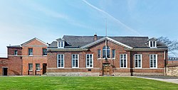
There are fourteen Grade I listed buildings in Leicester . In the United Kingdom, the term listed building refers to a building or other structure officially designated as being of special architectural, historical or cultural significance. Grade I structures are those considered to be "buildings of exceptional interest". [1] Listing was begun by a provision in the Town and Country Planning Act 1947. Once listed, severe restrictions are imposed on the modifications allowed to a building's structure or its fittings. In England, the authority for listing under the Planning (Listed Buildings and Conservation Areas) Act 1990 [2] rests with Historic England, a non-departmental public body sponsored by the Department for Culture, Media and Sport. Local authorities have a responsibility to regulate and enforce the planning regulations.
There are also ten Scheduled Monuments in Leicester, some of which are also listed buildings.
Name | Location | Type | Completed [note 1] | Date designated | Grid ref. [note 2] Geo-coordinates | Notes | Entry number [note 3] | Image | Ref. |
---|---|---|---|---|---|---|---|---|---|
Leicester Abbey Ruins | 1 Abbey Park | Ruin | Founded 1143 | 1950 | SK5846806007 52°38′55″N1°08′14″W / 52.648655°N 1.1372297°W | Within a public park. Includes a memorial slab to Cardinal Wolsey. | 1074051 | [3] | |
Abbot Penny's Wall | 2 Abbey Park | Wall | c.1500 | 1975 | SK5851306115 52°38′59″N1°08′12″W / 52.6496°N 1.13655°W | Forms West and north boundary to Abbey Lane and Abbey Park Road East boundary along River Soar. Some of the earliest medieval brickwork in Leicester. | 1361406 | [4] | |
Remains of Cavendish House | 3 Abbey Park | Ruin | c.1600 | 1950 | SK5840806078 52°38′57″N1°08′17″W / 52.6493°N 1.1381°W | Built from stones of Leicester Abbey. Now within the public park. | 1074052 | [5] | |
Castle Hall | 4 Castle Yard | Castle hall | 11th–12th century, front 1695 | 1975 | SK5822204190 52°37′56″N1°08′28″W / 52.63235°N 1.141185°W | Includes the Great Hall of Leicester Castle, with its hammer beam roof and Queen Anne frontage, and John of Gaunt's cellar | 1200622 | [6] | |
Turret Gateway | 5 Castle View | Fortification | c.1422-3 | 1950 | SK5831204122 52°37′54″N1°08′24″W / 52.6317°N 1.13987°W | It gave access from Castle Yard to 'The Newarke'. It is also known as Prince Rupert's Gateway, from his Civil War action, capturing the town. | 1074069 | [7] | |
Church of St Mary de Castro | 6 Castle Yard | Church | From early 13th century | 1950 | SK5828504188 52°37′56″N1°08′25″W / 52.6323°N 1.14025°W | Spire dismantled in 2013, with hopes of funding to re-instate it. | 1074070 | [8] | |
Former Church of All Saints | 7 High Cross Street | Church | From early 13th century | 1950 | SK5827404840 52°38′18″N1°08′25″W / 52.6382°N 1.1403°W | In the care of the Churches Conservation Trust | 1074012 | [9] | |
The Guildhall | 8 Guildhall Lane | Guildhall | From mid-14th century | 1950 | SK5844404453 52°38′05″N1°08′16″W / 52.6347°N 1.13786°W | Served as de facto Town Hall until 1874. Includes the Constable's House. | 1361405 | [10] | |
The City Rooms | 9 Hotel Street | Assembly Rooms | 1792 | 1950 | SK5869904350 52°38′01″N1°08′03″W / 52.6337°N 1.1341°W | Architect: John Johnson of Leicester. Name changed from 'County Rooms' when City Council acquired it. | 1184114 | [11] | |
Church of St Margaret | 10 St Margaret's Way | Church | Mainly 15th century | 1950 | SK5854205087 52°38′25″N1°08′11″W / 52.6404°N 1.1363°W | Transept dates to 1200. Evidence of Anglo-Saxon origins. It now stands on St Margaret's Way (A6), which was built in 1960s, but originally listed as being on Church Gate.) | 1074072 | [12] | |
Jewry Wall | 11 St Nicholas Circle | Roman masonry | AD 125-30 | 1950 | SK5822404489 52°38′06″N1°08′28″W / 52.635036°N 1.1411°W | Among the largest surviving non-military Roman masonry in Britain. Stands alongside excavated remains of Roman Forum. | 10748 | [13] | |
Church of St Nicholas | 12 St Nicholas Circle | Church | From AD 880 | 1950 | SK5823804501 52°38′07″N1°08′27″W / 52.63514°N 1.14089°W | Incorporates re-used Roman brickwork | 1361046 | [14] | |
Magazine Gateway | 13 The Newarke | fortification | c.1410 | 1950 | SK5844604120 52°37′54″N1°08′16″W / 52.6317°N 1.13789°W | Principal gateway to Henry, 3rd Earl of Lancaster's Newarke founded in 1310. | 1184902 | [15] | |
The Arch of Remembrance | 14 Victoria Park, Leicester | War memorial | 1923 | 1955 | SK5956503212 52°37′24″N1°07′17″W / 52.6234°N 1.1215°W | Architect: Sir Edwin Lutyens | 1074786 | [16] |
In the United Kingdom a listed building is a structure of particular architectural and/or historic interest deserving of special protection. Such buildings are placed on one of the four statutory lists maintained by Historic England in England, Historic Environment Scotland in Scotland, Cadw in Wales, and the Northern Ireland Environment Agency in Northern Ireland. The term has also been used in the Republic of Ireland, where buildings are protected under the Planning and Development Act 2000, although the statutory term in Ireland is "protected structure".
There are 100 Grade I listed buildings in Bristol, England according to Bristol City Council. The register includes many structures which for convenience are grouped together in the list below.
This is a list of Grade I listed buildings in Lancashire, England.
Mendip is a local government district in the English county of Somerset. The Mendip district covers a largely rural area of 285 square miles (738 km2) ranging from the Mendip Hills through on to the Somerset Levels. It has a population of approximately 11,000. The administrative centre of the district is Shepton Mallet.
North Somerset is a unitary authority in the ceremonial county of Somerset, England. In the United Kingdom, the term listed building refers to a building or other structure officially designated as being of special architectural, historical or cultural significance; Grade I structures are those considered to be "buildings of exceptional interest". Listing was begun by a provision in the Town and Country Planning Act 1947. Once listed, severe restrictions are imposed on the modifications allowed to a building's structure or its fittings. In England, the authority for listing under the Planning Act 1990 rests with Historic England, a non-departmental public body sponsored by the Department for Digital, Culture, Media and Sport; local authorities have a responsibility to regulate and enforce the planning regulations.
Sedgemoor is a local government district in the English county of Somerset. In the United Kingdom, the term listed building refers to a building or other structure officially designated as being of special architectural, historical or cultural significance; Grade I structures are those considered to be "buildings of exceptional interest". Listing was begun by a provision in the Town and Country Planning Act 1947. Once listed, severe restrictions are imposed on the modifications allowed to a building's structure or its fittings. In England, the authority for listing under the Planning Act 1990 rests with Historic England, a non-departmental public body sponsored by the Department for Digital, Culture, Media and Sport; local authorities have a responsibility to regulate and enforce the planning regulations.
Taunton Deane is a local government district with borough status in the English county of Somerset. In the United Kingdom, the term listed building refers to a building or other structure officially designated as being of special architectural, historical or cultural significance; Grade I structures are those considered to be "buildings of exceptional interest". Listing was begun by a provision in the Town and Country Planning Act 1947. Once listed, severe restrictions are imposed on the modifications allowed to a building's structure or its fittings. In England, the authority for listing under the Planning Act 1990 rests with Historic England, a non-departmental public body sponsored by the Department for Digital, Culture, Media and Sport; local authorities have a responsibility to regulate and enforce the planning regulations.
West Somerset is a local government district in the English county of Somerset. In the United Kingdom, the term listed building refers to a building or other structure officially designated as being of special architectural, historical or cultural significance; Grade I structures are those considered to be "buildings of exceptional interest". Listing was begun by a provision in the Town and Country Planning Act 1947. Once listed, severe restrictions are imposed on the modifications allowed to a building's structure or its fittings. In England, the authority for listing under the Planning Act 1990 rests with Historic England, a non-departmental public body sponsored by the Department for Digital, Culture, Media and Sport; local authorities have a responsibility to regulate and enforce the planning regulations.
There are 42 Grade I listed buildings in Maidstone. The Borough of Maidstone is a local government district in the English county of Kent. The district covers a largely rural area of 152 square miles (394 km2) between the North Downs and the Weald with the town of Maidstone, the county town of Kent, in the north-west. The district has a population of approximately 166,400 in 2016.
In the United Kingdom, the term listed building refers to a building or other structure officially designated as being of special architectural, historical, or cultural significance; Grade I structures are those considered to be "buildings of exceptional interest". Listing was begun by a provision in the Town and Country Planning Act 1947. Once listed, strict limitations are imposed on the modifications allowed to a building's structure or fittings. In Wales, the authority for listing under the Planning Act 1990 rests with Cadw.
West Somerset is a local government district in the county of Somerset which is in South West England. In the United Kingdom, the term listed building refers to a building or other structure officially designated as being of special architectural, historical or cultural significance; Grade II* structures are those considered to be "particularly significant buildings of more than local interest". Listing was begun by a provision in the Town and Country Planning Act 1947. Once listed, severe restrictions are imposed on the modifications allowed to a building's structure or its fittings. In England, the authority for listing under the Planning Act 1990 rests with Historic England, a non-departmental public body sponsored by the Department for Digital, Culture, Media and Sport; local authorities have a responsibility to regulate and enforce the planning regulations.
Bath and North East Somerset is a unitary authority created on 1 April 1996, following the abolition of the County of Avon, which had existed since 1974. Part of the ceremonial county of Somerset, Bath and North East Somerset occupies an area of 220 square miles (570 km2), two-thirds of which is green belt. It stretches from the outskirts of Bristol, south into the Mendip Hills and east to the southern Cotswold Hills and Wiltshire border. The city of Bath is the principal settlement in the district, but BANES also covers Keynsham, Midsomer Norton, Radstock and the Chew Valley. The area has a population of 170,000, about half of whom live in Bath, making it 12 times more densely populated than the rest of the area.
North Somerset is a unitary authority in the ceremonial county of Somerset, England. As a unitary authority, North Somerset is administered independently of the non-metropolitan county of Somerset. Its administrative headquarters are located in the town hall of Weston-super-Mare.
Sedgemoor is a local government district in the English county of Somerset. In the United Kingdom, the term listed building refers to a building or other structure officially designated as being of special architectural, historical or cultural significance; Grade II* structures are those considered to be "particularly significant buildings of more than local interest". Listing was begun by a provision in the Town and Country Planning Act 1947. Once listed, severe restrictions are imposed on the modifications allowed to a building's structure or its fittings. In England, the authority for listing under the Planning Act 1990 rests with Historic England, a non-departmental public body sponsored by the Department for Digital, Culture, Media and Sport; local authorities have a responsibility to regulate and enforce the planning regulations.
In the United Kingdom, the term listed building refers to a building or other structure officially designated as being of special architectural, historical, or cultural significance; Grade I structures are those considered to be "buildings of exceptional interest". Listing was begun by a provision in the Town and Country Planning Act 1947. Once listed, strict limitations are imposed on the modifications allowed to a building's structure or fittings. In Wales, the authority for listing under the Planning Act 1990 rests with Cadw.
There are 33 Grade I listed buildings in the Vale of Glamorgan all of which are churches and priory buildings, castles, country or manor houses and associated structures such as churchyard crosses and a dovecote.
In the United Kingdom, the term listed building refers to a building or other structure officially designated as being of special architectural, historical, or cultural significance; Grade II* structures are those considered to be "particularly important buildings of more than special interest". Listing was begun by a provision in the Town and Country Planning Act 1947. Once listed, strict limitations are imposed on the modifications allowed to a building's structure or fittings. In Wales, the authority for listing under the Planning Act 1990 rests with Cadw.
There are 62 Grade I listed buildings in South Yorkshire, England. In the United Kingdom, the term listed building refers to a building or other structure officially designated as being of special architectural, historical or cultural significance; Grade I structures are those considered to be "buildings of exceptional interest". In England, the authority for listing under the Planning Act 1990 rests with Historic England, a non-departmental public body sponsored by the Department for Culture, Media and Sport.