Related Research Articles

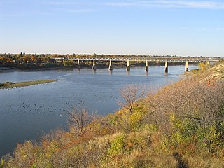
The Saskatchewan River is a major river in Canada, about 550 kilometres (340 mi) long, flowing roughly eastward across Saskatchewan and Manitoba to empty into Lake Winnipeg. Through its tributaries the North Saskatchewan and South Saskatchewan, its watershed encompasses much of the prairie regions of central Canada, stretching westward to the Rocky Mountains in Alberta and northwestern Montana in the United States. It reaches 1,939 kilometres (1,205 mi) to its farthest headwaters on the Bow River, a tributary of the South Saskatchewan in Alberta.

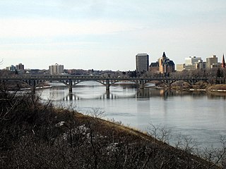
The South Saskatchewan River is a major river in Canada that flows through the provinces of Alberta and Saskatchewan.

Alberta is a Canadian province. Located in Western Canada, the province has an area of 661,190 square kilometres (255,290 sq mi) and is bounded to the south by the U.S. state of Montana along 49° north for 298 kilometres (185 mi); to the east at 110° west by the province of Saskatchewan for 1,223 kilometres (760 mi); and at 60° north the Northwest Territories for 644 kilometres (400 mi). The southern half of the province borders British Columbia along the Continental Divide of the Americas on the peaks of the Rocky Mountains, while the northern half borders British Columbia along the 120th meridian west. It is one of only two landlocked provinces.

Lake Athabasca is located in the northwest corner of Saskatchewan and the northeast corner of Alberta between 58° and 60° N. The lake is 26% in Alberta and 74% in Saskatchewan.

The Cypress Hills are a geographical region of hills in southwestern Saskatchewan and southeastern Alberta, Canada. The hills are part of the Missouri Coteau upland.

The Churchill River is a major river in Alberta, Saskatchewan and Manitoba, Canada. From the head of the Churchill Lake it is 1,609 kilometres (1,000 mi) long. It was named after John Churchill, 1st Duke of Marlborough and governor of the Hudson's Bay Company from 1685 to 1691.

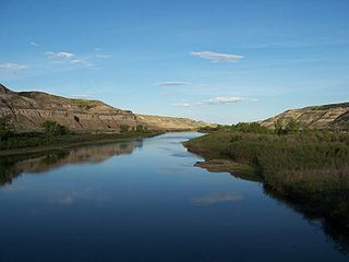
The Red Deer River is a river in Alberta and a small portion of Saskatchewan, Canada. It is a major tributary of the South Saskatchewan River and is part of the larger Saskatchewan-Nelson system that empties into Hudson Bay.

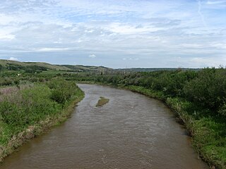
Battle River is a river in central Alberta and western Saskatchewan. It is a major tributary of the North Saskatchewan River.

Beaver River is a large river in east-central Alberta and central Saskatchewan, Canada. It flows east through Alberta and Saskatchewan and then turns sharply north to flow into Lac Île-à-la-Crosse on the Churchill River which flows into Hudson Bay.

The geography of Saskatchewan is unique among the provinces and territories of Canada in some respects. It is one of only two landlocked regions and it is the only region whose borders are not based on natural features like lakes, rivers, or drainage divides. The borders of Saskatchewan, which make it very nearly a trapezoid, were determined in 1905 when it became a Canadian province. Saskatchewan has a total area of 651,036 square kilometres (251,366 sq mi) of which 591,670 km2 (228,450 sq mi) is land and 59,366 km2 (22,921 sq mi) is water.

Big Lake is a lake in Edmonton metropolitan region, Canada. It is located adjacent to the northwest corner of Edmonton and the southwest corner of St. Albert. Its primary inflow is the Sturgeon River. The lake sits on the sands and gravels of the Empress Formation, an aquifer 30 m (98 ft) below its surface that was laid down by retreating glacial meltwaters.

The Waterhen River is an east-flowing river in northwest Saskatchewan in the basin of the Beaver River (Canada). It is north of and parallel to the east-flowing part of the Beaver River and joins the north-flowing part of that river. It is at the southern edge of the boreal forest belt. The large Primrose Lake discharges south through the Martineau River into Cold Lake on the Alberta-Saskatchewan border. Cold Lake discharges east into the Cold River through Pierce Lake then into Lac des Iles. The Waterhen River begins on the east side of Lac des Iles and flows east to Waterhen Lake. Most of the river from Lac des Iles to Waterhen Lake is in Meadow Lake Provincial Park. East of Waterhen Lake the river leaves the park and flows east and somewhat north into the north-flowing part of the Beaver River.

The Buffalo River Dene Nation is a Dene First Nations band government in Saskatchewan, Canada. The band's main community, Dillon, is located on the western shore of Peter Pond Lake at the mouth of the Dillon River, and is accessed by Highway 925 from Highway 155.
Conjuring Creek is a stream in Alberta, Canada, and is a minor tributary of the North Saskatchewan River. It originates at Wizard Lake and drains into the North Saskatchewan River. It runs from south to north passing through the town of Calmar.
Dillon River is a stream in Alberta and Saskatchewan, Canada. It discharges into Peter Pond Lake.

Dillon is an unincorporated community in the boreal forest of northern Saskatchewan, Canada. It is located on the western shore of Peter Pond Lake at the mouth of the Dillon River. The community is the administrative headquarters of the Buffalo River Dene Nation and is accessed by Highway 925 from Highway 155.

Pipestone Creek is a river in the Souris River watershed. Its flow begins in south-eastern Saskatchewan, just south of the town of Grenfell and travels in a south-eastly direction into Manitoba in the Westman Region where it empties into Oak Lake through the Oak Lake Marsh.

Long Creek is a river in central North America that begins in Saskatchewan, flows south-east into North Dakota, and then flows back north into Saskatchewan. It is a tributary of the Souris River. The Souris River drains into the Assiniboine River, which is part of the Red River drainage basin in a region called the Prairie Pothole Region of North America, which extends throughout three Canadian provinces and five U.S. states. It is also within Palliser's Triangle and the Great Plains ecoregion.

Moose Mountain Creek is a river in the province of Saskatchewan, Canada. Its source is the Chapleau Lakes near Montmartre and it is a tributary of the Souris River, which, in turn, is a tributary of the Assiniboine River. The whole system is part of the Red River watershed, which is part of the Hudson Bay drainage basin and in a region called the Prairie Pothole Region of North America, which extends throughout three Canadian provinces and five U.S. states. It is also within Palliser's Triangle and the Great Plains ecoregion.

Graham Creek, a tributary of the Souris River, is a river that flows from Saskatchewan near Maryfield into Manitoba where it meets the Souris River on the west side of Melita, Manitoba. The Souris River, in turn, drains into the Assiniboine River, which is part of the Red River drainage basin in a region called the Prairie Pothole Region of North America. That region extends throughout three Canadian provinces and five U.S. states. It is also within Palliser's Triangle and the Great Plains ecoregion.
References
- ↑ "Graham Creek". Geographical Names Data Base. Natural Resources Canada.
- ↑ Government of Canada, Natural Resources Canada. "Place names - Graham Lake". www4.rncan.gc.ca.
- ↑ Place-names of Alberta. Ottawa: Geographic Board of Canada. 1928. p. 59.