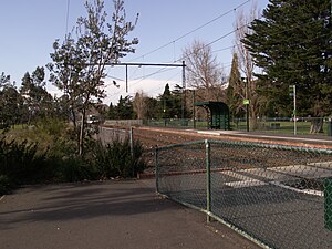
Burnley railway station is the junction for the Lilydale, Belgrave, Alamein and Glen Waverley lines in Victoria, Australia. It serves the inner eastern Melbourne suburb of Burnley, and it opened on 1 May 1880 as Burnley Street. It was renamed Burnley on 1 September 1882.

Carrum railway station is located on the Frankston line in Victoria, Australia. It serves the south-eastern Melbourne suburb of Carrum, and opened on 1 August 1882.

Frankston railway station, in Victoria, Australia, is the terminus of the suburban electrified Frankston line and diesel-hauled services on the Stony Point line. It serves the south-eastern Melbourne suburb of Frankston, and opened on 1 August 1882.

Oakleigh railway station is a commuter railway station in the suburb of Oakleigh, south east of Melbourne. Victoria. The station opened in 1877 as the up end of the Gippsland line, with the station being electrified in 1922. The station consists of two island platforms which offer direct street access and are connected via a pedestrian subway. There is a station building on both platforms which functions as a ticket office, a waiting room and a toilet. The station is fully accessible as there are lifts and accessible ramps provided at the station.

Williamstown railway station is the terminus of the electrified suburban Williamstown line in Victoria, Australia. It serves the western Melbourne suburb of Williamstown, and it opened on 17 January 1859.
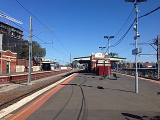
Essendon railway station is located on the Craigieburn line in Victoria, Australia. It serves the northern Melbourne suburb of Essendon, and it opened on 1 November 1860.

Macaulay railway station is located on the Upfield line in Victoria, Australia. It serves the inner northern Melbourne suburb of North Melbourne, and it opened on 1 December 1887 as Macaulay Road. It was renamed Macaulay on 1 May 1909.
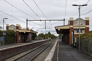
Spotswood railway station is located on the Werribee and Williamstown lines in Victoria, Australia. It serves the western Melbourne suburb of Spotswood, and opened on 1 December 1878 as Edom. It was renamed Bayswater on 1 September 1881, renamed Spottiswoode on 1 October 1881, and renamed Spotswood on 1 August 1905.

Northcote railway station is located on the Mernda line in Victoria, Australia. It serves the north-eastern Melbourne suburb of Northcote, and opened on 8 October 1889 as Middle Northcote. It was renamed Northcote on 10 December 1906.

Bell railway station is located on the Mernda line in Victoria, Australia. It serves the northern Melbourne suburb of Preston, and it opened on 8 October 1889 as Preston-Bell Street. It was renamed Bell on 1 August 1905.

Keon Park railway station is located on the Mernda line in Victoria, Australia. It serves the northern Melbourne suburb of Thomastown, and it opened on 16 December 1929 as Keonpark. It was renamed Keon Park on 29 February 1972.

Deer Park railway station is located on the Serviceton line in Victoria, Australia. It serves the western Melbourne suburb of Deer Park, and it opened on 2 April 1884 as Kororoit. It was renamed Deer Park on 3 December 1889.
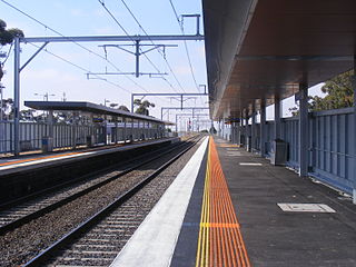
Diggers Rest railway station is located on the Sunbury line in Victoria, Australia. It serves the north-western Melbourne suburb of Diggers Rest, and it opened on 2 October 1859.

Craigieburn railway station is the terminus of the suburban electrified Craigieburn line in Victoria, Australia. It serves the northern Melbourne suburb of Craigieburn, and opened on 22 July 1872.
St Kilda station is a current tram stop and former railway station, located in the Melbourne suburb of St Kilda, Australia, and was the terminus of the St Kilda railway line in the Melbourne suburban rail system. It is one of the oldest surviving railway station buildings in Victoria. The building is currently used as retail premises, while the platform serves as stop 132 on tram route 96.

Station Pier is a historic Australian pier on Port Phillip, in Port Melbourne, Victoria. Opened in 1854, the pier is Melbourne's primary passenger terminal, servicing interstate ferries and cruise ships, and is listed on the Victorian Heritage Register.
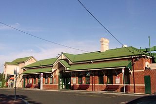
Bacchus Marsh railway station is located on the Serviceton line in Victoria, Australia. It serves the town of Bacchus Marsh, and it opened on 10 February 1887.

Montague Street is a light rail station and former railway station, on the former Port Melbourne railway line in the inner Melbourne suburb of South Melbourne, Australia. The station was located to the south of the Montague Street road underpass, between Woodgate Street and Gladstone Lane, with a large goods shed located on the Melbourne side of the station. The station buildings and platforms have been demolished, and there are now a pair of low-level platforms forming a tram stop on route 109.

Albert Park is a light rail station on the former St Kilda line, located in the Melbourne suburb of Albert Park, Victoria. The station is located on Ferrars Street just to the north of Albert Road, just minutes walk from the Bob Jane Stadium, current home of the South Melbourne Soccer club and the former home of the South Melbourne Football Club. A pair of low level side platforms now serve route 96 trams on the light rail line.

Sale railway station is located on the Gippsland line in Victoria, Australia. It serves the town of Sale, and it opened on 4 December 1983.
