
Mont Blanc is the second-highest mountain in Europe after Mount Elbrus. It is the highest mountain in the Alps, rising 4,808 m (15,774 ft) above sea level. It is the eleventh-most prominent peak in the world. The mountain stands in a range called the Graian Alps, between the regions of Aosta Valley, Italy, and Savoie and Haute-Savoie, France. The location of the summit is on the watershed line between the valleys of Ferret and Veny in Italy and the valleys of Montjoie, and Arve in France, on the border between the two countries.

The Dauphiné Alps are a group of mountain ranges in southeastern France, west of the main chain of the Alps. Mountain ranges within the Dauphiné Alps include the Massif des Écrins, Belledonne, the Taillefer range and the mountains of Matheysine.

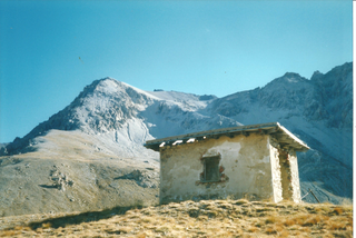
The Col du Galibier is a mountain pass in the southern region of the French Dauphiné Alps near Grenoble. It is the eighth highest paved road in the Alps, and recurrently the highest point of the Tour de France.

The Gran Paradiso or Grand Paradis is a mountain in the Graian Alps in Italy, located between the Aosta Valley and Piedmont regions.

The Barre des Écrins is a mountain in the French Alps with a peak at 4102m altitude. It is the highest peak of the Massif des Écrins and the Dauphiné Alps and the most southerly alpine peak in Europe that is higher than 4,000 m. It is the only 4,000 m mountain in France that lies outside the Mont Blanc Massif. Before the annexation of Savoy in 1860 it was the highest mountain in France.

Mont Pelvoux is a mountain in the Massif des Écrins in the French Alps.

Hoher Dachstein is a strongly karstic Austrian mountain, and the second highest mountain in the Northern Limestone Alps. It is situated at the border of Upper Austria and Styria in central Austria, and is the highest point in each of those states. Parts of the massif also lie in the state of Salzburg, leading to the mountain being referred to as the Drei-Länder-Berg. The Dachstein massif covers an area of around 20×30 km with dozens of peaks above 2,500 m, the highest of which are in the southern and south-western areas. Seen from the north, the Dachstein massif is dominated by the glaciers with the rocky summits rising beyond them. By contrast, to the south, the mountain drops almost vertically to the valley floor.

Col du Télégraphe is a mountain pass in the French Alps situated above the Maurienne valley between the eastern end of the massif d'Arvan-Villards and the massif des Cerces.
The massif des Cerces is a region of the French Alps on the Franco-Italian border. On the French side it lies in the departements of Hautes-Alpes and Savoie.

Col du Lautaret is a high mountain pass in the department of Hautes-Alpes in France.

The Aiguille du Dru is a mountain in the Mont Blanc massif in the French Alps. It is situated to the east of the village of Les Praz in the Chamonix valley. "Aiguille" means "needle" in French.

The Grande Casse is the highest mountain of the Vanoise Massif in the Graian Alps in the region of Savoie, France. It is located in the heart of the Vanoise National Park, near the village of Pralognan-la-Vanoise, which is about 25 km southeast of the nearest town, Moûtiers. It has a steep 600 m high north face. The other sides of the mountain are more gentle, mostly consisting of broken rocks. A high ridge connects it to the nearby peak of Grande Motte. The ridge connecting the Grande Casse and the Grande Motte is the watershed between the Tarentaise Valley in the north and Maurienne valley to the south.

The Aiguilles d’Arves is a mountain in the Arves massif in the French Alps. The mountain, comprising three separate peaks, is the highest point of the massif, and is located in the department of Savoie.

Pointe des Cerces is a mountain of Savoie, France. It lies in the Massif des Cerces range. It has an elevation of 3,097 metres above sea level.

The Pic du Thabor is a mountain of Savoie and Hautes-Alpes, France. It lies in the Massif des Cerces range. It has an elevation of 3,207 metres above sea level, it stands closed to another summit, the Mont Thabor, culminating at 3,178 metres above sea level.

Le Grand Argentier is a mountain of Savoie (France). It lies in the Cottian Alps range at an elevation of 3,042 metres (9,980 ft) above sea level.
The Pointe Rochers Charniers is a mountain of the Cottian Alps at an elevation of 3,063 metres above sea level, located in France.

The Grand Aréa is a 2.869 metres high mountain of the Cottian Alps located in the French department of Hautes-Alpes.

