History
The passing of the Country Roads Act of 1912 [4] through the Parliament of Victoria provided for the establishment of the Country Roads Board (later VicRoads) and their ability to declare Main Roads, taking responsibility for the management, construction and care of the state's major roads from local municipalities. Leongatha-Yarragon Road from Leongatha North via Hallston and Allambee to Yarragon, and Warragul-Leongatha Road from Ellinbank via Seaview to Hallston, were declared Main Roads, on 10 November 1913, [2] and Boolarra-Foster Road from Boolarra via Gunyah to Foster was declared a Main Road on 1 December 1913. [5]
The construction of (The) Ridge Road was detailed in the Country Roads Board's annual review for the 1924/25 financial year, [3] running from Seaview, Mirboo, Gunyah, Ryton, through Balook, Blackwarry to Carrajung (for a total of 66 miles, subsuming the original declarations of Warragul-Leongatha Road between Seaview and Hallston, Leongatha-Yarragon Road through Hallston, and Boolarra-Foster Road between Boolarra South and Gunyah, as Main Roads), described to "play an important part in the further development of the hill country of South Gippsland"; [3] it was referred to as Grand Ridge Road from 1933. [6]
A section of the road between Wonyip and Albert River was later declared as part of Midland Highway in 1939; [7] this was later incorporated back into Grand Ridge Road when highway status was revoked in 1990. [8] [9]
Grand Ridge Road was signed as State Route 190 between Wonyip and Albert River (as part of the Midland Highway) in 1986; despite the revocation of the highway in 1990, this section was still signed as such until the change-over to the new alphanumeric system in the late 1990s, when all traces of the former route were removed. It is today signed as Tourist Route 93 for its entire route; its eastern section between Balook and Willung South is also signed Tourist Route 94 as part of the eastern loop of the Strzelecki Trail.
The passing of the Road Management Act 2004 [10] granted the responsibility of overall management and development of Victoria's major arterial roads to VicRoads: in 2004, VicRoads re-declared the road as The Grand Ridge Road (Arterial #4023) between Tarra Valley Road in Balook and Hyland Highway at Willung South; [11] the remaining section of Grand Ridge Road between Seaview and Balook remains undeclared.
The Socialist Campaign Group, also simply known as the Campaign Group, is a UK parliamentary caucus of the Labour Party including Members of Parliament in the House of Commons. The group also includes some MPs who formerly represented Labour in Parliament but have had the whip withdrawn or been expelled from the party.

A labor camp or work camp is a detention facility where inmates are forced to engage in penal labor as a form of punishment. Labor camps have many common aspects with slavery and with prisons. Conditions at labor camps vary widely depending on the operators. Convention no. 105 of the United Nations International Labour Organization (ILO), adopted internationally on 27 June 1957, intended to abolish camps of forced labor.
300 is the natural number following 299 and preceding 301.

A zero-emission vehicle (ZEV) is a vehicle that does not emit exhaust gas or other pollutants from the onboard source of power. The California definition also adds that this includes under any and all possible operational modes and conditions. This is because under cold-start conditions for example, internal combustion engines tend to produce the maximum amount of pollutants. In a number of countries and states, transport is cited as the main source of greenhouse gases (GHG) and other pollutants. The desire to reduce this is thus politically strong.
Hugh Doggett Scott Jr. was an American politician. A member of the Republican Party, he represented Pennsylvania in the U.S. House of Representatives from 1941 to 1945 and from 1947 to 1959 and in the U.S. Senate, from 1959 to 1977. He served as Senate Minority Leader from 1969 to 1977.

Cyborg is a 1989 American martial-arts cyberpunk film directed by Albert Pyun. Jean-Claude Van Damme stars as Gibson Rickenbacker, a mercenary who battles a group of murderous marauders led by Fender Tremolo along the East coast of the United States in a post-apocalyptic future. It was followed by the sequels Cyborg 2 (1993) and Cyborg 3: The Recycler (1994).

The Arlene Schnitzer Concert Hall is a historic theater building and performing arts center in Portland, Oregon, United States. Part of the Portland Center for the Performing Arts, it is home to the Oregon Symphony, Portland Youth Philharmonic, Metropolitan Youth Symphony, White Bird Dance Company, and Portland Arts & Lectures. It is also a concert and film venue. Originally the Paramount Theatre, it is also locally nicknamed "The Schnitz".

Mark Leo Turgeon is an American college basketball coach. Turgeon served as the head men's basketball coach at Jacksonville State University from 1998 to 2000, Wichita State University from 2000 to 2007, Texas A&M University from 2007 to 2011, and University of Maryland, College Park from 2011 to 2021.

Mt. Lebanon High School is a four-year, comprehensive high school located in Pittsburgh, Pennsylvania, with an enrollment of 1,780 students in grades 9–12 for the 2024–2025 school year. Its mascot is the Blue Devil.

Williston is a town in Northern Cape, South Africa. Town 103 km north-east of Calvinia and 140 km south-west of Carnarvon.
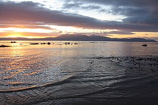
The Isle of Arran or simply Arran is an island off the west coast of Scotland. It is the largest island in the Firth of Clyde and the seventh-largest Scottish island, at 432 square kilometres (167 sq mi). Historically part of Buteshire, it is in the unitary council area of North Ayrshire. In the 2011 census it had a resident population of 4,629. Though culturally and physically similar to the Hebrides, it is separated from them by the Kintyre peninsula. Often referred to as "Scotland in Miniature", the Island is divided into highland and lowland areas by the Highland Boundary Fault and has been described as a "geologist's paradise".

Arbër Avni Zeneli is a professional footballer who plays as an attacking midfielder or left winger for Allsvenskan club IF Elfsborg and the Kosovo national team. Born in Sweden, he previously represented the country at the international youth level and was part of the Sweden U21 team that won the 2015 UEFA European Under-21 Championship.
Luigi Saidelli was an Italian sailor and sailboat racer who competed in the 1964 Summer Olympics.
Alessio Miceli is an Italian professional footballer who plays as a midfielder for Swiss Promotion League club Paradiso.
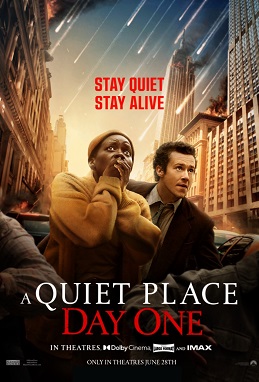
A Quiet Place: Day One is a 2024 American apocalyptic horror film written and directed by Michael Sarnoski, based on a story he conceived with John Krasinski. It is the third installment in the A Quiet Place film series, serving as a spin-off and prequel. The film stars Lupita Nyong'o as a terminally ill woman during the early stages of an invasion in New York City by blind, extraterrestrial creatures with an acute sense of hearing. The supporting cast includes Joseph Quinn, and Djimon Hounsou, who reprises his role from A Quiet Place Part II.

Musette Morell was an Australian playwright and children's writer. She wrote both for the stage and for radio.
Jack Dorsey first began to develop his early idea for the social media site Twitter in 2006 while working at early Internet tech company Odeo. Spun off in 2007 and expanding rapidly after that, Twitter became a significant component of global society. It became a key part of politics and international relations but was also banned or blocked in some countries.

The Bulgarian political crisis is a period of instability in Bulgaria, which has seen the country face seven parliamentary elections over four years: April 2021, July 2021, November 2021, October 2022, April 2023, June 2024 and October 2024.
The 2024 Formula 4 UAE Championship was the eighth season of the Formula 4 UAE Championship, and the last under this moniker before the change of the branding to F4 Middle East Championship from 2025 onwards. It was a motor racing series for the United Arab Emirates, regulated according to FIA Formula 4 regulations and organised and promoted by the Emirates Motorsport Organization (EMSO) and Top Speed.
On 23 September 2024, Israel began a series of airstrikes in Lebanon as part of the ongoing Israel–Hezbollah conflict with an operation it code-named Northern Arrows. Since then, Israel's attacks have killed over 800 people, injured more than 5,000, and displaced hundreds of thousands of Lebanese civilians. The attacks are the deadliest in Lebanon since the end of the Lebanese Civil War, and began five days after Israel performed a deadly pager and walkie-talkie attack on devices intended for Hezbollah members, and three days after Israel performed an airstrike on an apartment complex in Beirut which killed Redwan Force commander Ibrahim Aqil as well as 54 others.
