
Sudbury, officially the City of Greater Sudbury, is the largest city in Northern Ontario by population, with a population of 166,004 at the 2021 Canadian Census. By land area, it is the largest in Ontario and the fifth largest in Canada. It is administratively a single-tier municipality and thus is not part of any district, county, or regional municipality. The City of Greater Sudbury is separate from, but entirely surrounded by the Sudbury District. The city is also referred to as "Ville du Grand Sudbury" among Francophones.
King's Highway 400, commonly referred to as Highway 400, historically as the Toronto–Barrie Highway, and colloquially as the 400, is a 400-series highway in the Canadian province of Ontario linking the city of Toronto in the urban and agricultural south of the province with the scenic and sparsely populated central and northern regions. The portion of the highway between Toronto and Lake Simcoe roughly traces the route of the Toronto Carrying-Place Trail, a historic trail between the Lower and Upper Great Lakes. North of Highway 12, in combination with Highway 69, it forms a branch of the Trans-Canada Highway (TCH), the Georgian Bay Route, and is part of the highest-capacity route from southern Ontario to the Canadian West, via a connection with the mainline of the TCH in Sudbury. The highway also serves as the primary route from Toronto to southern Georgian Bay and Muskoka, areas collectively known as cottage country. The highway is patrolled by the Ontario Provincial Police and has a speed limit of 100 km/h (62 mph), except for the section south of Highway 401, where the speed limit is 80 km/h (50 mph).

King's Highway 2, commonly referred to as Highway 2, is the lowest-numbered provincially maintained highway in the Canadian province of Ontario, and was originally part of a series of identically numbered highways which started in Windsor, stretched through Quebec and New Brunswick, and ended in Halifax, Nova Scotia. Prior to the 1990s, Highway 2 travelled through many of the major cities in Southern Ontario, including Windsor, Chatham, London, Brantford, Hamilton, Burlington, Mississauga, Toronto, Oshawa, Belleville, Kingston and Cornwall, and many other smaller towns and communities.

Steeles Avenue is an east–west street that forms the northern city limit of Toronto and the southern limit of York Region in Ontario, Canada. It stretches 77.3 km (48.0 mi) across the western and central Greater Toronto Area from Appleby Line in Milton in the west to the Toronto-Pickering city limits in the east, where it continues east into Durham Region as Taunton Road, which itself extends 58 km (36 mi) across the length of Durham Region to its boundary with Northumberland County.

Bathurst Street is a main north–south thoroughfare in Toronto, Ontario, Canada. It begins at an intersection of the Queens Quay roadway, just north of the Lake Ontario shoreline. It continues north through Toronto to the Toronto boundary at Steeles Avenue. It is a four-lane thoroughfare throughout Toronto. The roadway continues north into York Region where it is known as York Regional Road 38.
King's Highway 69, commonly referred to as Highway 69, is a provincially maintained north–south highway in the central portion of the Canadian province of Ontario. In conjunction with Highway 400, it links Toronto with the city of Greater Sudbury at Highway 17, via Parry Sound. It is part of the Trans-Canada Highway and the National Highway System. From its southern terminus of Highway 559 at Carling, Highway 69 begins as Highway 400 narrows from a four-laned freeway to a two lane highway. It travels northerly for approximately 68 kilometres (42 mi) to south of the French River before widening back to a divided four lane freeway for approximately 64 kilometres (40 mi) into Sudbury. The final 6 kilometres (3.7 mi) of the route, connecting to Highway 17, is a five lane arterial road that will be converted to freeway as the final phase of the four-laning.

Dufferin Street is a major north–south street in Toronto, Vaughan and King, Ontario, Canada. It is a concession road, two concessions (4 km) west of Yonge Street. The street starts at Exhibition Place, continues north to Toronto's northern boundary at Steeles Avenue with some discontinuities and continues into Vaughan, where it is designated York Regional Road 53. The street is named for Frederick Hamilton-Temple-Blackwood, 1st Marquess of Dufferin and Ava, who served as Governor General of Canada from 1872 to 1878. Prior to 1878 the street was labelled as Western City Limits or Sideline Road south off Bloor. In 2003 and 2007, it was voted as one of "Ontario's Worst 20 Roads" in the Ontario's Worst Roads poll organized by the Canadian Automobile Association.
King's Highway 144, commonly referred to as Highway 144, is a provincially maintained highway in the northern portion of the Canadian province of Ontario, linking the cities of Greater Sudbury and Timmins. The highway is one of the most isolated in Ontario, passing through forest for the majority of its 271 km (168 mi) length. It is patrolled by the Ontario Provincial Police and features an 80 km/h (50 mph) speed limit.

Secondary Highway 637, commonly referred to as Highway 637 is a provincially maintained secondary highway in the Canadian province of Ontario. Located entirely within Sudbury District, the highway connects Highway 69 to the primary townsite of Killarney, 67.7 kilometres (42.1 mi) away, as well as providing access to Killarney Provincial Park.
The Southwest Bypass and Southeast Bypass are two separately-constructed contiguous roads in the city of Greater Sudbury, in the Canadian province of Ontario, which form a bypass around the southern end of the city's urban core for traffic travelling on Highway 17, a portion of the Trans-Canada Highway. Most of the route is a Super two road with at-grade intersections, with the exception of short section of divided freeway at an interchange with Highway 69. Along with the Northwest Bypass from Lively to Chelmsford, the roads form a partial ring road around the city's urban core.
Vermilion Lake is a lake in the city of Greater Sudbury, Ontario which is situated approximately 33 km west of downtown, in Fairbank Township. The lake's primary inflow and outflow is the Vermilion River. There is also a small creek that flows into Vermillion Lake, Cameron Creek. This creek connects Cameron lake and the Vermillion. The creek is unpassable except for canoe as the water level can only be a few inches. There is also a small set of rapids along the creek.
Municipal elections were held in Ontario, Canada, on October 25, 2010. Voters in Ontario elected mayors, councillors, school board trustees and all other elected officials in all of the province's municipalities. A total of 444 elections were held. Several smaller municipalities in Northern Ontario held no council elections, as their entire councils were acclaimed into office, although the towns still saw contested elections for their school board seats.
The Vermilion River is a river in the Lake Huron drainage basin in Sudbury District and Greater Sudbury in Northeastern Ontario, Canada.

Greater Sudbury Municipal Road 35 is a municipal road in the city of Greater Sudbury, Ontario, Canada. Extending from Chelmsford to Downtown Sudbury, most of the road's length is a former alignment of Highway 144, except for a short segment the city's downtown core which is a former alignment of Highway 17 and the Trans-Canada Highway.
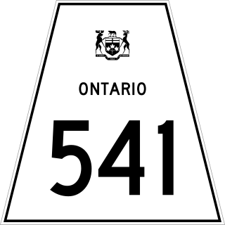
Secondary Highway 541, commonly referred to as Highway 541, was a provincially maintained secondary highway in the Canadian province of Ontario. The highway connected Highway 17 in Sudbury with the community of Skead on the southern shores of Lake Wanapitei, passing through the community of Garson en route. Within the urban region of Sudbury, the highway served to access Sudbury Airport. The designation was applied in 1956, along with many of the secondary highways in Ontario. The province transferred responsibility for the route shortly after the creation of the Regional Municipality of Sudbury in 1973. Highway 541 is now known as Sudbury Municipal Road 86, following Falconbridge Highway and Skead Road.

Secondary Highway 545, commonly referred to as Highway 545, was a provincially maintained secondary highway in the Canadian province of Ontario. This 33.9-kilometre (21.1 mi) highway connected Highway 541 at Bailey Corners near Garson with the now-abandoned community of Milnet, passing through Hanmer and Capreol. It followed what is now Municipal Road 85, Municipal Road 84, and Milnet Road. The route featured a concurrency with Highway 69 between Hanmer and Capreol.
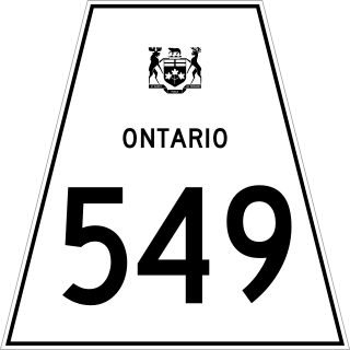
Ontario Highway 549, commonly referred to as Highway 549, was a provincially maintained secondary highway in the Canadian province of Ontario. This highway connected former Highway 17 in Whitefish to Lake Panache. The route was assumed along with many other secondary highways in 1956 and remained unchanged until the early 1980s, when it was decommissioned as a provincial highway and transferred to the newly formed Regional Municipality of Sudbury. Today it is known as Greater Sudbury Road 10.
Gibson Lake is a lake in geographic Hutton Township in Greater Sudbury in Northeastern Ontario, Canada. It is in the Great Lakes Basin and is on the Vermilion River, which flows via the Spanish River to Lake Huron. The Canadian National Railway transcontinental main line, used by freight traffic and the Canadian passenger train, travels along the eastern shore of the lake.
