
The Bridge River is an approximately 120 kilometres (75 mi) long river in southern British Columbia. It flows south-east from the Coast Mountains. Until 1961, it was a major tributary of the Fraser River, entering that stream about six miles upstream from the town of Lillooet; its flow, however, was near-completely diverted into Seton Lake with the completion of the Bridge River Power Project, with the water now entering the Fraser just south of Lillooet as a result.
The Skatin First Nations, aka the Skatin Nations, are a band government of the In-SHUCK-ch Nation, a small group of the larger St'at'imc people who are also referred to as Lower Stl'atl'imx. The Town of Skatin - the St'at'imcets version of the Chinook Jargon Skookumchuck- is located 4 km south of T'sek Hot Spring- alt. spelling T'sek Hot Spring - commonly & formerly named both St. Agnes' Well & Skookumchuck Hot Springs The community is 28 km south of the outlet of Lillooet Lake on the east side of the Lillooet River. It is approximately 75 km south of the town of Pemberton and the large reserve of the Lil'wat branch of the St'at'imc at Mount Currie. Other bands nearby are Samahquam at Baptiste Smith IR on the west side of the Lillooet River at 30 km. and Xa'xtsa First Nations; the latter is located at Port Douglas, near the mouth of the Lillooet River where it enters the head of Harrison Lake. The N'Quatqua First Nation on Anderson Lake, between Mount Currie and Lillooet, was at one time involved in joint treaty negotiations with the In-SHUCK-ch but its members have voted to withdraw, though a tribal council including the In-SHUCK-ch bands and N'Quatqua remains, the Lower Stl'atl'imx Tribal Council.

The Lillooet River is a major river of the southern Coast Mountains of British Columbia. It begins at Silt Lake, on the southern edge of the Lillooet Crown Icecap about 80 kilometres northwest of Pemberton and about 85 kilometres northwest of Whistler. Its upper valley is about 95 kilometres in length, entering Lillooet Lake about 15 km downstream from Pemberton on the eastern outskirts of the Mount Currie reserve of the Lil'wat branch of the St'at'imc people. From Pemberton Meadows, about 40 km upstream from Pemberton, to Lillooet Lake, the flat bottomlands of the river form the Pemberton Valley farming region.
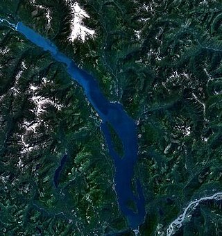
Harrison Lake is the largest lake in the southern Coast Mountains of Canada, being about 250 square kilometres (95 mi²) in area. It is about 60 km (37 mi) in length and at its widest almost 9 km (5.6 mi) across. Its southern end, at the resort community of Harrison Hot Springs, is c. 95 km east of downtown Vancouver. East of the lake are the Lillooet Ranges while to the west are the Douglas Ranges. The lake is the last of a series of large north-south glacial valleys tributary to the Fraser along its north bank east of Vancouver, British Columbia. The others to the west are the Chehalis, Stave, Alouette, Pitt, and Coquitlam Rivers. Harrison Lake is a natural lake, not man-made. The lake is supplied primarily from the Lillooet River, which flows into the lake at the northernmost point.
The Birkenhead River, formerly known as the Portage River, the Pole River and the Mosquito River, is a major tributary of the Lillooet River, which via Harrison Lake and the Harrison River is one of the major tributaries of the lower Fraser River. It is just over 50 km long from its upper reaches in the unnamed ranges south of Bralorne, British Columbia ; their western area towards the named Bendor Range east of Bralorne is sometimes called the Cadwallader Ranges.

Birkenhead Lake Provincial Park is a provincial park in British Columbia, Canada, located in the Lillooet Country region. The park lies north of the communities of Squamish, Whistler and Pemberton, and immediately northwest of Birkenhead Peak and Gates Lake at the community of Birken.

Nairn Falls Provincial Park is a provincial park in British Columbia, Canada located on the Green River adjacent to British Columbia Highway 99 and the Canadian National Railway line just south of Pemberton and less than twenty minutes north of the resort town of Whistler. The 170 hectare park was established in 1966, shortly after the highway's opening, to protect and enhance visitor access to Nairn Falls.
Tyaughton Creek, formerly gazetted as the Tyaughton River, also historically known as Tyoax Creek, is a 50 kilometre tributary of British Columbia's Bridge River, flowing generally southeast to enter the main flow of that river about mid-way along the length of Carpenter Lake, a reservoir formed by Terzaghi Dam of the Bridge River Power Project.

The Lil'wat First Nation, a.k.a. the Lil'wat Nation or the Mount Currie Indian Band, is a First Nation band government located in the southern Coast Mountains region of the Interior of the Canadian province of British Columbia. It is a member of the Lillooet Tribal Council, which is the largest grouping of band governments of the St'at'imc or Stl'atl'imx people. Other St'at'imc governments include the smaller In-SHUCK-ch Nation on the lower Lillooet River to the southwest, and the independent N'quatqua First Nation at the near end of Anderson Lake from Mount Currie, which is the main reserve of the Lil'wat First Nation, and also one of the largest Indian reserves by population in Canada.
Pemberton Pass, 505 m (1,657 ft), also formerly known as Mosquito Pass, is the lowest point on the divide between the Lillooet and Fraser River drainages, located at Birken, British Columbia, Canada, in the principal valley connecting and between Pemberton and Lillooet. The pass is a steep-sided but flat-bottomed valley adjacent to Mount Birkenhead and forming a divide between Poole Creek, a tributary of the Birkenhead River, which joins the Lillooet at Lillooet Lake, and the Gates River which flows northeast from Gates Lake, at the summit of the pass, which flows to the Fraser via Anderson and Seton Lakes and the Seton River.
Rutherford Creek is a tributary of the Green River, British Columbia, Canada, entering that river a few miles above Nairn Falls Provincial Park, near the village of Pemberton. The creek's headwaters are on the eastern side of the Pemberton Icefield, from where it flows southeast for the first half of its course, then generally east for the remainder. It is approximately 24 km (15 mi) in length. The mouth is at 50° 16' 3" N, 122° 57' 41" W.
The Soo River is a tributary of the Green River in the Pacific Ranges of the Coast Mountains in British Columbia, Canada, joining that river just north of the Resort Municipality of Whistler. Approximately 35 kilometres (22 mi) long, it begins on the south flank of the Pemberton Icefield. Its course is generally eastward from there to the Green River valley, although upon reaching that valley it runs north for about 3.5 kilometres (2.2 mi) roughly parallel to the Green before joining it. For much of its course, known as the Soo Valley, it forms a serpentine marshland until reaching a short canyon before entering the valley of the Green River.
The Ryan River is a short but major tributary of the Lillooet River in British Columbia, Canada, running largely eastward approximately 42 kilometres (26 mi) from its source on the eastern flank of the Pemberton Icefield before joining the Lillooet River in the area of Pemberton Meadows.
McGillivray Pass is a mountain pass in the Pacific Ranges of southwestern British Columbia, Canada, located about 30 miles west of the town of Lillooet and immediately west of the upper end of Anderson Lake, above the former resort community of McGillivray. The pass connects the head of McGillivray Creek with the head of Standard Creek, a tributary of Cadwallader Creek and was used as a route by prospectors, miners and hunters heading for the upper Bridge River Country beyond the pass. The pass was proposed at one time for a cog railway to connect the mines at Bralorne and Pioneer with the Pacific Great Eastern Railway (now part of CN but the project never went forward. There are private ski cabins near the summit area of the pass, which is the division between the Bendor Range to the east and the Cadwallader Range to the west.
The Gates River is a short river in the Lillooet Country of the Southern Interior of British Columbia, Canada. Approximately 14.5 km in length, it flows generally northeast from the outlet of Birken Lake to its mouth at the head of Anderson Lake. Its main tributaries are Haylmore Creek, from the southeast, and Blackwater Creek, from the northwest, which originates near the head of Birkenhead Lake. Augmented by the waters of McGillivray Creek, Lost Valley Creek and others, its flow becomes the Seton River from the foot of Anderson Lake onwards.
Haylmore Creek is the largest tributary of the Gates River, flowing northwest from its origin in the central Cayoosh Range to join that river at the community of Devine, British Columbia, Canada, in the Lillooet Country of the Southern Interior of British Columbia.
Norrish Creek is a tributary of the Fraser River. It is located in the Douglas Ranges, the southernmost subrange of the Pacific Ranges of the Coast Mountains of British Columbia, Canada to the north of Nicomen Island. Local residents refer to it as "Suicide Creek." It was named after William Henry Norrish a pioneer Scottish Canadian farmer.
Mission Ridge, also known as Mission Mountain, is a ridge in the Bridge River-Lillooet Country of the South-Central Interior of British Columbia, Canada, extending westward from the town of Lillooet along the north side of Seton Lake to Mission Pass, which is immediately above and to the north of the lakeside community of Shalalth. The road over the pass is also known as Mission Mountain, which is short for "Mission Mountain Road". Mission Creek lies on the north side of the pass, and is a tributary of the Bridge River, the lower reaches of which lie on the north side of the ridge, and which was the only road access into the upper Bridge River Country before the construction of a road through the Bridge River Canyon in the mid-1950s opened that region up to road access from the lower Bridge River valley and the town of Lillooet via the community of Moha. Most, or virtually all, of the ridge, is Indian Reserves, notably Slosh 1, under the administration of the Seton Lake Indian Band, and Bridge River 1, which is under the administration of the Bridge River Indian Band. Parts of the ridge's eastern end are in reserves controlled by the Lillooet Indian Band, including its final spires above Lillooet, which were dubbed St. Mary's Mount by the Reverend Lundin Brown in the 1860s, though that name never stuck and is ungazetted.
Wedge Pass, also known as Billygoat Pass, 1430 m (4692 ft), is a mountain pass in the northern Garibaldi Ranges, the southwesternmost subdivisions of the Pacific Ranges of the Coast Mountains in British Columbia, Canada. Located immediately on the southern flank of Wedge Mountain and to the immediate north of the Spearhead Range, site of the Blackcomb half of the Whistler Blackcomb Ski Area, it connects the head of Wedge Creek (W), a tributary of the Green River with those of Billgoat Creek (E), a tributary of the Lillooet River. The pass is within Garibaldi Provincial Park and has no road access.
Gwyneth Lake Provincial Park is a provincial park in British Columbia, Canada, 70 kilometres west of Lillooet, British Columbia. The park, which is 132 ha. in size, was established in 2010.
