Whistler Blackcomb is a ski resort located in Whistler, British Columbia, Canada. By many measures, it is the largest ski resort in North America and has the greatest uphill lift capacity. It features the Peak 2 Peak Gondola for moving between Whistler and Blackcomb mountains at the top. With its capacity, Whistler Blackcomb is a busy ski resort, often surpassing two million visitors a year.
Whistler is a resort municipality in Squamish-Lillooet Regional District, British Columbia, Canada. It is located in the southern Pacific Ranges of the Coast Mountains, approximately 125 km (78 mi) north of Vancouver and 36 km (22 mi) south of Pemberton. It has a permanent population of approximately 13,982 (2021), as well as a larger but rotating population of seasonal workers.

The Lillooet River is a major river of the southern Coast Mountains of British Columbia. It begins at Silt Lake, on the southern edge of the Lillooet Crown Icecap about 80 kilometres northwest of Pemberton and about 85 kilometres northwest of Whistler. Its upper valley is about 95 kilometres in length, entering Lillooet Lake about 15 km downstream from Pemberton on the eastern outskirts of the Mount Currie reserve of the Lil'wat branch of the St'at'imc people. From Pemberton Meadows, about 40 km upstream from Pemberton, to Lillooet Lake, the flat bottomlands of the river form the Pemberton Valley farming region.

The Pitt River in British Columbia, Canada is a large tributary of the Fraser River, entering it a few miles upstream from New Westminster and about 25 km ESE of Downtown Vancouver. The river, which begins in the Garibaldi Ranges of the Coast Mountains, is in two sections above and below Pitt Lake and flows on a generally southernly course. Pitt Lake and the lower Pitt River are tidal in nature as the Fraser's mouth is only a few miles downstream from their confluence.

The Garibaldi Ranges are the next-to-southwesternmost subdivision of the Pacific Ranges of the Coast Mountains; only the North Shore Mountains are farther southwest. They lie between the valley formed by the pass between the Cheakamus River and Green River on the west and the valley of the Lillooet River on the east, and extend south into Maple Ridge, an eastern suburb of Vancouver, and the northern District of Mission. To their south are the North Shore Mountains overlooking Vancouver while to their southeast are the Douglas Ranges.

The North Shore Mountains are a mountain range overlooking Vancouver in British Columbia, Canada. Their southernmost peaks are visible from most areas in Vancouver and form a distinctive backdrop for the city.

The Tonquin Valley is located in Jasper National Park, Alberta, Canada, next to the border of the provinces of Alberta and British Columbia, an area which is also the continental divide, running along the peaks of the South Jasper Range which rise above Amethyst Lake. Tonquin Creek drains Moat Lake and flows west into Mount Robson Provincial Park in British Columbia, and empties into the Fraser River. The Astoria River drains south and east into the Athabasca River.

The Purcell Wilderness Conservancy is a provincial park in British Columbia, Canada. It was established in 1974, and encompasses six large drainages in the Purcell Mountains in the southeast of the province. It contains high peaks, alpine meadows and ridges, deep creek and river valleys, and hot springs at Dewar Creek.

Gold Bridge is an unincorporated community in the Bridge River Country of British Columbia, Canada. Although numbering only around 40 inhabitants, Gold Bridge is the service and supply centre for the upper basin of the Bridge River Valley, which includes recreation-residential areas at the Gun Lakes, Tyaughton Lake, Marshall Creek, and Bralorne; and the nearby ghost towns of Brexton and Pioneer Mine.

The Sea-to-Sky Corridor, often referred to as the Corridor or the Sea to Sky Country, is a region in British Columbia spreading from Horseshoe Bay through Whistler to the Pemberton Valley and sometimes beyond to include Birken and D'Arcy. From Whistler on up, the region overlaps with the older and more historic Lillooet Country, of which Squamish, at the region's centre, was once the southward extension in the days when it was the rail-port terminus from the Interior, via Lillooet, and accessible from the Lower Mainland only by sea. Most of the region is in the Squamish-Lillooet Regional District, although south of Britannia Beach a small part of the region is in the Greater Vancouver Regional District.

Garibaldi Lake is a turquoise-coloured alpine lake in British Columbia, Canada, located 37 km (23 mi) north of Squamish and 19 km (12 mi) south of Whistler. The lake lies within Garibaldi Provincial Park, which features mountains, glaciers, trails, forests, flowers, meadows, waterfalls. The park is a wildlife protected area.

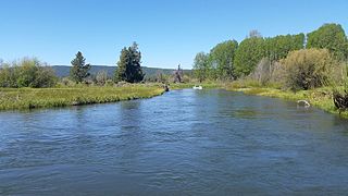
The Wood River is a short river in the southern region of the U.S. state of Oregon, and part of the Klamath Basin drainage. It flows 18 miles (29 km) through the Fremont-Winema National Forests, Bureau of Land Management land, and private property in southern Oregon. Its watershed consists of 220 square miles (570 km2) of conifer forest, rural pasture land, and marsh. The river provides habitat for many species of wildlife including an adfluvial (migratory) and resident populations of native Great Basin redband trout.
The Soo River is a tributary of the Green River in the Pacific Ranges of the Coast Mountains in British Columbia, Canada, joining that river just north of the Resort Municipality of Whistler. Approximately 35 kilometres (22 mi) long, it begins on the south flank of the Pemberton Icefield. Its course is generally eastward from there to the Green River valley, although upon reaching that valley it runs north for about 3.5 kilometres (2.2 mi) roughly parallel to the Green before joining it. For much of its course, known as the Soo Valley, it forms a serpentine marshland until reaching a short canyon before entering the valley of the Green River.

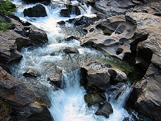
Icicle Creek is a non navigable stream in the U.S. state of Washington. It originates at Josephine Lake near the crest of the Cascade Range and flows generally east to join the Wenatchee River near Leavenworth. Icicle Creek's drainage basin is mountainous and mostly undeveloped land within the Wenatchee National Forest and the Alpine Lakes Wilderness. The final 6 miles (10 km) of the creek are moderately developed with scattered homes and pasture, a golf course, children's camp, a small housing development called Icicle Island Club, and the Leavenworth National Fish Hatchery. Some water is diverted from the creek for municipal use by the City of Leavenworth at Icicle Creek river mile 5.6. Near Leavenworth, the wheelchair-accessible Icicle Creek Nature Trail, a National Recreation Trail designated in 2005, runs 1.0 mile (1.6 km) along a historic creek channel.
The Tuya River is a major tributary of the Stikine River in northwest part of the province of British Columbia, Canada. From its source at High Tuya Lake in Tuya Mountains Provincial Park just south of Ash Mountain, the highest peak of the Tuya Range, the Tuya River flows south about 200 km (120 mi) to meet the Stikine River in the Grand Canyon of the Stikine. The Tuya River's main tributary is the Little Tuya River. The Tuya River divides the Tanzilla Plateau on the east from the Kawdy Plateau, to the northwest, and the Nahlin Plateau, to the southwest. All three are considered sub-plateaus of the Stikine Plateau. The Tuya River's watershed covers 3,575 km2 (1,380 sq mi), and its mean annual discharge is estimated at 36.9 m3/s (1,300 cu ft/s). The mouth of the Tuya River is located about 24 km (15 mi) northeast of Telegraph Creek, British Columbia, about 67 km (42 mi) southwest of Dease Lake, British Columbia, and about 210 km (130 mi) east of Juneau, Alaska. The Tuya River's watershed's land cover is classified as 35.7% shrubland, 31.4% conifer forest, 14.0% mixed forest, 7.2% herbaceous, and small amounts of other cover.

Trophy Mountain is a mountain in east-central British Columbia, Canada, located in the south-east region of Wells Gray Provincial Park. The Clearwater River flows to the west, Raft River to the east and Spahats Creek to the south. Trophy Mountain is part of the Shuswap Highland. There are nine summits in the group and the highest is 2,577 m (8,455 ft). Battle Mountain and Table Mountain are the closest summits to the north and Raft Mountain is immediately south. Trophy Mountain was given its name by Dan Case, a big-game hunting guide in the area.

Battle Mountain is a mountain in east-central British Columbia, Canada, located in the south-east region of Wells Gray Provincial Park. The Clearwater River flows to the west, Stevens Lakes are to the east, Philip Creek is to the south and Hemp Creek is to the north. Battle Mountain is part of the Shuswap Highland. There are three summits in the group, ranging from 2,306 m (7,566 ft) to 2,369 m (7,772 ft).

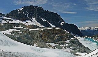
Parkhurst Mountain is a 2,494-metre (8,182-foot) mountain summit located in the Garibaldi Ranges of the Coast Mountains, in northwestern Garibaldi Provincial Park of southwestern British Columbia, Canada. It is situated 11 km (7 mi) east-northeast of Whistler, south of Wedgemount Lake, and on the west side of Wedgemount Glacier. Parkhurst's nearest neighbor is Rethel Mountain, 0.89 km (1 mi) to the northwest, and its nearest higher peak is Wedge Mountain, 1.8 km (1 mi) to the southeast. Mount Weart, the second-highest peak in the park, rises 2.6 km (2 mi) northeast of Parkhurst. Precipitation runoff from the peak drains into Wedge Creek, Wedgemount Creek, and Rethel Creek, which are all tributaries of the Green River, which in turn is a tributary of the Lillooet River. The present day ghost town of Parkhurst was an old logging town in the 1920s and 1930s set on the edge of Green Lake, 9 km (6 mi) west of Parkhurst Mountain. The site was named for Mr. and Mrs. Parkhurst who preempted the land on Green Lake in 1902 and built a small house where they lived with their family. The mountain's name was officially adopted on June 25, 1975, by the Geographical Names Board of Canada.

Rethel Mountain is a 2,408-metre (7,900-foot) mountain summit located in the Garibaldi Ranges of the Coast Mountains, in northwestern Garibaldi Provincial Park of southwestern British Columbia, Canada. It is situated 11 km (7 mi) northeast of Whistler, on the south side of Wedgemount Lake and west side of Wedgemount Glacier. Its nearest higher peak is Parkhurst Mountain, 1.3 km (1 mi) to the southeast. Rethel is set 3.2 km (2 mi) northwest of Wedge Mountain, the highest peak in Garibaldi Park, and 2.9 km (2 mi) southwest of Mount Weart, the second-highest in the park. Precipitation runoff from the peak drains into Wedgemount Creek and Rethel Creek, both tributaries of the Green River, which in turn is a tributary of the Lillooet River. It was named in association from Rethel station on the Pacific Great Eastern Railway route. The mountain's name was officially adopted on February 27, 1978, by the Geographical Names Board of Canada.


