Großer Finsterberg

Last updated
Großer Finsterberg
Schneekopf-Finsterberg.jpg
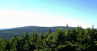
View from Kalter Staudenkopf (768 m) of the Großer (944 m, half right) and Kleiner (875 m, right) Finsterberg. Half left is the Schneekopf (978 m) and its subpeak, the Teufelskreise (967 m, in front) with the Schmücke (just below, pasture) and Fichtenkopf (944 m, to its left). The pasture below lies at the foot of the Großer Eisenberg (907 m, on the left, hidden). In the central foreground is the Volkmarskopf (726 m).
Highest point
Elevation 944.1 m above  sea level (NHN) (3,097 ft)
Prominence 122 m Mordfleck
Isolation 3.8 km Teufelskreis (Schneekopf)
Coordinates 50°38′17″N10°48′06″E / 50.63806°N 10.80167°E / 50.63806; 10.80167 Coordinates: 50°38′17″N10°48′06″E / 50.63806°N 10.80167°E / 50.63806; 10.80167
Geography
Thuringia relief location map.jpg
Red triangle with thick white border.svg
Großer Finsterberg
Parent range Thuringian Forest
Climbing
Normal route Along the L 2615 between Schmiedefeld/R. and Oberhof
Thueringen januar 2004 001.jpg

The Großer Finsterberg is a mountain, 944.1 m above NHN, [1] in the Thuringian Forest not far from the villages of Stützerbach and Schmiedefeld am Rennsteig. It is the third highest peak in the German state of Thuringia.

Mountain A large landform that rises fairly steeply above the surrounding land over a limited area

A mountain is a large landform that rises above the surrounding land in a limited area, usually in the form of a peak. A mountain is generally steeper than a hill. Mountains are formed through tectonic forces or volcanism. These forces can locally raise the surface of the earth. Mountains erode slowly through the action of rivers, weather conditions, and glaciers. A few mountains are isolated summits, but most occur in huge mountain ranges.

Thuringian Forest mountain range in the German state of Thuringia

The Thuringian Forest, is a mountain range in the southern parts of the German state of Thuringia, running northwest to southeast between the valley of the river Werra near Eisenach and the Thuringian-Vogtlandian Slate Mountains. The geographical boundary with the latter range follows approximately a line from Gehren via Großbreitenbach to Schönbrunn near Schleusingen, defined by the rivers Schleuse and Neubrunn on the southwestern slope, and Talwasser, Wohlrose and Möhre on the northeastern slope.

Stützerbach Ortsteil of Ilmenau in Thuringia, Germany

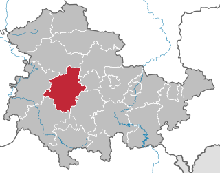
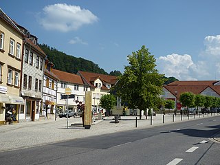
Stützerbach is a village and a former municipality in the Ilm-Kreis district, in Thuringia, Germany. Since 1 January 2019, it is part of the town Ilmenau.

Contents

Description

Former observation tower on the Finsterberg Finsterberg.jpg
Former observation tower on the Finsterberg

The volcanic origin of the Großer Finsterberg may be seen clearly from the conical shape of its summit, which tilts markedly towards the west.

Apart from the summit plateau, the mountain is completely covered by a nearly natural cotton and reed grass spruce woodland and in most places there is no shrub layer. On the plateau a special mountain pasture vegetation has formed with baldmoney, veronica and St. John's wort.

Spruce genus of plants

A spruce is a tree of the genus Picea, a genus of about 35 species of coniferous evergreen trees in the family Pinaceae, found in the northern temperate and boreal (taiga) regions of the Earth. Spruces are large trees, from about 20–60 m tall when mature, and have whorled branches and conical form. They can be distinguished from other members of the pine family by their needles (leaves), which are four-sided and attached singly to small persistent peg-like structures on the branches, and by their cones, which hang downwards after they are pollinated. The needles are shed when 4–10 years old, leaving the branches rough with the retained pegs. In other similar genera, the branches are fairly smooth.

<i>Veronica</i> (plant) genus of plants

Veronica is the largest genus in the flowering plant family Plantaginaceae, with about 500 species; it was formerly classified in the family Scrophulariaceae. Common names include speedwell, bird's eye, and gypsyweed.

Location

Subpeaks and boundaries

One kilometre away to the north-northeast is its smaller brother, the Kleiner Finsterberg or Finsterberger Köpfchen (875 m). Two less spectacular eastern subpeaks, 2 to 3 kilometres distant both bear the name Rosenkopf (728 m and 673 m). To the west, northwest and north the Finsterberg is bounded by the Freibach and, to the southeast, by the Taubach, both headstreams of the Ilm.

Freibach is a river of Thuringia, Germany. At its confluence with the Taubach and the Lengwitz near Stützerbach, the Ilm is formed.

Neighbouring peaks

Two kilometres to the southwest and separated by the Rennsteig (ca. 800 metres away), is the Großer Eisenberg (907 m). To the northwest, four to five kilometres away, are the two main summits of the range, the Schneekopf (978 m) and the Großer Beerberg (983 m), both of which are higher than the Finsterberg.

Rennsteig hiking trail in Germany

The Rennsteig is a ridge walk as well as an historical boundary path in the Thuringian Forest, Thuringian Highland and Franconian Forest in Central Germany. The long-distance trail runs for about 170 km from Eisenach and the Werra valley in the northwest to Blankenstein and the Selbitz river in the southeast.

Schneekopf mountain in Germany

The Schneekopf near Gehlberg in the Thuringian county of Ilm-Kreis is 978 m above sea level (NHN) and thus the second highest peak in the Thuringian Forest after its western neighbour, the Großer Beerberg. The Adler Saddle between them is only about 59.4 metres lower than the two summits. To the east some distance away is its subpeak, the Sachsenstein, to the south are the Teufelskreise and Fichtenkopf. The Goldlauterberg further south marks the transition to the mountain of Großer Finsterberg.

Großer Beerberg mountain

The Großer Beerberg is a mountain located in the Thuringian Forest, Germany, and the highest point in the state of Thuringia. The nearest town is Suhl.

History

Since the middle of the 18th century at the Mordfleck (1.5 kilometres east of the summit) and at the Blauer Stein (1 km away to the northwest), stone coal has been mined.

Towards the end of the Second World War, soldiers' graves were dug on the mountainside. From 1954 to 1990 the summit of the Großer Finsterberg was used by the Soviet Union for military purposes and was thus out of bounds to the public.

Soviet Union 1922–1991 country in Europe and Asia

The Soviet Union, officially the Union of Soviet Socialist Republics (USSR), was a socialist state in Eurasia that existed from 1922 to 1991. Nominally a union of multiple national Soviet republics, its government and economy were highly centralized. The country was a one-party state, governed by the Communist Party with Moscow as its capital in its largest republic, the Russian Soviet Federative Socialist Republic. Other major urban centres were Leningrad, Kiev, Minsk, Alma-Ata, and Novosibirsk. It spanned over 10,000 kilometres east to west across 11 time zones, and over 7,200 kilometres north to south. It had five climate zones: tundra, taiga, steppes, desert and mountains.

View

Refuge hut on the Finsterberg Thueringen Finsterberg Schutzhutte.JPG
Refuge hut on the Finsterberg

Between 1999 or 2001 and 2017 or 2018, a wooden observation platform stood at the summit of the Großer Finsterberg. [2] As of June 2018, there are plans to reinstate the tower. [3] The original tower gave views of the Kickelhahn, the Ringberg on the Adlersberg near Suhl, the Dolmar near Meiningen and the only two mountains in Thuringia that are higher the Großer Beerberg (983 m) and the Schneekopf (978 m) below whose summits the Schmücke may also be seen. On the east side there is a small hut with another observation point.

Related Research Articles

Gotha (district) District in Thuringia, Germany

Gotha is a Kreis (district) in western central Thuringia, Germany. Neighboring districts are Unstrut-Hainich-Kreis, Sömmerda, the Kreis-free city Erfurt, Ilm-Kreis, Schmalkalden-Meiningen and the Wartburgkreis.

Ilm-Kreis District in Thuringia, Germany

Ilm-Kreis is a district in Thuringia, Germany. It is bounded by the city of Erfurt, the districts of Weimarer Land, Saalfeld-Rudolstadt and Hildburghausen, the city of Suhl, and the districts of Schmalkalden-Meiningen and Gotha. It is named after the river Ilm, flowing through the district.

Suhl Place in Thuringia, Germany

Suhl is a city in Thuringia, Germany, located 50 kilometres SW of Erfurt, 110 kilometres NE of Würzburg and 130 kilometres N of Nuremberg. With its 37,000 inhabitants, it is the smallest of the six urban districts within Thuringia. Together with its northern neighbour-town Zella-Mehlis, Suhl forms the largest urban area in the Thuringian Forest with a population of 46,000. The region around Suhl is marked by up to 1,000-meter high mountains, including Thuringia's highest peak, the Großer Beerberg, approximately 5 kilometres NE of the city centre.

Ruhla Place in Thuringia, Germany

Ruhla  is a town situated in the forest of Thuringia in the district of Wartburgkreis in Germany, immediately next to the Rennsteig. Thal and Kittelsthal are parts of the town. It lies on Carl-Gareis-Straße 16.

Thuringian Forest Nature Park nature park in Thuringia, Germany

The Thuringian Forest Nature Park is one of the two nature parks in the state of Thuringia, Germany.

Rauhhügel mountain

The Rauhhügel is an 812.9 m high mountain located in the Thuringian Highland, Thuringia (Germany).

Gebaberg mountain

The Gebaberg, also called the Hohe Geba or Die Geba, near Geba in the county of Schmalkalden-Meiningen in southern Thuringia, Germany, is 750.7 m above sea level (NHN), and thus the highest point of the Anterior Rhön.

Großer Farmdenkopf mountain

At 869 m above sea level (NN), the Großer Farmdenkopf is the highest peak in the Thuringian Highland. It is situated in the county of Sonneberg in the German state of Thuringia.

Hohloh mountain

The Hohloh is a mountain, 988.3 m above sea level (NHN), on the eastern main ridge of the Northern Black Forest in Germany. It lies near the village of Kaltenbronn in the borough of Gernsbach, a town in the county of Rastatt in the German state of Baden-Württemberg. Its summit is the highest point in the borough of Gernsbach and the eastern chain of the Northern Black Forest, the ridge between the rivers Murg and Enz. A mountain pass runs northeast of the summit plateau between the two river valleys passing over the saddle of Schwarzmiss.

Schneeberg (Thuringian Forest)

The Schneeberg is a mountain, 692.4 metres high, that marks the southernmost boundary point of the borough of Suhl in the German state of Thuringia.

Theater Erfurt opera house in Erfurt, Germany

The Theater Erfurt is a German municipal theatre located in Erfurt, the capital of Thuringia. The main stage is in a new building in the Brühlervorstadt, completed in 2003. The theatre offers musical theatre and concerts, played by the Philharmonisches Orchester Erfurt. Ballet and plays are offered by guest performances. The company organizes the annual open air festival DomStufen. The theatre's current Generalintendant, Guy Montavon, has held the post since 2002.

Großer Inselsberg mountain in Germany

Großer Inselsberg is a mountain in the Thuringian Forest with a height of 916.5 m (3,007 ft) above sea level, located on Rennsteig in the districts of Gotha and Schmalkalden-Meiningen. It is the fourth-highest distinct mountain of Thuringia, after Großer Beerberg, Schneekopf and Großer Finsterberg and forms a landmark that can be viewed in particular from northern and western directions.

Kickelhahn mountain in Germany

Kickelhahn is a mountain in the northern edge of the Central Thuringian Forest in the municipal area of Ilmenau, Germany. Its summit has an altitude of 861.1 metres (2,825 ft) a.s.l.

Plaue–Themar railway railway line

Plaue–Themar railway is a 62 kilometre-long, single-track, non-electrified, standard-gauge branch-line in the Thuringian Forest in Germany. The Stützerbach–Schleusingerneundorf section was built as the first Prussian rack railway between 1879 and 1904 and connects the Erfurt–Schweinfurt railway in the north via the towns of Plaue, Ilmenau, Schleusingen and Themar with the Eisenach–Lichtenfels railway in the south.

Großer Hermannsberg mountain

The Großer Hermannsberg is a mountain, 867 metres high, south of the main ridge of the Thuringian Forest in the county of Schmalkalden-Meiningen in Germany.

References

  1. Map services of the Federal Agency for Nature Conservation
  2. Martius, Arne (10 August 2017). "Großer Finsterberg soll neuen Aussichtsturm erhalten" [Große Finsterberg to get new lookout tower]. Thüringer Allgemeine (in German). Erfurt, Germany. Retrieved 2019-01-01.
  3. Heckel, Andreas (4 June 2018). "Finsterberg bekommt neuen Turm" [Finsterberg gets a new tower]. Thüringer Allgemeine (in German). Erfurt, Germany. Retrieved 2019-01-01.