A cable-stayed bridge has one or more towers, from which cables support the bridge deck. A distinctive feature are the cables or stays, which run directly from the tower to the deck, normally forming a fan-like pattern or a series of parallel lines. This is in contrast to the modern suspension bridge, where the cables supporting the deck are suspended vertically from the main cable, anchored at both ends of the bridge and running between the towers. The cable-stayed bridge is optimal for spans longer than cantilever bridges and shorter than suspension bridges. This is the range within which cantilever bridges would rapidly grow heavier, and suspension bridge cabling would be more costly.

The Millau Viaduct is a multispan cable-stayed bridge completed in 2004 across the gorge valley of the Tarn near Millau in the Aveyron department in the Occitanie Region, in Southern France. The design team was led by engineer Michel Virlogeux and English architect Norman Foster. As of October 2023, it is the tallest bridge in the world, having a structural height of 336.4 metres (1,104 ft).

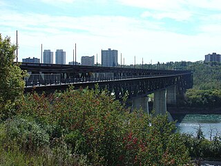
The High Level Bridge is a bridge that spans the North Saskatchewan River in Edmonton, Alberta, Canada.

Alberta Provincial Highway No. 216, better known by its official name of Anthony Henday Drive, is a 78-kilometre (48 mi) freeway that encircles Edmonton, Alberta. It is a heavily travelled commuter and truck bypass route with the southwest quadrant serving as a portion of the CANAMEX Corridor that links Canada to the United States and Mexico. Henday is one of the busiest highways in Western Canada, carrying over 95,000 vehicles per day in 2022 at its busiest point near West Edmonton Mall. Rush hour congestion is common on the four-lane section in southwest Edmonton, where traffic levels have risen due to rapid suburban development. Work began in fall 2019 to widen this section to six lanes by the end of 2023.

An extradosed bridge employs a structure that combines the main elements of both a prestressed box girder bridge and a cable-stayed bridge. The name comes from the word extrados, the exterior or upper curve of an arch, and refers to how the "stay cables" on an extradosed bridge are not considered as such in the design, but are instead treated as external prestressing tendons deviating upward from the deck. In this concept, they remain part of the main bridge superstructure.

The North Saskatchewan River is a glacier-fed river that flows from the Canadian Rockies continental divide east to central Saskatchewan, where it joins with the South Saskatchewan River to make up the Saskatchewan River. Its water flows eventually into the Hudson Bay.
Glenora is a residential neighbourhood in the city of Edmonton, Alberta, Canada, overlooking the North Saskatchewan River valley.
Westmount is an established central-west residential neighbourhood in Edmonton, Alberta, Canada. It is geographically close to the downtown core.

The Low Level Bridge is a bridge that spans the North Saskatchewan River in Edmonton, Alberta, Canada. Completed in 1900, this was the first bridge across the North Saskatchewan River. It was designed to carry a railway, and a railway track was added in 1902 to accommodate the Edmonton, Yukon and Pacific Railway.

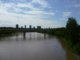
The Quesnell Bridge is a girder bridge that spans the North Saskatchewan River in Edmonton, Alberta, Canada. It is part of Edmonton's southern freeway, Whitemud Drive. An average of 120,000 cars pass over the bridge every day. The bridge connects the communities of Brookside and Brander Gardens on the south end to Quesnell Heights and Laurier Heights on the north end.

The James MacDonald Bridge is a bridge that spans the North Saskatchewan River in Edmonton, Alberta, Canada. Construction of the bridge began in the early 1960s and was completed in October 1971. The bridge was named after city engineer James Dugald Alexander MacDonald.

Groat Road is a major roadway in Edmonton, Alberta. It is named after Malcolm Groat, a former Hudson's Bay Company employee who settled in the present-day Groat Estates area in the 1880s. Groat Road is part of a 40-kilometre-long (25 mi) continuous roadway that runs through Sherwood Park, Edmonton, and St. Albert that includes Wye Road, Sherwood Park Freeway, Whyte Avenue, portions of University Avenue and Saskatchewan Drive, and St. Albert Trail. Groat Road functions as a grade-separated parkway between 87 Avenue and 111 Avenue.
The Alexandra Bridge is a steel arch bridge across the Fraser River in the lower Fraser Canyon area of southwestern British Columbia, Canada. The two-lane crossing, carrying BC Highway 1, is by road about 44 kilometres (27 mi) north of Hope and 66 kilometres (41 mi) south of Lytton.

Wayne Gretzky Drive is a freeway in Edmonton, Alberta. Originally Capilano Drive/Capilano Freeway, it was officially renamed October 1, 1999, after NHL hockey player Wayne Gretzky, as a tribute to his years with the Edmonton Oilers. The same day, Wayne Gretzky's number 99 jersey was retired at the Skyreach Centre, which lies just west of Wayne Gretzky Drive, at 118 Avenue. 66/75 Street is a major arterial road in east Edmonton which serves residential and industrial areas.

The Tawatinâ Bridge is an extradosed LRT bridge crossing the North Saskatchewan River in Edmonton, Alberta. Below the concrete box girder spans is a suspended eight-metre-wide shared-use path, which was opened to the public on December 12, 2021. It is part of Edmonton Transit Service's Valley Line extension, which opened on November 4, 2023. The Tawatinâ Bridge consists of two railway tracks.

The North Saskatchewan River flood of 1915 was one of the largest floods in the history of Edmonton. On 28 June, the Edmonton Bulletin reported the river had risen "10 feet [3.0 m] in as many hours." A frantic telegram from Rocky Mountain House alerted local authorities to the flood's arrival.

The Terwillegar Park Footbridge is a pedestrian bridge that crosses the North Saskatchewan River in Edmonton, Alberta, Canada. At 262 metres in length, it is the longest stressed ribbon bridge in Canada and second longest in the world after the David Kreitzer Lake Hodges Bicycle Pedestrian Bridge in Escondido, California, United States. The bridge is a first for the city and was built to connect Terwillegar Park in the southern side with Oleskiw River Valley Park on the north side of the river. It opened to the public on October 21, 2016.

The Murray River bridge is a heritage-listed road bridge that carries Main Road across the Murray River located at Barham in the Murray River Council local government area of New South Wales, Australia. It was designed by Department of Public Works and built in 1904 by John Monash. The bridge is also known as the Barham Bridge over Murray River and the Barham bridge. The bridge is owned by the Murray River Council and was added to the New South Wales State Heritage Register on 20 June 2000.


