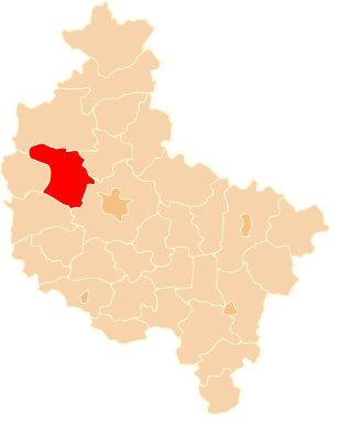
Czarnków-Trzcianka County is a unit of territorial administration and local government (powiat) in Greater Poland Voivodeship, west-central Poland. It came into being on January 1, 1999, as a result of the Polish local government reforms passed in 1998. Its administrative seat is the town of Czarnków, which lies 61 kilometres (38 mi) north-west of the regional capital Poznań. The county contains three other towns: Trzcianka, 18 km (11 mi) north of Czarnków, Krzyż Wielkopolski, 38 km (24 mi) west of Czarnków, and Wieleń, 27 km (17 mi) west of Czarnków.

Poznań County is a unit of territorial administration and local government (powiat) in Greater Poland Voivodeship, west-central Poland. It came into being on January 1, 1999, as a result of the Polish local government reforms passed in 1998. Its administrative seat is the city of Poznań, although the city is not part of the county. The county's administrative offices are in the Jeżyce neighbourhood of Poznań.

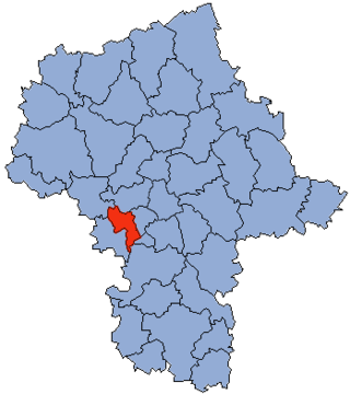
Grodzisk County is a unit of territorial administration and local government (powiat) in Masovian Voivodeship, east-central Poland. It came into being on 1 January 1999, as a result of the Polish local government reforms passed in 1998. Its administrative seat and largest town is Grodzisk Mazowiecki, which lies 29 kilometres (18 mi) south-west of Warsaw. The county also contains the towns of Milanówek, lying 2 km (1 mi) north-east of Grodzisk Mazowiecki, and Podkowa Leśna, 8 km (5 mi) east of Grodzisk Mazowiecki.

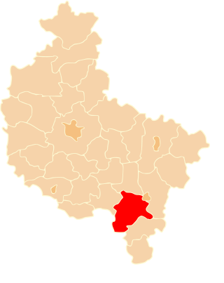
Ostrów County is a unit of territorial administration and local government (powiat) in Greater Poland Voivodeship, west-central Poland. It came into being on January 1, 1999, as a result of the Polish local government reforms passed in 1998. Its administrative seat and largest town is Ostrów Wielkopolski, which lies 100 kilometres (62 mi) south-east of the regional capital Poznań. The county contains three other towns: Nowe Skalmierzyce, 22 km (14 mi) east of Ostrów Wielkopolski, Odolanów, 10 km (6 mi) south of Ostrów Wielkopolski, and Raszków, 8 km (5 mi) north of Ostrów Wielkopolski.

Wolsztyn County is a unit of territorial administration and local government (powiat) in Greater Poland Voivodeship, west-central Poland. It came into being on January 1, 1999, as a result of the Polish local government reforms passed in 1998. Its administrative seat and only town is Wolsztyn, which lies 63 kilometres (39 mi) south-west of the regional capital Poznań.

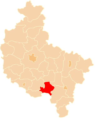
Krotoszyn County is a unit of territorial administration and local government (powiat) in Greater Poland Voivodeship, west-central Poland. It came into being on January 1, 1999, as a result of the Polish local government reforms passed in 1998. Its administrative seat and largest town is Krotoszyn, which lies 88 kilometres (55 mi) south-east of the regional capital Poznań. The county contains four other towns: Koźmin Wielkopolski, 16 km (10 mi) north of Krotoszyn, Zduny, 6 km (4 mi) south-west of Krotoszyn, Kobylin, 14 km (9 mi) west of Krotoszyn, and Sulmierzyce, 12 km (7 mi) south-east of Krotoszyn.

Gostyń County is a unit of territorial administration and local government (powiat) in Greater Poland Voivodeship, west-central Poland. It came into being on January 1, 1999, as a result of the Polish local government reforms passed in 1998. Its administrative seat and largest town is Gostyń, which lies 59 kilometres (37 mi) south of the regional capital Poznań. The county contains four other towns: Krobia, 11 km (7 mi) south of Gostyń, Poniec, 20 km (12 mi) south-west of Gostyń, Borek Wielkopolski, 17 km (11 mi) east of Gostyń, and Pogorzela, 17 km (11 mi) south-east of Gostyń.

Ostrzeszów County is a unit of territorial administration and local government (powiat) in Greater Poland Voivodeship, west-central Poland. It came into being on January 1, 1999, as a result of the Polish local government reforms passed in 1998. Its administrative seat and largest town is Ostrzeszów, which lies 134 kilometres (83 mi) south-east of the regional capital Poznań. The county also contains the towns of Grabów nad Prosną, lying 14 km (9 mi) north-east of Ostrzeszów, and Mikstat, 15 km (9 mi) north of Ostrzeszów.

Kościan County is a unit of territorial administration and local government (powiat) in Greater Poland Voivodeship, west-central Poland. It came into being on January 1, 1999, as a result of the Polish local government reforms passed in 1998. Its administrative seat and largest town is Kościan, which lies 40 kilometres (25 mi) south-west of the regional capital Poznań. The county contains three other towns: Śmigiel, 13 km (8 mi) south-west of Kościan, Czempiń, 13 km (8 mi) north-east of Kościan, and Krzywiń, 18 km (11 mi) south-east of Kościan.

Szamotuły County is a unit of territorial administration and local government (powiat) in Greater Poland Voivodeship, west-central Poland. It came into existence on January 1, 1999, as a result of the Polish local government reforms passed in 1998. Its administrative seat and largest town is Szamotuły, which lies 32 kilometres (20 mi) north-west of the regional capital Poznań. The county contains four other towns: Wronki, 18 km (11 mi) north-west of Szamotuły, Pniewy, 24 km (15 mi) south-west of Szamotuły, Obrzycko, 13 km (8 mi) north of Szamotuły, and Ostroróg, 9 km (6 mi) north-west of Szamotuły.

Śrem County is a unit of territorial administration and local government (powiat) in Greater Poland Voivodeship, west-central Poland. It came into being on January 1, 1999, as a result of the Polish local government reforms passed in 1998. Its administrative seat and largest town is Śrem, which lies 36 kilometres (22 mi) south of the regional capital Poznań. The county also contains the towns of Książ Wielkopolski, lying 15 km (9 mi) east of Śrem, and Dolsk, 12 km (7 mi) south of Śrem.

Nowy Tomyśl County is a unit of territorial administration and local government (powiat) in Greater Poland Voivodeship, west-central Poland. It came into being on January 1, 1999, as a result of the Polish local government reforms passed in 1998. Its administrative seat and largest town is Nowy Tomyśl, which lies 55 kilometres (34 mi) west of the regional capital Poznań. The county contains three other towns: Opalenica, 20 km (12 mi) east of Nowy Tomyśl, Zbąszyń, 17 km (11 mi) south-west of Nowy Tomyśl, and Lwówek, 16 km (10 mi) north of Nowy Tomyśl.
Ruchocice is a village in the administrative district of Gmina Rakoniewice, within Grodzisk Wielkopolski County, Greater Poland Voivodeship, in west-central Poland. It lies approximately 6 kilometres (4 mi) north-east of Rakoniewice, 8 km (5 mi) south of Grodzisk Wielkopolski, and 48 km (30 mi) south-west of the regional capital Poznań.
Gmina Kamieniec is a rural gmina in Grodzisk Wielkopolski County, Greater Poland Voivodeship, in west-central Poland. Its seat is the village of Kamieniec, which lies approximately 11 kilometres (7 mi) south-east of Grodzisk Wielkopolski and 41 km (25 mi) south-west of the regional capital Poznań.
Gmina Rakoniewice is an urban-rural gmina in Grodzisk Wielkopolski County, Greater Poland Voivodeship, in west-central Poland. Its seat is the town of Rakoniewice, which lies approximately 13 kilometres (8 mi) south-west of Grodzisk Wielkopolski and 53 km (33 mi) south-west of the regional capital Poznań.
Gmina Wielichowo is an urban-rural gmina in Grodzisk Wielkopolski County, Greater Poland Voivodeship, in west-central Poland. Its seat is the town of Wielichowo, which lies approximately 13 kilometres (8 mi) south of Grodzisk Wielkopolski and 50 km (31 mi) south-west of the regional capital Poznań.
Gnin is a village in the administrative district of Gmina Rakoniewice, within Grodzisk Wielkopolski County, Greater Poland Voivodeship, in west-central Poland. It lies approximately 8 kilometres (5 mi) north-east of Rakoniewice, 6 km (4 mi) south-west of Grodzisk Wielkopolski, and 47 km (29 mi) south-west of the regional capital Poznań.
Pawłówko is a settlement in the administrative district of Gmina Wielichowo, within Grodzisk Wielkopolski County, Greater Poland Voivodeship, in west-central Poland. It lies approximately 2 kilometres (1 mi) north-west of Wielichowo, 13 km (8 mi) south of Grodzisk Wielkopolski, and 51 km (32 mi) south-west of the regional capital Poznań.
Prochy is a village in the administrative district of Gmina Wielichowo, within Grodzisk Wielkopolski County, Greater Poland Voivodeship, in west-central Poland. It lies approximately 3 kilometres (2 mi) west of Wielichowo, 14 km (9 mi) south of Grodzisk Wielkopolski, and 52 km (32 mi) south-west of the regional capital Poznań.
Reńsko is a village in the administrative district of Gmina Wielichowo, within Grodzisk Wielkopolski County, Greater Poland Voivodeship, in west-central Poland. It lies approximately 7 kilometres (4 mi) east of Wielichowo, 16 km (10 mi) south of Grodzisk Wielkopolski, and 47 km (29 mi) south-west of the regional capital Poznań.


