Lüchow-Dannenberg is a district in Lower Saxony, Germany, which is usually referred to as Hanoverian Wendland or Wendland. It is bounded by the districts of Uelzen and Lüneburg and the states of Mecklenburg-Western Pomerania, Brandenburg and Saxony-Anhalt.
Osnabrück is a district (Landkreis) in the southwest of Lower Saxony, Germany. With 2,122 km2 it is the second largest district of Lower Saxony.
Amt is a type of administrative division governing a group of municipalities, today only in Germany, but formerly also common in other countries of Northern Europe. Its size and functions differ by country and the term is roughly equivalent to a British or U.S. county.
A Verbandsgemeinde is a low-level administrative unit in the German federal states of Rhineland-Palatinate and Saxony-Anhalt. A Verbandsgemeinde is typically composed of a small group of villages or towns.
The Official Municipality Key, formerly also known as the Official Municipality Characteristic Number or Municipality Code Number, is a number sequence for the identification of politically independent municipalities or unincorporated areas. Other classifications for the identification of areas include postal codes, NUTS codes or FIPS codes.

Große Kreisstadt is a term in the municipal law (Gemeindeordnung) of several German states. In some federal states the term is used as a special legal status for a district-affiliated town—as distinct from an independent city—with additional competences in comparison with other municipalities of the district. The title is based on sovereign conferment by the state government.

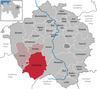
Suderburg is a municipality in the district of Uelzen, in Lower Saxony, Germany. It is situated approximately 11 km southwest of Uelzen.

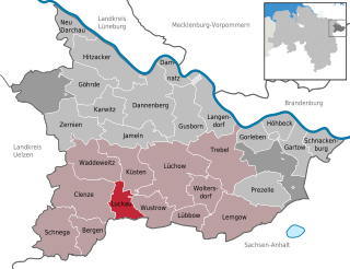
Luckau (Wendland) is a village or Gemeinde (municipality) in the south of the Kreis (local government district) of Lüchow-Dannenberg in Lower Saxony, Germany, where it forms part of the Samtgemeinde (joint municipal association) of Lüchow (Wendland).

Schleife is a municipality of 3,000 in northern Görlitz district, northeast Saxony, Germany. It is the seat of the Verwaltungsgemeinschaft Schleife.

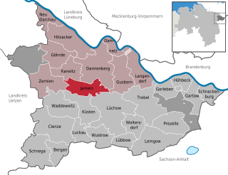
Jameln is a municipality in the district Lüchow-Dannenberg, in Lower Saxony, Germany. Jameln is part of the Samtgemeinde Elbtalaue.

Ohne is a community in the district of Grafschaft Bentheim in Lower Saxony, Germany.

Süpplingen is a municipality in the district of Helmstedt, in Lower Saxony, Germany. The village is located on the Schunter in Helmstedt district, Lower Saxony, about 6 km to the west of Helmstedt, by the Bundesstraße 1. It is one of the municipalities constituting the Nord-Elm municipal association. The former mining settlement of Nordschacht forms part of the municipality.

Ankum is a municipality in the district of Osnabrück, in Lower Saxony, Germany. From the Parish Ankum many people had emigrated to the Netherlands until 1800 and later to the USA.
Börde is a district in Saxony-Anhalt in Germany. Its seat is the town Haldensleben. It takes its name from the natural region Magdeburg Börde. It is the site of the Morsleben radioactive waste repository. The disposal of waste into the facility ended in 1998.
Hollenstedt is a Samtgemeinde in the district of Harburg, in Lower Saxony, Germany. It was created as part of municipal reorganization in Lower Saxony on 1 July 1972. Its seat is in the village Hollenstedt.
A Samtgemeinde is a type of administrative division in Lower Saxony, Germany. Samtgemeinden are local government associations of municipalities, equivalent to the Ämter in Schleswig-Holstein, Mecklenburg-Vorpommern, and Brandenburg, and the Verbandsgemeinden in Rhineland-Palatinate.
The village of Kakerbeck lies in the north German state of Lower Saxony in the district of Gifhorn. It is a village in the town of Wittingen.

Veenhusen is a village in the region of East Frisia, in Lower Saxony, Germany. Administratively, it is an Ortsteil of the municipality of Moormerland. Veenhusen is located just to the south of Warsingsfehn and is approximately 8 kilometers to the northeast of Leer. It has a population of 4,157.

Hilgenriedersiel is a village in the region of East Frisia, Lower Saxony, Germany. It is an Ortsteil of the municipality of Hagermarsch, part of the municipal association (Samtgemeinde) of Hage. The village borders the Wadden Sea to the north, looks out on the island of Norderney, and has the only natural bathing area on the East Frisian North Sea coast. Near Hilgenriedersiel is the Hilgenried Bay.
Theener is a village in the region of East Frisia, Lower Saxony, Germany. It is an Ortsteil of the municipality of Hagermarsch, part of the municipal association (Samtgemeinde) of Hage. It is a dispersed settlement to the south of Hilgenriedersiel. Historically, the village was first recorded in 1787 as Thener and has been officially registered under its current name since 1818.


