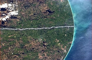
The Jordan River is a name given to two minor rivers in the South Island of New Zealand, one in Marlborough, the other in Tasman. Further south, there is also 4 km (2.5 mi) stream in Otago named River Jordan.

The Waitaki River is a large braided river in the South Island of New Zealand. It drains the Mackenzie Basin and runs 209 kilometres (130 mi) south-east to enter the Pacific Ocean between Timaru and Oamaru on the east coast. It starts at the confluence of the Ōhau and Tekapo rivers, now at the head of the artificial Lake Benmore, these rivers being fed by three large glacial lakes, Pukaki, Tekapo, and Ōhau at the base of the Southern Alps. The Waitaki flows through Lake Benmore, Lake Aviemore and Lake Waitaki, these lakes being contained by hydroelectric dams, Benmore Dam, Aviemore Dam and Waitaki Dam. The Waitaki has several tributaries, notably the Ahuriri River and the Hakataramea River. It passes Kurow and Glenavy before entering the Pacific Ocean. The River lends its name the Waitaki District on the south side of the river bank.

The Tekapo River flows occasionally through the Mackenzie Basin, Canterbury, in New Zealand's South Island, although the riverbed is now often dry in the upper reaches. It maintains a constant flow below the confluence of several tributaries, notably the Maryburn, Forks, and Grays rivers.
The Grays River is a tributary of the Tekapo River in the Mackenzie Basin of New Zealand. It flows southwest for 25 kilometres (16 mi), joining the larger river southeast of Lake Pukaki.

Barrington River, a perennial river of the Manning River catchment, is located in the Upper Hunter district of New South Wales, Australia.
The Edison River is a river of the Westland District of New Zealand. It arises in the Solution Range near Mount Elliot and flows north-west and north into the Mahitahi River.
Coldstream River, a watercourse of the Clarence River catchment, is located in the Northern Rivers district of New South Wales, Australia.
The Little Awakino River is a river of North Otago, New Zealand. A tributary of the Waitaki River, it flows into that river a short distance downstream of Lake Waitaki.
The Little Opawa River is a river of the south Canterbury region of New Zealand's South Island. It flows generally east from a ridge 20 kilometres (12 mi) southwest of Fairlie, joining with its southern neighbour, the Ōpaoa River very close to their joint outflow into the Tengawai River, close to the settlement of Albury.

The Macaulay River is a river of the Mackenzie Country of New Zealand's South Island. It flows south from the Two Thumb Range, part of the Southern Alps, its valley merging with that of the Godley River shortly before it enters the northern end of Lake Tekapo.

The Mōhakatino River is a river in the northern Taranaki region of New Zealand's North Island. It generally flows west from its origins west of Ōhura, roughly paralleling the course of its northerly neighbour, the larger Mokau River. The Mōhakatino reaches the Tasman Sea 3 kilometres (2 mi) south of Mokau.
The Penk River is a river of the Marlborough Region of New Zealand's South Island. It flows predominantly south from its origins on the slopes of Mount Horrible to reach the Awatere River 35 kilometres (22 mi) southwest of Seddon.
The Te Rahotaiepa River is a river of the West Coast Region of New Zealand's South Island. It rises to the north of Lake Ianthe and flows parallel with the Tasman Sea coast along the edge of marshy ground for several kilometres to flow into the mouth of the Waitaha River.
The Twizel River is a river of the Mackenzie Basin, in the Canterbury region of New Zealand's South Island. It is part of the Waitaki River system. It was named for Twizel Bridge in Northumberland by John Turnbull Thomson, Chief Surveyor of Otago in the mid 1800s.
The Waimeamea River is a river in the Southland Region of New Zealand. It rises in the Longwood Range and flows south-eastward into Te Waewae Bay north of Orepuki.
The Whareatea River is a river of the West Coast Region of New Zealand's South Island. It flows generally northwest to reach the Tasman Sea five kilometres to the east of Westport.
The Fork Stream is a river in the Canterbury region of New Zealand. It arises in the Gamack Range and flows south-east into the Tekapo River, which exits at Lake Benmore and eventually via the Waitaki River into the Pacific Ocean. Fraser Stream is a tributary. A high proportion of the stream's flow comes from snow melt.
The Waikura River is a river of the northern Gisborne Region of New Zealand's North Island. It flows initially northwest before turning southwest to reach the Raukokore River 25 kilometres (16 mi) east of Te Kaha.
The Indori river, is a rain-fed river originates from Aravalli Range from Sikar district and flows through Alwar district of Rajasthan to Rewari district of Haryana and it is the longest tributary of Sahibi River which stretches to 50 km. In Delhi, it is called the Najafgarh drain or Najafgarh Nallah.


