Hanglip

Last updated

Hanglip
Hanglip.jpg
Hanglip from the southeast
Highest point
Elevation 1,719 m (5,640 ft) [1]
Listing List of mountains in South Africa
Coordinates 22°59′45″S29°53′0″E / 22.99583°S 29.88333°E / -22.99583; 29.88333
Geography
South Africa relief location map.svg
Red triangle with thick white border.svg
Hanglip
Location in South Africa
Location Limpopo
Parent range Soutpansberg

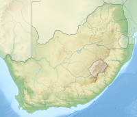
Hanglip (Afrikaans for hanging lip, Venda: Songozwi- thavha khulu ya VhaDzanani [2] ) is a prominent mountain peak near Louis Trichardt, South Africa. It is situated in the Vhembe District of Limpopo in the central Soutpansberg range. The peak with radar station, at 1,719 meters a.s.l., forms a conspicuous landmark visible from the town and the N1 national road.
Contents

History

Hanglip is situated in the 354 hectare Hanglip Forest Reserve within the Hanglip State Forest. The state forest contains commercial pine plantations, protected natural forest and bushveld. The pine plantations are harvested in 30 to 40 year cycles for construction wood.

Geologically, the mountain consists of tilted layers of the Karoo succession including glacial till deposits. Red quartzite deposits and grey andesite lava intrusions are also present.

Fort Botha was established under Hanglip some kilometers southwest of Mphephu's kraal. The ruins of the fort are currently off limits, being situated near graves of the Singos and the sacred site of vhaDzanani on the other side. The town of Trichardtsdorp was established after the conflict. The Hanglip Forest Reserve is a protected area in the zone of the mountain. [3]

Hikers can arrange to overnight in the Hanglip trail hut east of the peak, and motorists can visit a picnic site against its southern slope. [4]

See also

Related Research Articles

<span class="mw-page-title-main">Rocky Mountains</span> Major mountain range in western North America

The Rocky Mountains, also known as the Rockies, are a major mountain range and the largest mountain system in North America. The Rocky Mountains stretch 3,000 miles in straight-line distance from the northernmost part of western Canada, to New Mexico in the southwestern United States. Depending on differing definitions between Canada and the U.S., its northern terminus is located either in northern British Columbia's Terminal Range south of the Liard River and east of the Trench, or in the northeastern foothills of the Brooks Range/British Mountains that face the Beaufort Sea coasts between the Canning River and the Firth River across the Alaska-Yukon border. Its southernmost point is near the Albuquerque area adjacent to the Rio Grande rift and north of the Sandia–Manzano Mountain Range. Being the easternmost portion of the North American Cordillera, the Rockies are distinct from the tectonically younger Cascade Range and Sierra Nevada, which both lie farther to its west.

<span class="mw-page-title-main">Table Mountain</span> Flat-topped mountain overlooking the city of Cape Town, South Africa

Table Mountain is a flat-topped mountain forming a prominent landmark overlooking the city of Cape Town in South Africa. It is a significant tourist attraction, with many visitors using the cableway or hiking to the top. Table Mountain National Park is the most visited national park in South Africa, attracting 4.2 million people every year for various activities. The mountain has 8,200 plant species, of which around 80% are fynbos, meaning fine bush. It forms part of the Table Mountain National Park, and part of the lands formerly ranged by Khoe-speaking clans, such as the !Uriǁʼaes. It is home to a large array of mostly endemic fauna and flora. Its top elevates about 1.000 m above the surrounding city, making the popular hike upwards on a large variety of different, often steep and rocky pathways a serious mountain tour which requires fitness, preparation and hiking equipment.

<span class="mw-page-title-main">Manistee National Forest</span> National forest

The Manistee National Forest is a national forest located in the Lower Peninsula of Michigan. It has a total area of 540,187 acres (2,190 km2). It was established in 1938, and combined with the Huron National Forest in 1945 for administrative purposes, creating the Huron-Manistee National Forests. However, they are two separate forest units, as they are not connected. The area is popular for hiking, fishing, camping, boating, snowmobiling, cross-country skiing and hunting. The North Country Trail passes through it, and connects with the 11-mile Manistee River Trail to form a 23-mile loop. The highest point in the lower peninsula, Briar Hill (1,706 ft), is located here. The Manistee National Forest is not one continuous mass, but is a "mosaic" broken by private property and towns. The headquarters for the forest is in Cadillac, Michigan.

<span class="mw-page-title-main">Devil's Peak (Cape Town)</span> Mountain peak in Cape Town, South Africa

Devil's Peak is part of the mountainous backdrop to Cape Town, South Africa. When looking at Table Mountain from the city centre, or when looking towards the city across Table Bay, the skyline from left to right consists of Devil's Peak, the flat summit of Table Mountain, the peak of Lion's Head, and Signal Hill.

<span class="mw-page-title-main">Thohoyandou</span> Town in Limpopo, South Africa

Thohoyandou is a town in the Limpopo Province of South Africa. It is the administrative centre of Vhembe District Municipality and Thulamela Local Municipality. It is also known for being the former capital of the bantustan of Venda.

<span class="mw-page-title-main">Silvermine Nature Reserve</span>

Silvermine Nature Reserve forms part of the Table Mountain National Park in Cape Town, South Africa. It covers the section of the Cape Peninsula mountain range from the Kalk Bay mountains through to Constantiaberg. The area is a significant conservation area for the indigenous fynbos vegetation, which is of the montane cone-bush type at this location.

<span class="mw-page-title-main">Hout Bay</span> Seaside suburb of Cape Town, Western Cape, South Africa

Hout Bay is a seaside suburb of Cape Town in the Western Cape province of South Africa. It is situated in a valley on the Atlantic seaboard of the Cape Peninsula, twenty kilometres south of the Central business district of Cape Town. The name "Hout Bay" can refer to the town, the bay on which it is situated, or the entire valley.

<span class="mw-page-title-main">Soutpansberg</span> Mountain range in Limpopo, South Africa

The Soutpansberg, meaning "Salt Pan Mountain" in Afrikaans, is a range of mountains in far northern South Africa. It is located in Vhembe District, Limpopo. It is named for the salt pan located at its western end. The mountain range reaches the opposite extremity in the Matikwa Nature Reserve, some 107 kilometres (66 mi) due east. The range as a whole had no Venda name, as it was instead known by its sub-ranges which include Dzanani, Songozwi and others.

<span class="mw-page-title-main">Table Mountain National Park</span> A nature conservation area on the Cape Peninsula in Cape Town, South Africa

Table Mountain National Park, previously known as the Cape Peninsula National Park, is a national park in Cape Town, South Africa, proclaimed on 29 May 1998, for the purpose of protecting the natural environment of the Table Mountain Chain, and in particular the rare fynbos vegetation. The park is managed by South African National Parks. The property is included as part of the UNESCO Cape Floral Region World Heritage Site.

<span class="mw-page-title-main">Hogsback, South Africa</span> Place in Eastern Cape, South Africa

Hogsback is a village in the Amathole Mountains in the Eastern Cape Province, South Africa.

<span class="mw-page-title-main">Lincoln National Forest</span> National forest in New Mexico, United States

Lincoln National Forest is a unit of the U.S. Forest Service located in southern New Mexico. The Lincoln National Forest covers an extensive 1.1 million acres in southeastern New Mexico. Established by Presidential Proclamation in 1902 as the Lincoln Forest Reserve, the 1,103,897 acres (4,467.31 km2) forest begins near the Texas border and contains lands in parts of Chaves, Eddy, Lincoln, and Otero counties. The Lincoln National Forest is home to three major mountain ranges: Sacramento, Guadalupe and Capitan. The three Ranger Districts within the forest contain all or part of a total of four mountain ranges, and include a variety of different environmental areas, from desert to heavily forested mountains and sub-alpine grasslands. Clean air, water, and soil are necessary elements that the National Forests contribute to the environment. Established to balance conservation, resource management, and recreation, the lands of the Lincoln National Forest include important local timber resources, protected wilderness areas, and popular recreation and winter sports areas. The forest headquarters is located in Alamogordo, N.M. with local offices in Carlsbad, Cloudcroft, and Ruidoso.

<span class="mw-page-title-main">Helderberg</span> Region of the City of Cape Town, South Africa

Helderberg refers to a planning district of the City of Cape Town metropolitan municipality, the mountain after which it is named, a wine-producing area in the Western Cape province of South Africa, or a small census area in Somerset West.

Mpofu Nature Reserve is a nature reserve in the Amatole district of the Eastern Cape Province, South Africa that is managed by Eastern Cape Parks.

<span class="mw-page-title-main">Blouberg Nature Reserve</span> South African nature reserve

Blouberg Nature Reserve is a protected area situated close to Vivo, west of Louis Trichardt in the Limpopo Province, of South Africa. It covers an area of 9,360 hectares from the eastern portion of the Blouberg mountain range to the savanna near the Brak River, Blouberg was established as a protected area in 1990 by Peter G Dix. The reserve is currently managed and administered by the Limpopo Provincial Government Department of Economic Development, Environment & Tourism

<span class="mw-page-title-main">Louis Trichardt</span> Place in Limpopo, South Africa

Louis Trichardt, informally shortened to Louis Tri, is a town at the foot of Songozwi, in the Soutpansberg mountain range in the Limpopo province of South Africa. It is the centre of the Makhado Local Municipality, which comprises 16,000 km2 with a population of 270,000 (2001). Louis Trichardt is located in a fertile region where litchis, bananas, mangoes and nuts are produced. The N1 National Route runs through the town. Louis Trichardt is 437 kilometres from Johannesburg and one hour's drive from the Zimbabwean border at Beitbridge. Louis Trichardt was known for a time as Makhado, but it was changed back to Louis Trichardt. Vleifontein, Elim, Tshikota, Madombidzha, Makhado Park and Dzanani surround the town in all directions.

<span class="mw-page-title-main">Cecilia, Table Mountain</span> Section of the Table Mountain National Park

Cecilia is a section of the Table Mountain National Park on the lower eastern slopes of Table Mountain in Cape Town, located just to the south of Kirstenbosch National Botanical Garden. It was previously used for commercial logging and known as Cecilia Forest or Cecilia Plantation, but has now been given protected status and integrated into the National Park.

<span class="mw-page-title-main">Dzanani</span> Place in Limpopo, South Africa

Dzanani is a town and also the name of a region in the former Venda, now part of Limpopo province in South Africa. Dzanani was named after MuDzanani, which is one of the main surnames in Venda; and also the then Paramount Chiefs of Songozwi. The language predominantly spoken is TshiVenda, which is one of the eleven official languages of South Africa.

Schoemansdal was a settlement situated 16 km west of Louis Trichardt (Makhado), which had its origins during the Great Trek. It existed from 1848 to 1867, and functioned as the capital of an autonomous region until the S.A.R. Volksraad was established, when the outpost came under the supervision and regulations of the central government. The settlement was evacuated after only thirty years when attacked by Venda militants. The government rendered indecisive support and the town as torched by Katze-Katze on the night of 15 July 1867.

<span class="mw-page-title-main">Tokai Park</span> Small section of Table Mountain National Park in Cape Town, South Africa

Tokai Park, previously known as "Tokai Forest", is a small wing, about 600 ha, of the greater Table Mountain National Park in Cape Town, South Africa. Tokai Park is made up of two sections: upper and lower Tokai Park. Lower Tokai Park is flat, and characterized by the threatened Cape Flats Sand Fynbos. Upper Tokai Park is on the slopes of Constantiaberg Mountain, and consists of conservation area as well as the Tokai Arboretum. Upper Tokai Park is characterized by Peninsula Granite Fynbos, Peninsula Sandstone Fynbos and Afromontane Forest and noted for its diversity.

<span class="mw-page-title-main">Gamkaberg Nature Reserve</span> Nature reserve in the Western Cape, South Africa

The Gamkaberg Nature Reserve is situated in the Little Karoo region of the Western Cape province, South Africa.

References

  1. Explore the Hanglip Hiking Trail
  2. Braun, Lindsay F. (2014). Colonial Survey and Native Landscapes in Rural South Africa, 1850 - 1913: The Politics of Divided Space in the Cape and Transvaal (revised ed.). BRILL. p. 254. ISBN   9789004282292.
  3. Hanglip Forest Reserve, Louis Trichardt, Soutpansberg, showme.co.za. Accessed 31 July 2023.
  4. Soutpansberg/Hanglip hiking trail, Department of Forestry Archived 21 January 2012 at the Wayback Machine , places.co.za. Accessed 31 July 2023.