Related Research Articles
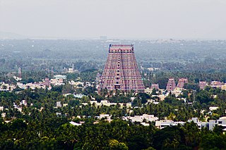
Srirangam is a neighbourhood in the city of Tiruchirappalli in the Indian state of Tamil Nadu. A river island, Srirangam is bounded by the Kaveri River on one side and its distributary Kollidam on the other side. Considered as the first among the 108 Divya Desams, a group of Vishnu temples, it is famous for the Sri Ranganathaswamy Temple, the largest temple complex in India and the biggest functioning Hindu temple in the world. Srirangam is also home to a significant population of Sri Vaishnavas.

Tenkasi is a town and headquarters of the Tenkasi district in Indian state of Tamil Nadu.

The Thamirabarani or Tamraparni or Porunai is a perennial river that originates from the Agastyarkoodam peak of Pothigai hills of the Western Ghats, above Papanasam in the Ambasamudram taluk. It flows through Tirunelveli and Thoothukudi districts of the Tamil Nadu state of southern India into the Gulf of Mannar. It was called the Tamraparni River in the pre-classical period, a name it lent to the island of Sri Lanka. The old Tamil name of the river is Porunai. From the source to sea, the river is about 128 kilometres (80 mi) long and is the only perennial river in Tamil Nadu. This river flows towards north direction initially. However, it changes to east direction later.

Aygudi(pronunciation ), also spelled Aaikudi, is a panchayat town in Tenkasi district in the state of Tamil Nadu, India.It is also the Home to The Amar Seva Sangam.
Chittar River and its five tributaries and numerous other contributing streams originate in the Courtallam hills of Tenkasi District in the state of Tamil Nadu in southern India. Together with its tributaries and streams, the Chittar River serves as an important source of irrigation for the region and is a major tributary of the Tambaraparani River along with the Manimuthar River.

Veerakeralampudur is a taluk in Tenkasi district in the Indian state of Tamil Nadu.

Perunchani Dam is an irrigation dam at Perunchani, in Kalkulam Taluk, Kanyakumari District, in the state of Tamil Nadu, India. It is one of the dams of the Kodayar Irrigation System. As there was water deficiency in the Kodayar Irrigation System, Perunchani Dam was constructed in December 1952 to store flood water of the Paralayar River as an extension. It was built about 1 km (0.62 mi) upstream of the Puthen dam on the Paralayar River. The irrigation system became operational on 2 September 1953. It feeds the left bank irrigation canal system of the Puthen dam, which is the terminal structure of the system.
The Nambiyar river runs across Nanguneri taluk in Tirunelveli district in Tamil Nadu state in India. It is a small river which runs for only 45 kilometres (28 mi). The river originates from near Thirukkurungudi village in the Western Ghats, about 1,500 metres (4,900 ft) above sea level, and ends at the Gulf of Mannar.
Thayar Thoppu is a village comes under Veerakeralampudur Panchayat, Veerakeralamputhur taluk, Tenkasi District Tamil Nadu, India. It locates between Alangulam and veerakeralampudur. Like any Indian rural village, this village too is steeped in tradition and rich in heritage, struggling to hold on to its past glories. Here the modern co-exist peacefully with the bullock-carts of yesterday years It's Panchayath union comes under Kilapavoor. It has one Government primary school. Due to its location near Courtallam, the climatic condition is just awful and drizzles during Courtallam season.

The Vellar River is a river in the Indian state of Tamil Nadu. It originates in the Kalrayan Hills, and flows generally eastward through Salem, Perambalur, and Cuddalore districts, before flowing into the Bay of Bengal near Parangipettai. The river has a total length of 150 kilometres (93 mi), and its drainage basin covers an area of 7,504.346 square kilometres (2,897.444 sq mi) in Cuddalore, Perambalur, Salem, Kallakurichi, Ariyalur, Namakkal, Tiruchirappalli, and Dharmapuri districts.
Agarakattu is a village, which located on the banks of the Hanuman River. This Village and Tenkasi are very closely located with each other. The majority of Catholics are part of the community. This Village and Shengottai Taluk was the part of Travancore and ruled by the Maharaja of Kingdom of Travancore. In the early 19th century, the kingdom became a Princely State of the British Empire. The Travancore Government and Maharaja ruled this area till 1956. Government of India decided to Merge the Agarakattu and Shengottai taluk with Tamil Nadu State after the great struggle and protest held in Shengottai and Nagercoil. On November 1, 1956 Agarakattu, Shengottai Taluk and Kanyakumari District were officially merged with Tamilnadu by K. Kamaraj the Honorable Chief Minister of Tamil Nadu.
The Koraiyar River is a river in the Ambasamudram taluk of the Tirunelveli district of the Indian state of Tamil Nadu. It is a right-bank tributary of the Thamirabarani River, which flows through Tirunelveli and Thoothukudi districts. It is formed by the confluence of the minor Vadakkur Koraiyar and Therkku Koraiyar rivers, which are its headwater streams, on the eastern slopes of the Western Ghats. It flows for a total length of 13.2 kilometres (8.2 mi) before flowing into the Kannadian channel near the village of Vellankuli upstream of the Kannadian anicut. The channel bypasses the anicut before joining the Thamirabarani downstream and to the east of the dam. Along its course it is joined by three tributaries, the Vandal Odai, Elumichaiyar, and Koppuraiyar rivers. The Koraiyar's drainage basin covers an area of 75.75 square kilometres (29.25 sq mi) and has a recorded maximum flood discharge of 12000 cusecs.
Aluthakanniar is a river flowing in the Tirunelveli district of the Indian state of Tamil Nadu. It is one of the tributaries of Chittar River, which joins Tamiraparani near Tirunelveli. It arises in the eastern slopes of the Western Ghats, and forms the Old Kutralam falls as it descends down the mountain. It flows 10 kilometres (6 mi) towards northeast before joining its main river Chittar near Kadapagothi village.

Gadananathi (கடனாநதி)also can be called as Gadananadhi or Gatananadhi or Kadananathi or Kadananadhi is a river flowing in the Tirunelveli district of the Indian state of Tamil Nadu.
Ramanathi (ராமாநதி) is a river flowing in the Tenkasi of the Indian state of Tamil Nadu.Gadananathi originates from Agasthyamalai Biosphere Reserve.This river enters Gadananathi River in Kizha Ambur. The Ramanadhi has 7 anicuts, a reservoir of 4,300,000 cubic metres (3,500 acre⋅ft), and irrigates 20.23 square kilometres (7.81 sq mi) of wetlands. This river flows on many villages like Alwarkurichi, Ravanasamudram, Pottalpudur, Pillaukulam.The Gadananathi is fed by Thekkaru and Ramanathi Rivers.This was proposed and opened by Karunanithi.

The Lower Anaicut or Anaikkarai is a dam and bridge built on the Kollidam in the Indian state of Tamil Nadu.
Appayanaickenpatti is a village panchayat located in Virudhunagar taluk in Virudhunagar district of the Indian state of Tamil Nadu.
The Pambar River is a tributary of the Thenpennai River in the Krishnagiri and Tirupattur districts of the Indian state of Tamil Nadu.
The river Karuppanadhi is a branch of Tamirabarani and tributary of Chittar River in India. It originates at an altitude of 5870 feet falls in the Krishnapuram village of Kadayanallur taluk in the Tirunelveli district of the Indian state of Tamil Nadu.
References
Archived 18 February 2014 at the Wayback Machine This river flowing in Ayikudy, Tenkasi taluk,
The restoration and desilting work is being done to the Hanuman Nadhi (Sep 2020) by a self interest group with the help of officials