Harbison Township | |
---|---|
![]() Evangelische Lutherische Emanuels Kirche, a historic site in the township | |
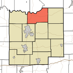
![]() Location of Harbison Township in Dubois County | |
Coordinates: 38°28′15″N86°51′30″W / 38.47083°N 86.85833°W | |
Country | United States |
State | Indiana |
County | Dubois |
Government | |
• Type | Indiana township |
Area | |
• Total | 38.21 sq mi (99.0 km2) |
• Land | 37.55 sq mi (97.3 km2) |
• Water | 0.66 sq mi (1.7 km2) |
Elevation | 535 ft (163 m) |
Population | |
• Total | 1,585 |
• Density | 42.3/sq mi (16.3/km2) |
FIPS code | 18-31324 [3] |
GNIS feature ID | 453373 |
Harbison Township is one of twelve townships in Dubois County, Indiana. As of the 2010 census, its population was 1,588 and it contained 690 housing units. [4]
Harbison Township was named for Arthur Harbison, a pioneer settler and judge. [5]
The Evangelische Lutherische Emanuels Kirche was listed on the National Register of Historic Places in 1990. [6]
According to the 2010 census, the township has a total area of 38.21 square miles (99.0 km2), of which 37.55 square miles (97.3 km2) (or 98.27%) is land and 0.66 square miles (1.7 km2) (or 1.73%) is water. [4]
(This list is based on USGS data and may include former settlements.)
The township contains ten cemeteries: Cavender, Chattin, Cooper, Ewing, Gwin, Harbison, Hardin, Hope, Mount Zion and Reed.
Harbison Township is in Northeast Dubois County School Corporation. [7] The comprehensive high school of that school district is Northeast Dubois High School.
In 1948 Harbison and Marion townships were planning a joint high school. [8]