
West Branch Area School District is a mid-sized, rural, public school district located in Morrisdale, Clearfield County, and Clinton County, Pennsylvania. The district is one of the 500 public school districts of Pennsylvania. West Branch Area School District was created in 1958 by the joining of Cooper Township High School and Morris Township High School. The district also includes Karthaus Township and Graham Township. The district extends across Clearfield County's eastern border to include West Keating Township in Clinton County. West Branch Area School District encompasses approximately 165 square miles (430 km2). According to 2000 federal census data, it served a resident population of 7,833. By 2010, the district's population was 7,857 people. The educational attainment levels for the school district population were 85% high school graduates and 9.3% college graduates. In 2009, West Branch Area School District residents' per capita income was $15,055, while the median family income was $37,054 a year. In the Commonwealth, the median family income was $49,501 and the United States median family income was $49,445, in 2010.
The Clearfield Area School District is a midsized, rural, public school district. The district is one of the 500 public school districts of Pennsylvania. It is located within the central and northern portion of Clearfield County, Pennsylvania. Clearfield Area School District encompasses approximately 345 square miles (890 km2). The Clearfield Area School District serves the Borough of Clearfield and Bradford Township, Covington Township, Girard Township, Goshen Township, Knox Township, Lawrence Township and Pine Township. According to 2000 federal census data, Clearfield Area School District served a resident population of 20,215 people. By 2010, the district's population declined to 19,115 people. In 2009, the district residents' per capita income was $16,245 a year, while the median family income was $37,134. In the Commonwealth, the median family income was $49,501 and the United States median family income was $49,445, in 2010. The educational attainment levels for the school district population were 85.5% high school graduates and 11.9% college graduates.

United School District is a small, rural public school district headquartered in East Wheatfield Township, Indiana County, Pennsylvania, United States. The United School District encompasses approximately 131 square miles (340 km2). The district serves the borough of Armagh and the townships of Brush Valley, Buffington, East Wheatfield, and West Wheatfield. According to 2000 federal census data, United School District served a resident population of 8,269. By 2010, the district's population declined to 7,988 people. The educational attainment levels for the school district population were 82.9% high school graduates and 10.9% college graduates. The district is one of the 500 public school districts of Pennsylvania.

The Central Cambria School District is a small, suburban school district covering Ebensburg Boro, Cambria Township, and Jackson Township in Cambria County, Pennsylvania. The district encompasses approximately 99 square miles (260 km2). According to 2010 US Census Bureau data, resident population declined to 13,842 people. Per 2000 federal census data, it served a resident population of 14,339 in 2000. The educational attainment levels for the Central Cambria School District population were 88.5% high school graduates and 21% college graduates. The district is one of the 500 public school districts of Pennsylvania.

The Philipsburg-Osceola Area School District is a small, rural, public school district that is located in a region that straddles two central Pennsylvania counties.

The Ambridge Area School District is a midsized, urban public school district in Beaver County, Pennsylvania. It serves the boroughs of Ambridge, Baden, Economy and South Heights and Harmony Township. The district encompasses approximately 27 square miles (70 km2). According to 2000 United States Census Bureau data, it serves a resident population of 25,022. By 2010, the District's population declined to 23,831 people. The educational attainment levels for the Ambridge Area School District population were 89.8% high school graduates and 21.8% college graduates. The district is one of the 500 public school districts of Pennsylvania.
The Bald Eagle Area School District is a midsized, suburban/rural public school district located in Centre County, Pennsylvania. The district serves the Boroughs of Howard, Milesburg, Port Matilda, Snow Shoe and Unionville and Boggs Township, Burnside Township, Howard Township, Huston Township, Snow Shoe Township, Union Township and Worth Township in Centre County, Pennsylvania. Bald Eagle Area School District encompasses approximately 345 square miles (890 km2). According to 2000 federal census data, it serves a resident population of 12,882. By 2010, the district's population increased to 13,218.

The Benton Area School District is a small, rural public school district in Columbia County, Pennsylvania. Benton Area School District serves the boroughs of Benton and Stillwater and Benton Township, Fishing Creek Township, Jackson Township and Sugarloaf Township. The District encompasses approximately 97 square miles (250 km2). According to 2000 federal census data, it served a resident population of 5,260. By 2010, the District's population declined to 5,231 people. It is one of eight public school districts operating in Columbia County and is one of the 500 public school districts of Pennsylvania in 2016.
The Cambria Heights School District covers the Boroughs of Carrolltown, Chest Springs, Hastings and Patton as well as Chest Township, Clearfield Township, East Carroll Township, Elder Township and West Carroll Township in Cambria County, Pennsylvania. The district encompasses approximately 110 square miles (280 km2). According to 2010 US Census Bureau data, it serves a resident population of 9,884 people. According to 2000 federal census data, it served a resident population of 7,120. According to 2007 local census data, it served a resident population of 10,299. The educational attainment levels for the Cambria Heights School District population were 90% high school graduates and 12% college graduates. The district is one of the 500 public school districts of Pennsylvania.

The Clarion Area School District is a small, rural public school district which covers the Borough of Clarion, Highland Township, and Paint Township as well as most of Monroe Township in Clarion County, Pennsylvania. It encompasses approximately 71 square miles (180 km2). According to 2000 federal census data, it serves a resident population of 10,183. By 2010, the district's population declined to 8,978 people. In 2009, the district residents' per capita income was $14,302, while the median family income was $43,665. In the Commonwealth, the median family income was $49,501 and the United States median family income was $49,445, in 2010. By 2013, the median household income in the United States rose to $52,100.
The Curwensville Area School District is a small, rural, public school district. It serves the residents of the Boroughs of Curwensville and Grampian and Ferguson Township, Greenwood Township, Penn Township and Pike Township in Clearfield County, Pennsylvania. Curwensville Area School District encompasses approximately 115 square miles (300 km2). According to 2000 federal census data, Curwensville Area School District serves a resident population of 7,646. In 2009, Curwensville Area School District residents’ per capita income was $14,830, while the median family income in the District was just $38,107. In the Commonwealth of Pennsylvania, the median family income was $49,501 and the United States median family income was $49,445, in 2010.
Purchase Line School District is a small, public school district located in central Pennsylvania which covers small areas in two counties. It serves a rural region, including the townships of Montgomery and Green, and the Borough of Glen Campbell in Indiana County. It also serves the Boroughs of New Washington, Burnside, Mahaffey, Newburg, and Bell Township in Clearfield County. Purchase Line School District encompasses approximately 144 square miles (370 km2). According to 2000 federal census data, Purchase Line Area School District serves a resident population of 7,687. In 2009, the District residents’ per capita income was $12,174, while the median family income was $31,893. In the Commonwealth, the median family income was $49,501 and the United States median family income was $49,445, in 2010.
The Glendale School District is a rural, public school district in Flinton, Cambria County, Pennsylvania and Clearfield County, Pennsylvania. It serves Irvona Borough, Coalport Borough, and Beccaria Township in Clearfield County, and Reade Township and White Township in Cambria County. Glendale School District encompasses approximately 60 square miles. According to 2000 federal census data, it serves a resident population of 5,582. Per 2010 US Census Bureau data, the resident population declined to 5,407 people. The educational attainment levels for the school district population were 86.3% high school graduates and 6.9% college graduates. The district is one of the 500 public school districts of Pennsylvania.

The Millersburg Area School District is a small, rural, public school district located in the northwestern portion of Dauphin County, Pennsylvania. It encompasses the borough of Millersburg and Upper Paxton Township. Millersburg Area School District encompasses approximately 32 square miles (83 km2). According to 2007 local census data, it served a resident population of 6,420. By the 2010 federal census data, the district's resident population grew to 6,721. The educational attainment levels for the Millersburg Area School District population were 82.1% high school graduates and 13.5% college graduates.
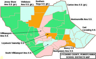
The Montgomery Area School District is a small, rural, public school district in Lycoming County. The school is centered on the borough of Montgomery and also serves: Clinton Township, Brady Township, and Washington Township. The district encompasses approximately 87 square miles (230 km2). According to 2000 federal census data, it serves a resident population of 7,749. By 2010, the district's population declined to 7,429 people. In 2009, the district residents’ per capita income was $14,133, while the median family income was $42,027. In the Commonwealth, the median family income was $49,501 and the United States median family income was $49,445, in 2010. The educational attainment levels for the population were 81.9% high school graduates and 10.9% college graduates.

The Northern Potter School District is a rural public school district located in northeastern Potter County, Pennsylvania. It serves the municipalities of Ulysses, Ulysses Township, Genesee Township, Bingham Township, and Harrison Township. Portions of Allegany Township and Hector Township are also within its boundaries. Northern Potter School District encompasses approximately 231 square miles (600 km2). According to 2010 federal census data, it serves a resident population of 4,113, making it a district of the fourth class. The educational attainment levels for the School District population were 84% high school graduates and 8.2% college graduates. The district is one of the 500 public school districts of Pennsylvania.
The Galeton Area School District is a diminutive, rural public school district operating in Potter County and Tioga County in Pennsylvania. Galeton Area School District encompasses approximately 325 square miles (840 km2). It serves the municipalities of Galeton, Abbott Township, West Branch Township, Pike Township, and a portion of Hector Township in Potter County, plus Elk Township and Gaines Township in Tioga County, Pennsylvania. According to 2000 federal census data, the district served a resident population of 3,292. By 2010, the district's population declined to 2,929 people. The educational attainment levels for the Galeton Area School District population were 82.7% high school graduates and 9.6% college graduates.
The Mahanoy Area School District is a small, rural public school district in Schuylkill County, Pennsylvania. It serves the municipalities of Mahanoy City, Mahanoy Township, Delano Township, Ryan Township, and Gilberton. Mahanoy Area School District encompasses approximately 53 square miles (140 km2). According to 2000 federal census data, the district served a resident population of 8,939 people. By 2010, the district's population increased to 11,472 people. The educational attainment levels for the Mahanoy Area School District population were 80.9% high school graduates and 9.2% college graduates.
The Minersville Area School District is a small, rural public school district in Schuylkill County, Pennsylvania. It is centered on the borough of Minersville and also serves Branch Township, Cass Township, Foster Township, and Reilly Township. The district encompasses approximately 55 square miles.

The Montrose Area School District is a small, rural public school district that is located in northwestern Susquehanna County, Pennsylvania. It serves the following municipalities: Montrose, Bridgewater Township, Franklin Township, Liberty Township, Jessup Township, Forest Lake Township, Silver Lake Township, Little Meadows, Choconut Township, Friendsville, and Middletown Township.

