Harristown, Indiana

Last updated

Harristown, Indiana
Map of Indiana highlighting Washington County.svg
Washington County's location in Indiana
Location map of Washington County, Indiana.svg
Red pog.svg
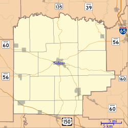
Harristown
Location of Harristown in Washington County
Coordinates: 38°35′52″N86°01′27″W / 38.59778°N 86.02417°W / 38.59778; -86.02417
Country United States
State Indiana
County Washington
Township Washington
Elevation
[1]
873 ft (266 m)
Time zone UTC-5 (Eastern (EST))
  Summer (DST) UTC-4 (EDT)
ZIP code
47167
Area code(s) 812, 930
GNIS feature ID435806 [1]

Harristown is an unincorporated community in Washington Township, Washington County, in the U.S. state of Indiana. [1]

Contents

History

Harristown was laid out in 1850 by Thomas M. Harris, and named for him. [2]

A post office was established at Harristown in 1851, and remained in operation until it was discontinued in 1914. [3]

Geography

Harristown is located at 38°35′52″N86°01′27″W / 38.59778°N 86.02417°W / 38.59778; -86.02417 .

References

  1. 1 2 3 U.S. Geological Survey Geographic Names Information System: Harristown, Indiana
  2. History of Lawrence, Orange, and Washington Counties, Indiana: From the Earliest Time to the Present. Higginson Book Company. 1884. pp.  792.
  3. "Washington County". Jim Forte Postal History. Retrieved July 8, 2016.