Northwood is an area in the London Borough of Hillingdon, North West London, located 14+1⁄2 miles northwest of Charing Cross. Northwood was part of the ancient parish of Ruislip, Middlesex. The area was situated on the historic Middlesex boundary with Hertfordshire, and since being incorporated into Greater London in 1965, has been on the Greater London boundary with that county.

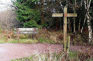
The Forest of Dean is a geographical, historical and cultural region in the western part of the county of Gloucestershire, England. It forms a roughly triangular plateau bounded by the River Wye to the west and northwest, Herefordshire to the north, the River Severn to the south, and the City of Gloucester to the east.

Leytonstone is an area in East London, England, within the London Borough of Waltham Forest. It adjoins Wanstead to the north-east, Forest Gate to the south-east, Stratford to the south-west, Leyton to the west, and Walthamstow to the north-west, and is 7 miles (11 km) north-east of Charing Cross.

Coventry City Football Club is a professional football club based in Coventry, West Midlands, England. The club plays in the EFL Championship, the second tier of English football. The club is nicknamed after the sky blue colours that were part of the club's early years, before making a return in 1962.

Harrow is a large town in Greater London, England, and serves as the principal settlement of the London Borough of Harrow. Lying about 9.5 miles (15.3 km) north-west of Charing Cross and 5.4 miles (8.7 km) south of Watford, the entire town including its localities had a population of 149,246 at the 2011 census, whereas the wider borough had a population of 250,149.

Totton and Eling is a civil parish in Hampshire, England, with a population of about 28,100 people. It contains the town of Totton and is situated between the eastern edge of the New Forest and the River Test, close to the city of Southampton but outside the city boundary; the town is within the New Forest non-metropolitan district. Surrounding towns and villages include Ashurst, Marchwood, Cadnam and Ower.

Kenilworth Road, known affectionately as The Kenny, is an association football stadium in Bury Park, Luton, Bedfordshire, England. It has been the home ground of Luton Town since 1905. The stadium has also hosted women's and youth international matches, including the second leg of the 1984 European Competition for Women's Football final.

Ruardean Hill is a prominent hill and a village in the English county of Gloucestershire, 20 km (12 mi) west of Gloucester. It lies in the Forest of Dean, in the parish of Drybrook.
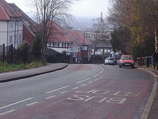
South Harrow is the southern part of the town of Harrow, located south-west of Harrow-on-the-Hill in the London Borough of Harrow. Its development originally spread south and west from the hamlet of Roxeth in the urbanisation process and easier access from Central London by rail. Six roads now converge at Roxeth hamlet centre at the bottom of Roxeth Hill. Its areas include, in the west, the area of Shaftesbury Circus/Avenue and in the south a shopping area, South Harrow tube station and the high street, Northolt Road.

Huntley, Gloucestershire, is a village on the A40 located seven miles (11 km) west of Gloucester. It is in the north of the Forest of Dean.

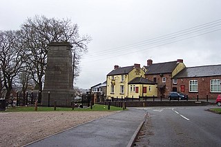
Harrow Hill A.F.C. is an English football club which is based in the village of Harrow Hill, Gloucestershire, nearby Drybrook. The club are currently members of the Gloucestershire Northern Senior League Division Two and play at Larksfield Road. The club also have two other senior men's teams that play in the North Gloucestershire Football League and are affiliated to the Gloucestershire County FA.

Mitcheldean is a market town in the Forest of Dean in Gloucestershire, England.

Sudbury is a suburb in the London Borough of Brent, located in northwest London, United Kingdom. The suburb forms the western part of Wembley and is centred around 0.6 miles (1 km) west of Wembley Central railway station.

Bream is a village in the Forest of Dean, west Gloucestershire, England. The population was around 3,170 in the 2011 census.

Roxeth was a hamlet in the ancient Harrow on the Hill parish, which now forms part of the London Borough of Harrow in Greater London, England.

Lydbrook is a civil parish in the Forest of Dean, a local government district in the English county of Gloucestershire and is located in the Wye Valley. It is on the north west edge of the Forest of Dean's present legal boundary proper. It comprises the districts of Lower Lydbrook, Upper Lydbrook, Joys Green and Worrall Hill. It has a mile and a half long high street, reputed to be the longest high street of any village in England.

Drybrook is a village and civil parish in the Forest of Dean in west Gloucestershire, England.
Thomas Carlyle Joseph Robert Hamish Deakin, known as Robert Deakin (1917–1985), was the Anglican Bishop of Tewkesbury from 1973 until his death in 1985.

Drybrook Road is a closed station on the Cinderford to Coleford direct railway line in the Forest of Dean in Gloucestershire, near the village of Drybrook. The former station was on the former Severn and Wye Railway system. It opened in 1875 and closed in 1929.

The Mitcheldean Road and Forest of Dean Junction Railway was an independent railway company incorporated in 1871, to provide a northerly outlet for iron ore and coal products from the Cinderford and Whimsey area in the Forest of Dean, to the Hereford, Ross and Gloucester Railway line; mineral traffic to industrial centres in South Wales and the Midlands was foreseen.


