
The Forest of Dean is a geographical, historical and cultural region in the western part of the county of Gloucestershire, England. It forms a roughly triangular plateau bounded by the River Wye to the west and northwest, Herefordshire to the north, the River Severn to the south, and the City of Gloucester to the east.

Forest of Dean is a local government district in west Gloucestershire, England, named after the Forest of Dean. Its council is based in Coleford. Other towns and villages in the district include Blakeney, Cinderford, Drybrook, English Bicknor, Huntley, Littledean, Longhope, Lydbrook, Lydney, Mitcheldean, Newnham and Newent.

Ruardean Hill is a prominent hill and a village in the English county of Gloucestershire, 20 km (12 mi) west of Gloucester. It lies in the Forest of Dean, in the parish of Drybrook.

Abenhall is a small village and former civil parish, now in the parish of Mitcheldean, in the Forest of Dean district, in the county of Gloucestershire, England. It lies on the road between Mitcheldean and Flaxley in the Forest of Dean. The parish included the settlement of Plump Hill, which is actually more populous than Abenhall itself, and was once part of the Hundred of St Briavels. Originally a mining and iron-making centre like much of the surrounding area, the village is notable for its 14th century Church of St Michael, which is built of local red sandstone and has ornate contemporary carvings relating to the Forest of Dean's principal industries. These include a shield bearing the arms of the Freeminers on the west wall and a mid-15th century octagonal font, that has tools of miners and metalworkers incised on its sides. Abenhall is a tiny, ancient village in a secluded quiet valley near Mitcheldean. The parish includes the settlement of Plump Hill, on the Mitcheldean to Cinderford Road as it climbs into the high Forest. Abenhall is on the Flaxley to Mitcheldean Road. Originally a mining and iron making centre, it is notable for its 14th century Church of St Michael, which is built of local red sandstone and has excellent contemporary carvings relating to the Forest of Dean's industries. These include a shield bearing the arms of the Freeminers on the west wall and the fabulous mid-15th century octagonal font, that has tools of miners and metalworkers incised on its sides. In the west tower is a spectacular new window installed 14 April 2011 by stained glass artist Thomas Denny; presented by the current free miners of the Forest of Dean to represent their gratitude and present day continuation of the ancient local customs of coal, iron ore and stone mining. In 1931 the parish had a population of 230.

Aston Ingham is a village in south-eastern Herefordshire, England, near Newent and about 7 miles (11 km) east of Ross-on-Wye. The population of the village at the 2011 census was 398. There is a church, dedicated to St John the Baptist, which has been a Grade II* listed building since 17 March 1987.

Harrow Hill A.F.C. is an English football club which is based in the village of Harrow Hill, Gloucestershire, nearby Drybrook. The club are currently members of the Gloucestershire Northern Senior League Division Two and play at Larksfield Road. The club also have two other senior men's teams that play in the North Gloucestershire Football League and are affiliated to the Gloucestershire County FA.
East Dean and United Parishes Rural District, later renamed East Dean Rural District, was a rural district in Gloucestershire, England from 1894 to 1974. It included a number of civil parishes, including East Dean, and was subject to a significant boundary reform in 1935.

Mitcheldean is a market town in the Forest of Dean in Gloucestershire, England.
Forest of Dean District Council is the local authority for the Forest of Dean in Gloucestershire, England. The council is elected every four years. Since the last boundary changes in 2019, 38 councillors are elected from 21 wards.

Lydbrook is a civil parish in the Forest of Dean, a local government district in the English county of Gloucestershire and is located in the Wye Valley. It is on the north west edge of the Forest of Dean's present legal boundary proper. It comprises the districts of Lower Lydbrook, Upper Lydbrook, Joys Green and Worrall Hill. It has a mile and a half long high street, reputed to be the longest high street of any village in England.

Ruardean is a village in the Forest of Dean, Gloucestershire, England, to the North West of Cinderford. It is situated on a hillside with views west towards the mountains of South Wales. Little now remains of the village's industrial history, but once it was a centre for iron-ore smelting furnaces, forges and coal mines. The Norman castle, now little more than a mound, commanded the shortest route from Gloucester Castle to the Welsh Marches and the Wye Valley.
The GL postcode area, also known as the Gloucester postcode area, is a group of 27 postcode districts in south-west England and a very small part of south-east Wales, within 28 post towns. These cover most of Gloucestershire, including Gloucester, Cheltenham, Stroud, Cirencester, Tewkesbury, Badminton, Berkeley, Blakeney, Chipping Campden, Cinderford, Coleford, Drybrook, Dursley, Dymock, Fairford, Lechlade, Longhope, Lydbrook, Lydney, Mitcheldean, Moreton-in-Marsh, Newent, Newnham, Ruardean, Stonehouse, Tetbury, Westbury-on-Severn and Wotton-under-Edge. The area also covers very small parts of Herefordshire, Worcestershire, Warwickshire, Oxfordshire and Wiltshire, while the GL16 district extends across the Welsh border to cover a very small part of Monmouthshire.

Dene Magna School is a secondary school in Mitcheldean, Gloucestershire, England. The school takes both girls and boys, and has 1005 pupils aged between 11 and 18, including a sixth form. In 2005, the school was included on Ofsted's "Honours List" of 234 high-achieving schools, and received further positive Ofsted reports in 2008 and 2012. The headteacher is Declan Mooney, who replaced Stephen Brady in September 2024.
Ruardean Woodside is a village in Gloucestershire, England, located in the Forest of Dean and tucked away behind Ruardean Hill and Brierley. There is a primary school and a village hall. The Roebuck was the last of the local pubs to close.

East Dean is a hamlet and former civil parish, now in the parish of Mitcheldean, in the Forest of Dean district, in the county of Gloucestershire, England.

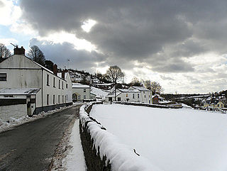
Harrow Hill is a village situated in the Forest of Dean in Gloucestershire, England. It is contiguous with the larger village of Drybrook. Originally, the village was known as Harry Hill. "Until fairly recently the village was once called Harry Hill"

The Mitcheldean Road and Forest of Dean Junction Railway was an independent railway company incorporated in 1871, to provide a northerly outlet for iron ore and coal products from the Cinderford and Whimsey area in the Forest of Dean, to the Hereford, Ross and Gloucester Railway line; mineral traffic to industrial centres in South Wales and the Midlands was foreseen.

