Haselbach, Bavaria

Last updated

Haselbach
Haselbach Straubinger Strasse 17 Kirche Sankt Jakobus Nordansicht.jpg
Church of Saint James
Wappen Haselbach (Niederbayern).svg
Location of Haselbach within Straubing-Bogen district
Haselbach in SR.svg
Germany adm location map.svg
Red pog.svg
Haselbach
Bavaria location map.svg
Red pog.svg
Haselbach
Coordinates: 49°0′N12°42′E / 49.000°N 12.700°E / 49.000; 12.700 Coordinates: 49°0′N12°42′E / 49.000°N 12.700°E / 49.000; 12.700
Country Germany
State Bavaria
Admin. region Niederbayern
District Straubing-Bogen
Municipal assoc. Mitterfels
Government
   Mayor (202026) Simon Haas [1] (FW)
Area
  Total18.45 km2 (7.12 sq mi)
Elevation
428 m (1,404 ft)
Population
 (2020-12-31) [2]
  Total1,903
  Density100/km2 (270/sq mi)
Time zone UTC+01:00 (CET)
  Summer (DST) UTC+02:00 (CEST)
Postal codes
94354
Dialling codes 09961
Vehicle registration SR, BOG, MAL
Website www.haselbach-gemeinde.de

Haselbach is a municipality in the district of Straubing-Bogen in Bavaria, Germany.

Contents

Geography

Haselbach is located in the southern outskirts of the Bavarian Forest, approximately 11 kilometres (6,8 miles) north of the river Danube. The municipality comprises the village of Haselbach as well as 49 other named districts.

History

The village of Haselbach was first mentioned in 1130 and for centuries belonged to the estates of the Oberalteich monastery. At the end of the 17th century, the Danse-Macabre chapel, which today is the village's landmark and represented in the coat of arms, was built in the churchyard surrounding St. James' church. The municipality in its current form was established in 1818 in the course of administrative reforms in the kingdom of Bavaria.

After World War II, Haselbach vastly expanded from a loose accumulation of farmhouses to a coherent village. The population figure rose from well below 1000 after World War II to currently over 1900.

Related Research Articles

Rohrdorf, Bavaria Place in Bavaria, Germany

Rohrdorf is a municipality in the district of Rosenheim in Upper Bavaria, Germany. It is located in the Inn valley.

Oberhausen (near Neuburg) Place in Bavaria, Germany

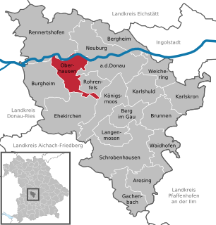
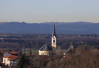
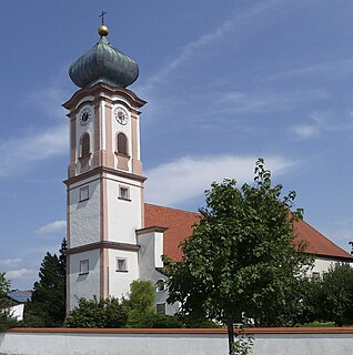
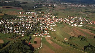
Oberhausen is a municipality in the Neuburg-Schrobenhausen district in the state of Bavaria in Germany.

Mauerstetten Place in Bavaria, Germany

Mauerstetten is a municipality in the district of Ostallgäu in the southwest of Bavaria in Germany.

Bischofsheim in der Rhön Place in Bavaria, Germany

Bischofsheim in der Rhön is a town in the district Rhön-Grabfeld, in Bavaria, Germany. It is situated in the Rhön Mountains, 29 km southeast of Fulda.

Gstadt am Chiemsee Place in Bavaria, Germany

Gstadt am Chiemsee is a municipality in the district of Rosenheim, Bavaria, Germany. It is located on lake Chiemsee.

Sondheim vor der Rhön Place in Bavaria, Germany

Sondheim vor der Rhön is a municipality in the district Rhön-Grabfeld, Bavaria, Germany. It is administrated by the Verwaltungsgemeinschaft Ostheim. As of 2002 it had a population of 1123, and covers an area of 18.58 km².

Hirschbach, Bavaria Place in Bavaria, Germany

Hirschbach is a municipality in the district of Amberg-Sulzbach in Bavaria in Germany.

Außernzell Place in Bavaria, Germany

Außernzell is a municipality in the district of Deggendorf in Bavaria in Germany. It is part of the municipal union of Schöllnach.

Buckenhof Place in Bavaria, Germany

Buckenhof is a municipality in the district of Erlangen-Höchstadt, in Bavaria, Germany.

Langensendelbach Place in Bavaria, Germany

Langensendelbach is a municipality in the district of Forchheim in Bavaria in Germany with a population of over 3100. The village Bräuningshof is a part of Langensendelbach.

Harsdorf Place in Bavaria, Germany

Harsdorf is a municipality in the district of Kulmbach in Bavaria in Germany.

Igling Place in Bavaria, Germany

Igling is a municipality in the district of Landsberg in Bavaria in Germany.

Kaufering, Bavaria Place in Bavaria, Germany

Kaufering is a municipality in the district of Landsberg in Bavaria in Germany. It lies on the river Lech.

Utting am Ammersee Place in Bavaria, Germany

Utting am Ammersee is a municipality in the district of Landsberg in Bavaria in Germany.

Waakirchen Place in Bavaria, Germany

Waakirchen is a municipality in the district of Miesbach in Bavaria in Germany. At the end of World War II, Japanese American soldiers rescued concentration camp victims on a death march at this village.

Zangberg municipality in the district of Mühldorf in Bavaria in Germany

Zangberg is a municipality in the district of Mühldorf in Bavaria in Germany.

Mühlhausen, Upper Palatinate Place in Bavaria, Germany

Mühlhausen is a municipality in the district of Neumarkt in Bavaria in Germany. It lies in the Sulz River valley.

Tiefenbach, Passau Place in Bavaria, Germany

Tiefenbach is a municipality in the district of Passau in Bavaria in Germany.

Schwebheim Place in Bavaria, Germany

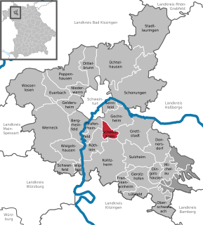
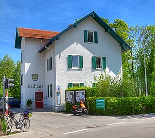
Schwebheim is a municipality in the district of Schweinfurt in Bavaria, Germany. Historically important as the location of the Bibra family castle by the same name. The castle was heavily damaged during severe bombings of Schweinfurt in World War II and only partially repaired. Today, the village is fast becoming a suburb of nearby Schweinfurt.

Ustersbach Place in Bavaria, Germany

Ustersbach is a municipality in the district of Augsburg in Bavaria in Germany. It is situated approx. 20 kilometres (12 mi) west of Augsburg

References

  1. Liste der ersten Bürgermeister/Oberbürgermeister in kreisangehörigen Gemeinden, Bayerisches Landesamt für Statistik, 15 July 2021.
  2. "Tabellenblatt "Daten 2", Statistischer Bericht A1200C 202041 Einwohnerzahlen der Gemeinden, Kreise und Regierungsbezirke". Bayerisches Landesamt für Statistik (in German). June 2021.