Hathoway Slough

Last updated • a couple of secsFrom Wikipedia, The Free Encyclopedia
Hathoway Slough
Tributary to Big Springs Creek
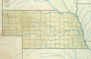
USA Nebraska relief location map.svg
Red pog.svg
Location of Hathoway Slough mouth
Usa edcp relief location map.png
Red pog.svg
Hathoway Slough (the United States)
Location
Country United States
State Nebraska
County Antelope
Physical characteristics
Source Elkhorn River divide
  locationabout 1 mile east of Orchard, Nebraska
  coordinates 42°20′22.02″N098°11′52.26″W / 42.3394500°N 98.1978500°W / 42.3394500; -98.1978500 [1]
  elevation1,978 ft (603 m) [1]
Mouth Big Springs Creek (South Branch Verdigre Creek tributary)
  location
about 6 miles north-northeast of Orchard, Nebraska [1]
  coordinates
42°24′17.01″N098°12′58.27″W / 42.4047250°N 98.2161861°W / 42.4047250; -98.2161861 Coordinates: 42°24′17.01″N098°12′58.27″W / 42.4047250°N 98.2161861°W / 42.4047250; -98.2161861 [1]
  elevation
1,680 ft (510 m) [1]
Length6.39 mi (10.28 km) [2]
Basin size7.54 square miles (19.5 km2) [3]
Discharge 
  location Big Springs Creek (South Branch Verdigre Creek tributary)
  average1.12 cu ft/s (0.032 m3/s) at mouth with Big Springs Creek (South Branch Verdigre Creek tributary) [3]
Basin features
Progression Big Springs Creek (South Branch Verdigre Creek tributary)South Branch Verdigre CreekVerdigre CreekNiobrara RiverMissouri RiverMississippi
River system Niobrara
Bridges516th Avenue, 864th Road, 516th Avenue, 865th Road, 866th Road, 867th Road

Hathoway Slough is a 6.39 mi (10.28 km) long 2nd order tributary to Big Springs Creek (South Branch Verdigre Creek tributary) in Antelope County, Nebraska.

Contents

Course

Hathoway Slough rises on the Elkhorn River divide about 1 mile east of Orchard, Nebraska in Antelope County and then flows northeast and northwest to join Big Springs Creek about 6 miles north-northeast of Orchard, Nebraska. [1]

Watershed

Hathoway Slough drains 7.54 square miles (19.5 km2) of area, receives about 26.3 in/year of precipitation, has a wetness index of 555.68, and is about 2.24% forested. [3]

See also

Related Research Articles

Accokeek Creek is a tidal tributary of Potomac Creek, itself a tributary of the Potomac River, in Stafford County, Virginia, United States. From it headwaters to its mouth, Accokeek Creek is 15.4 miles (24.8 km) in total length.

<span class="mw-page-title-main">Verdigre Creek</span> Stream in Nebraska, USA

Verdigre Creek is a stream in Knox and Antelope counties, in the U.S. state of Nebraska.

Varnals Creek is a 7.13 mi (11.47 km) long 3rd order tributary to the Haw River, in Alamance County, North Carolina.

Duck Creek is a 3.86 mi (6.21 km) long 3rd order tributary to Smyrna River in New Castle County, Delaware.

Little Buffalo Creek is a 9.33 mi (15.02 km) long 2nd order tributary to the Deep River in Lee County, North Carolina.

McLendons Creek is a 28.20 mi (45.38 km) long 4th order tributary to the Deep River in Moore County, North Carolina. This creek is the only stream of this name in the United States.


Johnson Creek is a 10.71 mi (17.24 km) long 2nd order tributary to the Ararat River in Surry County, North Carolina.


Toms Creek is a 16.10 mi (25.91 km) long 4th order tributary to the Ararat River in Surry County, North Carolina.

Goose Creek is a 15.41 mi (24.80 km) long 3rd order tributary to the Rocky River in Union County, North Carolina.

Mockingbird Creek is a 4.28 mi (6.89 km) long 2nd tributary to Barren Creek in Wicomico County, Maryland.

East Branch Verdigre Creek is a 3.37 mi (5.42 km) long 3rd order tributary to Verdigre Creek in Knox County, Nebraska. This stream along with South Branch Verdigre Creek forms Verdigre Creek.

South Branch Verdigre Creek is a 19.18 mi (30.87 km) long 4th order tributary to Verdigre Creek in Knox County, Nebraska. This stream along with East Branch Verdigre Creek forms Verdigre Creek.

Cottonwood Creek is a 7.37 mi (11.86 km) long 2nd order tributary to Verdigre Creek in Knox County, Nebraska.

Merriman Creek is a 11.11 mi (17.88 km) long 2nd order tributary to Verdigre Creek in Knox County, Nebraska.

Middle Branch Verdigre Creek is a 25.28 mi (40.68 km) long 4th order tributary to Verdigre Creek in Knox County, Nebraska.

Lamb Creek is a 3.70 mi (5.95 km) long 1st order tributary to Middle Branch Verdigre Creek in Knox County, Nebraska.

North Branch Verdigre Creek is a 27.96 mi (45.00 km) long 2nd order tributary to Verdigre Creek in Knox County, Nebraska.

Big Springs Creek is a 10.78 mi (17.35 km) long 3rd order tributary to South Branch Verdigre Creek in Antelope County, Nebraska.

Burgess Creek is a 8.49 mi (13.66 km) long 2nd order tributary to the Niobrara River in Knox County, Nebraska.

References

  1. 1 2 3 4 5 6 "Geographic Names Information System". edits.nationalmap.gov. US Geological Survey. Retrieved 24 October 2022.
  2. "ArcGIS Web Application". epa.maps.arcgis.com. US EPA. Retrieved 24 October 2022.
  3. 1 2 3 "Hathoway Slough Watershed Report". watersgeo.epa.gov. US EPA. Retrieved 24 October 2022.