
Casanare is a department located in the central eastern of Colombia. It is famous for its oil and natural gas production as well as its livestock and extensive plains. It is also the tenth largest department with an area of 44,490 km2, similar to that of Denmark, but also the seventh least densely populated.

Corozal is a town and municipality of Puerto Rico located in the central-eastern region, north of Orocovis and Barranquitas; south of Vega Alta; southwest of Toa Alta; east of Morovis and Orocovis; and west of Naranjito. Corozal is spread over 12 barrios and Corozal Pueblo. It is part of the San Juan-Caguas-Guaynabo Metropolitan Statistical Area.

Curaçao International Airport, also known as Hato International Airport, is the only airport for the Dutch Caribbean island of Curaçao, in the southern Caribbean Sea.
Aerovías de Integración Regional S.A., d/b/a LATAM Airlines Colombia, is a Colombian airline. It is the second-largest air carrier in Colombia, after Avianca. It operates scheduled regional domestic passenger services, as well as a domestic cargo service. Its main hub is El Dorado International Airport in Bogotá.
Corozal Airport is an airport that serves Corozal, Belize. It is located at the south entrance of Corozal, in Ranchito village, and is therefore known as Ranchito Airport.
Sarteneja Airport is an airport serving Sarteneja, a town in the Corozal District in northern Belize. The airport is just east of the town, which is on Chetumal Bay.

Corozal is a town and municipality in the Sucre Department, northern Colombia.

Hato Corozal is a town and municipality in the Department of Casanare, Colombia.
Hato or HATO may refer to:
El Valle Airport is located in El Valle, a town in the Hato Mayor province of the Dominican Republic. It is an alternative for Sabana de la Mar Airport, and serves as a Domestic airport without regular scheduled services.
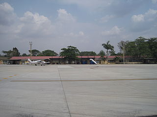
The Las Brujas Airport is a domestic airport located in the town of Corozal, Sucre in Colombia. The airport is located 10 minutes from the capital of the department, the city of Sincelejo. In emergency situations, it serves as the alternate airport of the city of Montería. It has regional and national operations with regular passenger services to Bogotá and Medellín.

Scarlett Martínez International Airport, also known as Río Hato Airport, is an international airport serving Río Hato, a town in the Coclé Province of Panama. The airport is 3 kilometres (2 mi) east of Río Hato.

The 7th Reconnaissance Squadron is a squadron of the United States Air Force. It is assigned to the 319th Operations Group and is stationed at Naval Air Station Sigonella, Sicily, Italy.

Puerto Rico Highway 891 (PR-891) is the road that goes to downtown Corozal, the administrative center of Corozal, Puerto Rico. With a length of 1.8 km (1.1 mi), this road can be seen as the Alt 159, since it was the original alignment of PR-159 through the municipal center.
Pedasí Airport is an airport serving the town of Pedasí, in Panama. It parallels the Pacific coastline 2 kilometres (1 mi) north of the town.
Hato Grande Airport is an airport serving the hamlet of Hato Grande in the Chontales Department of Nicaragua. The runway is 14 kilometres (8.7 mi) southwest of Juigalpa.
Johnny Chan Chen Airstrip is an airport serving Chan Chen, a village in the Corozal District of Belize. The airport is 1.6 kilometres (1 mi) west of Chan Chen and 7 kilometres (4.3 mi) northwest of Corozal.

Puerto Rico Highway 633 (PR-633) is an east–west rural road located between the municipalities of Ciales and Morovis in Puerto Rico. With a length of 4.3 km (2.7 mi), it begins at its intersection with PR-149 in Hato Viejo barrio and ends at its junction with PR-155 in Barahona.
On 2 September 2022, a police vehicle hit a bomb near the town of Corozal, killing seven police officers and injuring another.
