Related Research Articles
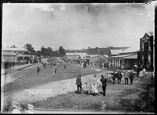
Raglan is a small beachside town located 48 km west of Hamilton, New Zealand on State Highway 23. It is known for its surfing, and volcanic black sand beaches.

Te Awamutu is a town in the Waikato region in the North Island of New Zealand. It is the council seat of the Waipa District and serves as a service town for the farming communities which surround it. Te Awamutu is located some 30 kilometres (19 mi) south of Hamilton on State Highway 3, one of the two main routes south from Auckland and Hamilton.

Tuakau is a town in the Waikato region at the foot of the Bombay Hills, formerly part of the Franklin District until 2010, when it became part of Waikato District in the North Island of New Zealand. The town serves to support local farming, and is the residence of many employees of New Zealand Steel at Glenbrook.
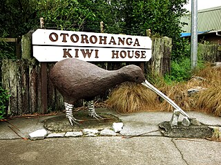
Ōtorohanga is a north King Country town in the Waikato region in the North Island of New Zealand. It is located 53 kilometres (33 mi) south of Hamilton and 18 kilometres (11 mi) north of Te Kūiti, on the Waipā River. It is a service town for the surrounding dairy-farming district. It is recognised as the "gateway" to the Waitomo Caves and as the "Kiwiana Town" of New Zealand. Until 2007, Ōtorohanga held a yearly 'Kiwiana Festival.'
Aotea Harbour is a settlement and smallest of three large natural inlets in the Tasman Sea coast of the Waikato region of New Zealand's North Island. It is located between Raglan Harbour to the north and Kawhia Harbour to the south, 30 kilometres southwest of Hamilton.
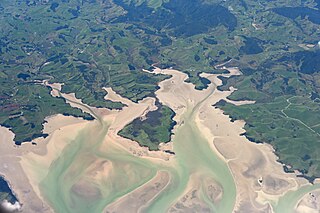
Kawhia Harbour is one of three large natural inlets in the Tasman Sea coast of the Waikato region of New Zealand's North Island. It is located to the south of Raglan Harbour, Ruapuke and Aotea Harbour, 40 kilometres southwest of Hamilton. Kawhia is part of the Ōtorohanga District and is in the King Country. It has a high-tide area of 68 km2 (26 sq mi) and a low-tide area of 18 km2 (6.9 sq mi). Te Motu Island is located in the harbour.
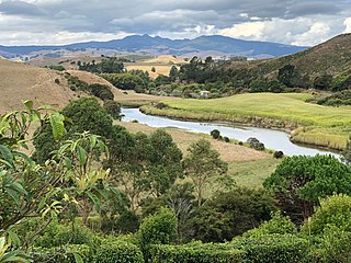
The Ōpārau River is a river of the Waikato Region of New Zealand's North Island in the area occupied by Ngāti Hikairo. It flows southwest from its sources in the Pirongia Forest Park, the highest being The Cone, and flows into the Kawhia Harbour, 5 kilometres (3 mi) east of Kawhia. The river has about 171 km (106 mi) of tributaries.

Te Pahu is a rural community in the Waipa District and Waikato region of New Zealand's North Island, located just north of Cambridge across State Highway 1.

Waikato County was one of the counties of New Zealand on the North Island. Under the Local Government Reorganisation Order of 1989, nearly all of the county was added to the boroughs of Huntly, Ngāruawāhia, most of Raglan County Council, and a small part of Waipa County Council, to form Waikato District Council.
Whatawhata, previously also spelt Whata Whata, is a small town in the Waikato region on the east bank of the Waipā River, at the junction of State Highways 23 and 39, 12 km (7.5 mi) from Hamilton. Te Araroa tramping route passes through Whatawhata.

Te Uku is a small, mainly farming, settlement on SH23 in the North Island of New Zealand, located 34 km (21 mi) from Hamilton and 11 km (6.8 mi) from Raglan. It has a 4-Square shop, church, coffee stall and art gallery, filling station, hall, school and Xtreme Zero Waste recycle bins.
The Awaroa River is a short river in the Waikato District of New Zealand's North Island. It flows east from its source in the dunes near Karioitahi Beach and Lake Puketi, then south from Waiuku joining with the Aka Aka Stream before reaching the Waikato River in its tidal reaches close to Motutieke Island.

Marokopa is a rural community in Waitomo District and Waikato region of New Zealand. It is located close to the coast between Awakino and Kawhia Harbour. The meshblock includes the coastal township of Marokopa, at the mouth of the Marokopa River, and the south side of the small village of Awamarino, about 10 km (6.2 mi) upstream.
Te Ākau is a small farming settlement in the North Island of New Zealand, located 62 km (39 mi) north west of Hamilton, 39 km (24 mi) south west of Huntly, 45 km (28 mi) south of Port Waikato and 47 km (29 mi), or 19 km (12 mi) by ferry and road, north of Raglan. It has a hall and a school.

Whitikahu is a settlement scattered along Whitikahu Rd in the Waikato District and Waikato region of New Zealand's North Island.
Okauia is a rural settlement and community located east of Matamata, in the Waikato region of New Zealand's North Island.
Glen Murray is a rural community in the Waikato District and Waikato region of New Zealand's North Island, on Highway 22, about 6 km (3.7 mi) up the Tikotiko Stream from Lake Whangape. In 2013 the population of meshblock 0846601, which includes Glen Murray, was 42. It has a garage and a War Memorial Hall, which opened in 1952. It is named after William Murray, who moved from Piako in 1885.

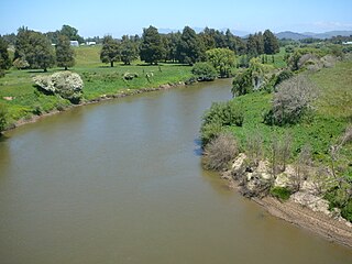
The Awaroa River is a river in the Ōtorohanga District on the west coast of New Zealand's North Island. It flows north from its source near Te Koraha through Hauturu to Kawhia Harbour. The river passes through both pasture and indigenous forest. Over half of the river is in forest.

Te Rore was in the 1850s an important transhipment point on New Zealand's Waipā River, between the agriculture of the Waikato basin and its Auckland market. That was ended in 1864 by the Invasion of the Waikato, when Te Rore was, for a few months, part of the supply route to four redoubts set up nearby. It is now a rural community in the Waipa District, 6 km (3.7 mi) north of Pirongia and roughly the same distance south of Ngāhinapōuri on State Highway 39.
References
- ↑ Hariss, Gavin. "Hauturu, Waikato". topomap.co.nz. NZ Topo Map.
- ↑ "Māori Maps". maorimaps.com. Te Potiki National Trust.
- ↑ "Te Kāhui Māngai directory". tkm.govt.nz. Te Puni Kōkiri.
- ↑ "Ministry of Education School Profile". educationcounts.govt.nz. Ministry of Education.
- ↑ "New Zealand Schools Directory". New Zealand Ministry of Education. Retrieved 14 March 2024.
- ↑ "Education Review Office Report". ero.govt.nz. Education Review Office.
- ↑ "Hauturu School" (PDF). 2016.
- ↑ "Local and General. KAWHIA SETTLER AND RAGLAN ADVERTISER". paperspast.natlib.govt.nz. 22 April 1910. Retrieved 26 October 2021.
- ↑ Parliament, New Zealand (1923). Parliamentary Debates.
- ↑ "WAIKATO M.P. ON TOUR. WAIPA POST". paperspast.natlib.govt.nz. 19 May 1923. Retrieved 26 October 2021.
- ↑ "LOCAL AND GENERAL. KAWHIA SETTLER AND RAGLAN ADVERTISER". paperspast.natlib.govt.nz. 10 October 1924. Retrieved 26 October 2021.
- ↑ "CROWN LANDS: REPORT OF THE ROYAL COMMISSION ON LAND-TENURE, LAND-SETTLEMENT, AND OTHER MATTERS AFFECTING THE CROWN LANDS OF THE COLONY: TOGETHER WITH MINUTES OF EVIDENCE". paperspast.natlib.govt.nz. 1905. Retrieved 26 October 2021.
- ↑ "APPENDIX E: PUBLIC SCHOOLS AND TEACHERS". paperspast.natlib.govt.nz. 1911. Retrieved 26 October 2021.
- ↑ "1:63360 map Kawhia". www.mapspast.org.nz. 1935. Retrieved 26 October 2021.
38°06′16″S174°55′50″E / 38.104438°S 174.930491°E
| | This Waikato geography article is a stub. You can help Wikipedia by expanding it. |