Kerapa

Last updated
Kerapa
Borneo Locator Topography.png
Red pog.svg
Kerapa
Coordinates: 1°32′00″N111°41′00″E / 1.53333°N 111.68333°E / 1.53333; 111.68333 Coordinates: 1°32′00″N111°41′00″E / 1.53333°N 111.68333°E / 1.53333; 111.68333
Country Flag of Malaysia.svg  Malaysia
State Flag of Sarawak.svg  Sarawak
Elevation
311 m (1,020 ft)
Population
500

Kerapa is an Iban longhouse in Betong, Sarawak, Malaysia. [1] It lies approximately 150.3 kilometres (93.4 mi) east of the state capital Kuching. Neighbouring settlements include:

Iban people branch of the Dayak peoples of Borneo

The Ibans or Sea Dayaks are a branch of the Dayak peoples of Borneo, in South East Asia. Most Ibans are located in the Malaysian state of Sarawak. It is believed that the term "Iban" was originally an exonym used by the Kayans, who - when they initially came into contact with them - referred to the Sea Dayaks in the upper Rajang river region as the "Hivan".

Longhouse type of house

A longhouse or long house is a type of long, proportionately narrow, single-room building built by peoples in various parts of the world including Asia, Europe, and North America.

Betong, Sarawak Place in Sarawak, Malaysia

Betong is a town and of the Betong Division in Sarawak, Malaysia, lying in the Saribas area. It used to be placed under the district of Sri Aman.

Luing one of the Slate Islands, Firth of Lorn, in the west of Argyll in Scotland

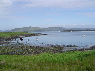
Luing is one of the Slate Islands, Firth of Lorn, in the west of Argyll in Scotland, about 16 miles (26 km) south of Oban. The island has an area of 1,430 hectares (5.5 sq mi) and is bounded by several small skerries and islets. It has a population of around 200 people, mostly living in Cullipool, Toberonochy, and Blackmillbay.

The recent installation of a photoelectric solar panel farm with batteries has opened up VSAT telecommunications (telephony and internet access) to the 500 people in this remote village, which is four hours by river from Betong. [2]

Solar cell electrical device that converts the energy of light directly into electricity by the photovoltaic effect

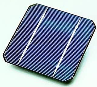
A solar cell, or photovoltaic cell, is an electrical device that converts the energy of light directly into electricity by the photovoltaic effect, which is a physical and chemical phenomenon. It is a form of photoelectric cell, defined as a device whose electrical characteristics, such as current, voltage, or resistance, vary when exposed to light. Individual solar cell devices can be combined to form modules, otherwise known as solar panels. In basic terms a single junction silicon solar cell can produce a maximum open-circuit voltage of approximately 0.5 to 0.6 volts.

Solar panel Absorb sunlight as a source of energy to generate electricity

Photovoltaic solar panels absorb sunlight as a source of energy to generate electricity. A photovoltaic (PV) module is a packaged, connected assembly of typically 6x10 photovoltaic solar cells. Photovoltaic modules constitute the photovoltaic array of a photovoltaic system that generates and supplies solar electricity in commercial and residential applications.

Related Research Articles

Debak Place in Sarawak, Malaysia

Debak is a very small town and a sub-district in the Betong division of Sarawak, Malaysia. It lies approximately 120 kilometres (75 mi) east of the state capital Kuching.

Maludam Place in Sarawak, Malaysia

Maludam is a very small town and sub district in Betong Division, Sarawak, Malaysia. It is made up of a small town including some modern longhouses with a few Malay fishing villages nearby. The majority of people are Malays, with some Ibans and Chinese. Maludam was made a district in 1985.

Merunjau Place in Sarawak, Malaysia

Merunjau is a settlement in Betong, Sarawak, Malaysia. It lies approximately 147.1 kilometres (91.4 mi) east of the state capital Kuching. Neighbouring settlements include:

Langit Place in Sarawak, Malaysia

Langit is a settlement in Sarawak, Malaysia. It lies approximately 146.5 kilometres (91.0 mi) east of the state capital Kuching. Neighbouring settlements include:

Nanga Linsum Place in Sarawak, Malaysia

Nanga Linsum is a settlement in Sarawak, Malaysia. It lies approximately 148.3 kilometres (92.1 mi) east of the state capital Kuching. Neighbouring settlements include:

Semumoh Place in Sarawak, Malaysia

Semumoh is a settlement in Sarawak, Malaysia. It lies approximately 132.9 kilometres (82.6 mi) east of the state capital Kuching. Neighbouring settlements include:

Empaong Place in Sarawak, Malaysia

Empaong is a settlement in Sarawak, Malaysia. It lies approximately 134.8 kilometres (83.8 mi) east of the state capital Kuching. Neighbouring settlements include:

Melaban Place in Sarawak, Malaysia

Melaban is a settlement in Sarawak, Malaysia. It lies approximately 133.2 kilometres (82.8 mi) east of the state capital Kuching. Neighbouring settlements include:

Batikal Place in Sarawak, Malaysia

Batikal is a settlement in Sarawak, Malaysia. It lies approximately 157.6 kilometres (98 mi) east of the state capital Kuching.

Sekatap Place in Sarawak, Malaysia

Sekatap is a settlement in the Betong division of Sarawak, Malaysia. It lies approximately 137.8 kilometres (86 mi) east of the state capital Kuching.

Lawing, Sarawak Place in Sarawak, Malaysia

Lawing is a settlement in the Betong division of Sarawak, Malaysia. It lies approximately 139.9 kilometres (87 mi) east of the state capital Kuching.

Engkeranji Place in Sarawak, Malaysia

Engkeranji is a settlement in the Betong division of Sarawak, Malaysia. It lies approximately 137.8 kilometres (86 mi) east of the state capital Kuching.

Long Banio Place in Sarawak, Malaysia

Long Banio is a large longhouse village in the Marudi division of Sarawak, Malaysia. It lies approximately 522.5 kilometres (325 mi) east-north-east of the state capital Kuching.

Meroh Place in Sarawak, Malaysia

Meroh is a settlement in the Saratok division of Sarawak, Malaysia. It lies approximately 141 kilometres (88 mi) east of the state capital Kuching.

Long Baleh Place in Sarawak, Malaysia

Long Baleh is a settlement in the Marudi division of Sarawak, Malaysia. It lies approximately 597.3 kilometres (371 mi) east-north-east of the state capital Kuching.

Rumah Asun Place in Sarawak, Malaysia

Rumah Asun is a settlement in the Kanowit division of Sarawak, Malaysia. It lies approximately 150.9 kilometres (94 mi) east of the state capital Kuching.

Tansang Place in Sarawak, Malaysia

Tansang is a settlement in the Betong division of Sarawak, Malaysia. It lies approximately 135.3 kilometres (84 mi) east of the state capital Kuching.

Nyelutong Place in Sarawak, Malaysia

Nyelutong is a settlement in the Betong division of Sarawak, Malaysia. It lies approximately 137.5 kilometres (85 mi) east of the state capital Kuching.

Sematan Place in Sarawak, Malaysia

Sematan is a settlement in the Lundu district of Sarawak, Malaysia. It lies approximately 67.5 kilometres (42 mi) west-north-west of the state capital Kuching.

Beduru Place in Sarawak, Malaysia

Beduru is a longhouse in the Saratok division of Sarawak, Malaysia. It lies approximately 131.9 kilometres (82 mi) east of the state capital Kuching.

References

  1. "Kerapa, Malaysia". Geonames. 1994-02-10. Retrieved 2010-12-27.
  2. Abd Hakim (2010-07-07). "Project sunshine in Kerapa Spak". Sarawak Update. Retrieved 2010-12-27.