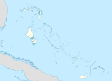
Mores Island Airport is a public use airport located near Moore's Island, the Bahamas.

Scotland Cay Airport is a private use airport located near Scotland Cay, the Bahamas.

Walker's Cay Airport is a public use airport located near Walker's Cay, the Bahamas.

Cat Cay Airport is a private airport located on North Cat Cay, the Bahamas. The airport is for the exclusive use of the Cat Cay Yacht Club and requires permission to land. It has the 21st shortest runway in the world, and the 2nd shortest for an ICAO named airport.

Ocean Cay Airport is a private use airport located near Ocean Cay, the Bahamas.

Cutlass Bay Airport is a public use airport serving Cutlass Bay, on the Cat Island in The Bahamas.

Cay Sal Airport was an airport located on Cay Sal, the Bahamas. The airstrip which was built there during WWII is now abandoned according to aerial imagery.

Cape Eleuthera Airport was a public use airport located 3 nm east-southeast of Cape Eleuthera, The Bahamas. The airport is closed, and the runway is not usable.

Black Point Airport is a public use airport located near Black Point, the Bahamas.

Darby Island Airport is a private use airport located near Darby Island, the Bahamas.

Farmer's Cay Airport is a private use airport located near Farmer's Cay, the Bahamas.

Rudder Cut Cay Airport is a public use airport located near Rudder Cut Cay, the Bahamas.

Big Sampson Cay Airport is a private use airport located near Big Sampson Cay, the Bahamas.

Cape Santa Maria Airport was a PRIVATE use ONLY se airport located near Cape Santa Maria, the Bahamas.It is on private land and is not in any way affiliated with the nearby Cape Santa Maria Resort. The nearest useable airport is Stella Maris SML, about 20 minutes away.

Hard Bargain Airport is a public use airport located near Long Island, the Bahamas.

Leaf Cay Airport is a private use airport located near Leaf Cay, the Bahamas.

Deep Water Cay Airport is a private use airport located in Deep Water Cay, in the Bahamas.

Grand Bahama Aux AF Airport is a public use airport located 9 nm east of Grand Bahama, the Bahamas.

New Providence Airport was a private use airport located on Paradise Island, the Bahamas. It closed in 1999 and the land incorporated into the island resort.

Twin Lakes Airport was a public use airport located 15 nm north of Andros Central, the Bahamas. The airport is closed.

