
The Wasatch Range or Wasatch Mountains is a mountain range in the western United States that runs about 160 miles (260 km) from the Utah-Idaho border south to central Utah. It is the western edge of the greater Rocky Mountains, and the eastern edge of the Great Basin region. The northern extension of the Wasatch Range, the Bear River Mountains, extends just into Idaho, constituting all of the Wasatch Range in that state.
The Bear River is the largest tributary of the Great Salt Lake, draining a mountainous area and farming valleys northeast of the lake and southeast of the Snake River Plain. It flows through northeastern Utah, southwestern Wyoming, southeastern Idaho, and back into northern Utah, in the United States. Approximately 350 miles (560 km) long it is the longest river in North America that does not ultimately reach the sea.

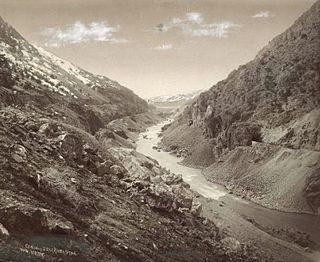
The Uinta Mountains are an east-west trending chain of mountains in northeastern Utah extending a short distance into northwest Colorado and slightly into southwestern Wyoming in the United States. As a subrange of the Rocky Mountains, they are unusual for being the highest range in the contiguous United States running east to west, and lie approximately 100 miles (160 km) east of Salt Lake City. The range has peaks ranging from 11,000 to 13,528 feet, with the highest point being Kings Peak, also the highest point in Utah. The Mirror Lake Highway crosses the western half of the Uintas on its way to Wyoming. Utah State Route 44 crosses the east end of the Uintas between Vernal and Manila.

Kings Peak is the highest peak in the U.S. state of Utah, with an elevation of 13,528 feet (4,123 m) NAVD 88.

Delano Peak is a mountain in the Tushar Mountains in the Fishlake National Forest in Beaver and Piute counties in Utah, United States.

Bald Mountain is a 11,949-foot (3,642 m) peak in the western Uinta Mountain Range in the Uinta-Wasatch-Cache National Forest on the border between Summit and Wasatch counties in northeastern Utah, United States.

The Uinta Highline Trail is a trail in the Uinta Mountains of Utah that traverses the range 104 miles (167 km) from east to west. The trail passes through expansive alpine landscapes dominated by metasedimentary rocks sculpted by past glaciers. The broad glacial basins are dotted by hundreds of lakes.

Mount Agassiz is a peak in the Uinta Mountains of northeastern Utah with an elevation of 12,433 feet (3,790 m). It is located in the High Uintas Wilderness and the Uinta-Wasatch-Cache National Forest. The summit is named in honor of Louis Agassiz, a well-known paleontologist, glaciologist and geologist.

Humpy Peak is a peak located in the Uinta Mountain Range in northern Utah. It is approximately 27.56 miles (44 km) south of Evanston, Wyoming and 21.29 miles (34 km) east of Coalville, Utah. The summit has an elevation of 10,875 feet (3,315 m).

Kletting Peak is a mountain in Summit County, Utah, named in 1964 for Utah architect Richard K.A. Kletting (1858-1943). It is in the High Uintas Wilderness and the Uinta-Wasatch-Cache National Forest.

South Kings Peak is the second highest peak in Utah, United States with an elevation of 13,518 feet (4,120 m). It lies just south of the spine of the central Uinta Mountains, in the Ashley National Forest in northeastern Utah, in north-central Duchesne County. It lies within the boundaries of the High Uintas Wilderness.
Uintah Lake is one of many lakes in Uinta Mountains in Duchesne County, Utah, United States. The lake is at an elevation of 10,945 feet (3,336 m).

Provo Peak is a mountain peak located in the Wasatch Range and the Uinta National Forest that is located within the city limits of Provo, Utah, United States. The peak has an elevation of 11,068 feet (3,374 m), but a prominence of only 3,442 feet (1,049 m). Although located along the Wasatch Front, it is situated behind (east-southeast) of Y Mountain.

Ostler Peak is a 12,718-foot elevation (3,876 m) mountain summit located in Summit County, Utah, United States.

Explorer Peak is a 12,708-foot elevation (3,873 m) mountain summit located in Duchesne County, Utah, United States.

Dead Horse Peak is a 12,642-foot elevation (3,853 m) mountain summit located on the common border that Duchesne County shares with Summit County in the U.S. state of Utah.

Yard Peak is a 12,706-foot elevation (3,873 m) mountain summit located on the common border that Duchesne County shares with Summit County in the U.S. state of Utah.

The Cathedral is a 12,224-foot elevation (3,726 m) mountain summit located in Summit County, Utah, United States.

Mount Beulah is a 12,557-foot elevation (3,827 m) mountain summit located in Summit County, Utah, United States.
