
The Prince-Archbishopric of Bremen, also Archbishopric of Bremen, — not to be confused with the former Archdiocese of Bremen, and the modern Archdiocese of Hamburg, founded in 1994 — was an ecclesiastical principality (787–1566/1648) of the Holy Roman Empire, which after its definitive secularization in 1648, became the hereditary Duchy of Bremen. The prince-archbishopric, which was under the secular rule of the archbishop, consisted of about a third of the diocesan territory. The city of Bremen was de facto and de jure not part of the prince-archbishopric. Most of the prince-archbishopric lay rather in the area to the north of the city of Bremen, between the Weser and Elbe rivers. Even more confusingly, parts of the prince-archbishopric belonged in religious respect to the neighbouring diocese of Verden, making up 10% of its diocesan territory.

Bremen-Verden, formally the Duchies of Bremen and Verden, were two territories and immediate fiefs of the Holy Roman Empire, which emerged and gained imperial immediacy in 1180. By their original constitution they were prince-bishoprics of the Archdiocese of Bremen and Bishopric of Verden.

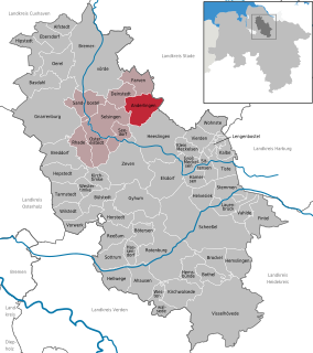
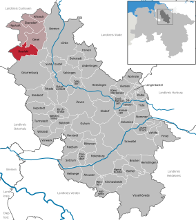
Zeven [] is a town in the district of Rotenburg, in Lower Saxony, Germany. It has a population of around 14,000. The nearest large towns are Bremerhaven, Bremen and Hamburg. It is situated approximately 22 km northwest of Rotenburg, and 40 km northeast of Bremen. Zeven is also the seat of the Samtgemeinde Zeven.
Nordholz is a village and a former municipality in the district of Cuxhaven, in Lower Saxony, Germany. Since 1 January 2015 it is part of the municipality Wurster Nordseeküste. It is situated approximately 25 km north of Bremerhaven, and 12 km southwest of Cuxhaven.
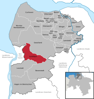
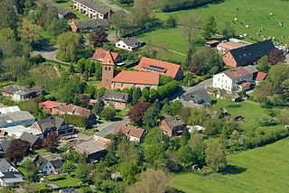
Schiffdorf is a municipality in the district of Cuxhaven, in Lower Saxony, Germany. It is situated at the eastern boundary of the Bremian city of Bremerhaven, and 35 kilometers south of Cuxhaven.

Bad Bederkesa is a village and a former municipality in the district of Cuxhaven, in Lower Saxony, Germany. Since 1 January 2015 it is part of the town of Geestland. It is situated approximately 20 km northeast of Bremerhaven, and 30 km southeast of Cuxhaven. Bad Bederkesa was the seat of the former Samtgemeinde Bederkesa, an administrative division consisting of several component municipalities.
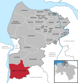
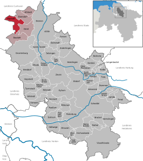
Hagen im Bremischen is a municipality in the district of Cuxhaven, in Lower Saxony, Germany. It is situated approximately 20 km south of Bremerhaven, and 35 km northwest of Bremen. Hagen was the seat of the former Samtgemeinde Hagen.

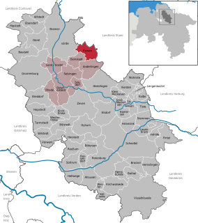
Gnarrenburg is a municipality in the district of Rotenburg, in Lower Saxony, Germany. It is situated approximately 15 km southwest of Bremervörde, and 40 km northeast of Bremen.

Tarmstedt is a municipality in the district of Rotenburg in Lower Saxony, Germany. It is situated approximately 25 km northwest of Rotenburg, and 25 km northeast of Bremen.

Alfstedt is a municipality in the district of Rotenburg, in Lower Saxony, Germany.
Anderlingen is a municipality in the district of Rotenburg, in Lower Saxony, Germany.
Basdahl is a municipality in the district of Rotenburg, in Lower Saxony, Germany.
Farven is a municipality in the district of Rotenburg, in Lower Saxony, Germany.

Hepstedt is a municipality in the district of Rotenburg, in Lower Saxony, Germany.
Hipstedt is a municipality in the district of Rotenburg, in Lower Saxony, Germany.

Lengenbostel is a municipality in the district of Rotenburg, in Lower Saxony, Germany.

Oerel is a municipality in the district of Rotenburg, in Lower Saxony, Germany.

Ostereistedt is a municipality in the district of Rotenburg, in Lower Saxony, Germany.

Westertimke is a municipality in the district of Rotenburg, in Lower Saxony, Germany.


