Vahlde

Last updated
Vahlde
Wappen Vahlde.gif
Coat of arms
Location of Vahlde within Rotenburg (Wümme) district
Vahlde in ROW.svgEbersdorfSeedorfKalbeBothelElsdorfHarburgVorwerk
Germany adm location map.svg
Red pog.svg
Vahlde
Lower Saxony location map.svg
Red pog.svg
Vahlde
Coordinates: 53°11′05″N09°37′52″E / 53.18472°N 9.63111°E / 53.18472; 9.63111 Coordinates: 53°11′05″N09°37′52″E / 53.18472°N 9.63111°E / 53.18472; 9.63111
Country Germany
State Lower Saxony
District Rotenburg (Wümme)
Municipal assoc. Fintel
Subdivisions3
Government
   Mayor Artur Behrens
Area
  Total17.53 km2 (6.77 sq mi)
Elevation
38 m (125 ft)
Population
 (2020-12-31) [1]
  Total683
  Density39/km2 (100/sq mi)
Time zone UTC+01:00 (CET)
  Summer (DST) UTC+02:00 (CEST)
Postal codes
27389
Dialling codes 04265, 04267
Vehicle registration ROW
Website www.fintel.de

Vahlde is a municipality in the district of Rotenburg, in Lower Saxony, Germany.

Contents

Description and history

In 1180 Vahlde was first mentioned in a document of the Prince-Bishop of Verden. In 1648 the Prince-Bishopric was transformed into the Principality of Verden, which was first ruled in personal union by the Swedish Crown – interrupted by a Danish occupation (1712–1715) – and from 1715 on by the Hanoverian Crown. In 1807 the ephemeric Kingdom of Westphalia annexed the Principality, before France annexed it in 1810. In 1813 the Principality was restored to the Electorate of Hanover, which – after its upgrade to the Kingdom of Hanover in 1814 – incorporated the Principality in a real union and the Princely territory, including Vahlde, became part of the new Stade Region, established in 1823.

Coat of arms

The coat of arms shows the silhouettes of three flying birds, symbolising the three subdivisions of the municipality. The blue lines under them, uniting in the bottom center, show the unification of the rivers Fintau and Ruschwede near the main village Vahlde.

Related Research Articles

Bothel, Lower Saxony Place in Lower Saxony, Germany

Bothel is a municipality in the district of Rotenburg, Germany in the Stade Geest region of central Lower Saxony. It has 2,500 inhabitants. Bothel was founded by workers of the nearby Trochel Forest. The name developed from Borstel which is Old Saxon and means "little woods".

Fintel Place in Lower Saxony, Germany

Fintel is a municipality in the district of Rotenburg, in Lower Saxony, Germany and has about 3,000 inhabitants. It is located on the rivers Fintau and Ruschwede.

Sottrum Place in Lower Saxony, Germany

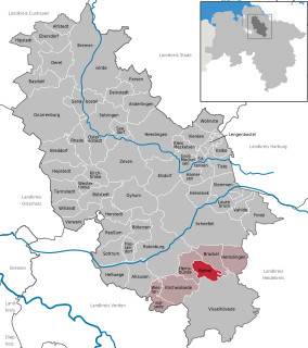
Sottrum is a municipality in the district of Rotenburg, in Lower Saxony, Germany. It is situated approximately 11 km west of Rotenburg, and 30 km east of Bremen.

Dörverden Place in Lower Saxony, Germany

Dörverden is a municipality in the district of Verden, in Lower Saxony, Germany. It is situated on the right bank of the Weser, approx. 8 km south of Verden, and 40 km southeast of Bremen.

Kirchlinteln Place in Lower Saxony, Germany

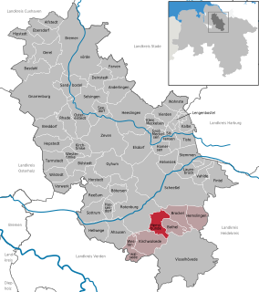
Kirchlinteln is a municipality in the district of Verden, in Lower Saxony, Germany. Its central village is situated approximately 6 km east of Verden, and 40 km southeast of Bremen. It is surrounded by the Linteln Geest which is dominated by woods, hills, heath and small villages. Within the last decades many people decided to build their homes in Kirchlinteln or to buy old cottages in this region because of its picturesque landscape and its location close to the cities of Bremen and Hanover.

Langwedel Place in Lower Saxony, Germany

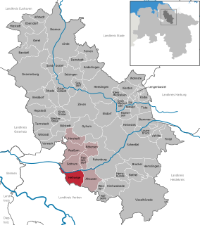
Langwedel is a municipality in the district of Verden, in Lower Saxony, Germany. It is situated on the right bank of the Weser, approx. 7 km northwest of Verden, and 30 km southeast of Bremen.

Oyten Place in Lower Saxony, Germany

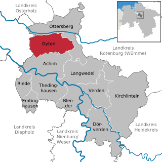
Oyten is a municipality in the district of Verden, in Lower Saxony, Germany. It is situated approximately 20 km northwest of Verden, and 15 km east of Bremen.

Bötersen Place in Lower Saxony, Germany

Bötersen is a municipality in the district of Rotenburg, in Lower Saxony, Germany.

Brockel Place in Lower Saxony, Germany

Brockel is a municipality in the district of Rotenburg, in Lower Saxony, Germany.

Hassendorf Place in Lower Saxony, Germany

Hassendorf is a municipality in the district of Rotenburg, in Lower Saxony, Germany.

Hellwege Place in Lower Saxony, Germany

Hellwege is a municipality in the district of Rotenburg, in Lower Saxony, Germany.

Helvesiek Place in Lower Saxony, Germany

Helvesiek is a municipality in the district of Rotenburg, in Lower Saxony, Germany.

Hemsbünde Place in Lower Saxony, Germany

Hemsbünde is a municipality in the district of Rotenburg, in Lower Saxony, Germany.

Hemslingen Place in Lower Saxony, Germany

Hemslingen is a municipality in the district of Rotenburg, in Lower Saxony, Germany.

Horstedt Place in Lower Saxony, Germany

Horstedt is a municipality in the district of Rotenburg, in Lower Saxony, Germany.

Kirchwalsede Place in Lower Saxony, Germany

Kirchwalsede is a municipality in the district of Rotenburg, in Lower Saxony, Germany.

Lauenbrück Place in Lower Saxony, Germany

Lauenbrück is a municipality in the district of Rotenburg, in Lower Saxony, Germany.

Reeßum Place in Lower Saxony, Germany

Reeßum is a municipality in the district of Rotenburg, in Lower Saxony, Germany.

Stemmen Place in Lower Saxony, Germany

Stemmen is a municipality in the district of Rotenburg, in Lower Saxony, Germany.

Westerwalsede Place in Lower Saxony, Germany

Westerwalsede is a municipality in the district of Rotenburg, in Lower Saxony, Germany.

References