This article needs additional citations for verification .(March 2015) (Learn how and when to remove this template message) |
| Sandbostel | ||
|---|---|---|
| ||
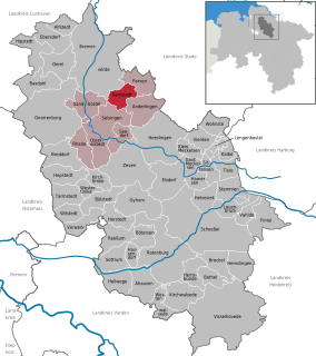
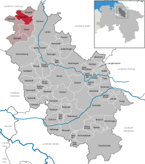
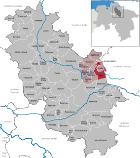
 Sandbostel Location of Sandbostel within Rotenburg (Wümme) district   | ||
| Coordinates: 53°24′34″N09°07′50″E / 53.40944°N 9.13056°E Coordinates: 53°24′34″N09°07′50″E / 53.40944°N 9.13056°E | ||
| Country | Germany | |
| State | Lower Saxony | |
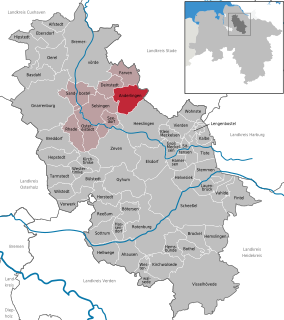
| District | Rotenburg (Wümme) | |
| Municipal assoc. | Selsingen | |
| Government | ||
| • Mayor | Johann Gerken (WGO) | |
| Area | ||
| • Total | 31.54 km2 (12.18 sq mi) | |
| Elevation | 8 m (26 ft) | |
| Population (2015-12-31) [1] | ||
| • Total | 822 | |
| • Density | 26/km2 (68/sq mi) | |
| Time zone | CET/CEST (UTC+1/+2) | |
| Postal codes | 27446 | |
| Dialling codes | 04284, 04764 | |
| Vehicle registration | ROW | |
| Website | www.selsingen.de | |

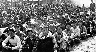
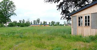
Sandbostel is a municipality in Lower Saxony (Niedersachsen) in northwestern Germany, 43 km north-east of Bremen, 60 km west of Hamburg. It is part of the Samtgemeinde Selsingen. In 2013, it had 830 inhabitants.

Lower Saxony is a German state (Land) situated in northwestern Germany. It is the second-largest state by land area, with 47,624 km2 (18,388 sq mi), and fourth-largest in population among the 16 Länder federated as the Federal Republic of Germany. In rural areas, Northern Low Saxon and Saterland Frisian are still spoken, but the number of speakers is declining.

Germany, officially the Federal Republic of Germany, is a country in Central and Western Europe, lying between the Baltic and North Seas to the north, and the Alps to the south. It borders Denmark to the north, Poland and the Czech Republic to the east, Austria and Switzerland to the south, France to the southwest, and Luxembourg, Belgium and the Netherlands to the west.

Hamburg is the second-largest city in Germany with a population of over 1.8 million.