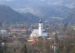
Heinersreuth

Last updated
Heinersreuth
Heinersreuther Rathaus.jpg
Town hall
Wappen von Heinersreuth.svg
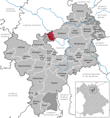
Location of Heinersreuth within Bayreuth district
Heinersreuth in BT.svgPrüllWarmensteinacher Forst-NordWaidacher ForstWaidacher ForstNeubauer Forst-NordHeinersreuther ForstGlashüttener ForstForst Neustädtlein am ForstGemeindefreies Gebiet FichtelbergHaagMistelbachGlashüttenPegnitzFichtelbergBischofsgrüner ForstPottenstein
Germany adm location map.svg
Red pog.svg
Heinersreuth
Bavaria location map.svg
Red pog.svg
Heinersreuth
Coordinates: 49°58′4.54″N11°31′54.82″E / 49.9679278°N 11.5318944°E / 49.9679278; 11.5318944
Country Germany
State Bavaria
Admin. region Oberfranken
District Bayreuth
Subdivisions18 Ortsteile
Government
   Mayor (202026) Simone Kirschner [1] (CSU)
Area
  Total14.63 km2 (5.65 sq mi)
Elevation
340 m (1,120 ft)
Population
 (2023-12-31) [2]
  Total3,790
  Density260/km2 (670/sq mi)
Time zone UTC+01:00 (CET)
  Summer (DST) UTC+02:00 (CEST)
Postal codes
95500
Dialling codes 0921
Vehicle registration BT
Website www.heinersreuth.de

Heinersreuth is a municipality in the district of Bayreuth in Bavaria in Germany.

People

Related Research Articles

<span class="mw-page-title-main">Oberaudorf</span> Municipality in Bavaria, Germany

Oberaudorf is a municipality in the district of Rosenheim in Bavaria, Germany. It lies on the river Inn.
<span class="mw-page-title-main">Baar, Bavaria</span> Municipality in Bavaria, Germany

Baar is a municipality in Aichach-Friedberg district, in Bavaria, southern Germany.

<span class="mw-page-title-main">Roding, Germany</span> Town in Bavaria, Germany

Roding is a town in the district of Cham, in Bavaria, Germany, near the Czech border.

<span class="mw-page-title-main">Pegnitz (town)</span> Town in Bavaria, Germany

Pegnitz is a town in the Bayreuth district in Upper Franconia, Bavaria, Germany, with a population of approximately 15,000 inhabitants. It is also the source of the river Pegnitz. The city Bayreuth is about 27 km to the north.

<span class="mw-page-title-main">Ergolding</span> Municipality in Bavaria, Germany

Ergolding is a municipality in the district of Landshut, in Bavaria, Germany. It is situated on the left bank of the Isar, 5 km northeast of Landshut.

<span class="mw-page-title-main">Thannhausen</span> Town in Bavaria, Germany

Thannhausen is a town in the district of Günzburg, in Bavaria, Germany. It is situated on the river Mindel, 24 kilometres (15 mi) southeast of Günzburg, and 33 kilometres (21 mi) west of Augsburg.

<span class="mw-page-title-main">Eggolsheim</span> Municipality in Bavaria, Germany

Eggolsheim is a municipality in the district of Forchheim in Bavaria in Germany.

<span class="mw-page-title-main">Wörnitz</span> Municipality in Bavaria, Germany

Wörnitz is a municipality in the district of Ansbach, in Bavaria, Germany. It is situated on the river Wörnitz, west of Ansbach.

<span class="mw-page-title-main">Adelshofen, Middle Franconia</span> Municipality in Bavaria, Germany

Adelshofen is a municipality in the district of Ansbach in Bavaria in Germany.

<span class="mw-page-title-main">Bechhofen</span> Municipality in Bavaria, Germany

Bechhofen is a market town and municipality in the district of Ansbach in Bavaria in Germany.

<span class="mw-page-title-main">Petersaurach</span> Municipality in Bavaria, Germany

Petersaurach is a municipality in the district of Ansbach in Bavaria in Germany.

<span class="mw-page-title-main">Schnelldorf</span> Municipality in Bavaria, Germany

Schnelldorf is a municipality in the district of Ansbach in Mittelfranken in Bavaria in Germany. It neighbours to Feuchtwangen, Wörnitz and Wettringen (Mittelfranken) in Bavaria and Rot am See, Wallhausen, Baden-Württemberg, Satteldorf and Kreßberg

<span class="mw-page-title-main">Steinsfeld</span> Municipality in Bavaria, Germany

Steinsfeld is a municipality in the district of Ansbach in Bavaria in Germany.

<span class="mw-page-title-main">Heinrichsthal</span> German community

Heinrichsthal is a community in the Aschaffenburg district in the Regierungsbezirk of Lower Franconia (Unterfranken) in Bavaria, Germany. It is part of the Verwaltungsgemeinschaft of Heigenbrücken.

<span class="mw-page-title-main">Wald, Upper Palatinate</span> Municipality in Bavaria, Germany

Wald is a municipality in the district of Cham in Bavaria in Germany.

<span class="mw-page-title-main">Heroldsbach</span> Municipality in Bavaria, Germany

Heroldsbach is a municipality in the district of Forchheim in Bavaria in Germany.

<span class="mw-page-title-main">Ködnitz</span> Municipality in Bavaria, Germany

Ködnitz is a municipality in the district of Kulmbach in Bavaria in Germany.

<span class="mw-page-title-main">Leuchtenberg</span> Municipality in Bavaria, Germany

Leuchtenberg is a municipality in the district of Neustadt an der Waldnaab in Bavaria, Germany, essentially a suburb of nearby Weiden in der Oberpfalz, and a larger historical region in the Holy Roman Empire governed by the Landgraves of Leuchtenberg.

<span class="mw-page-title-main">Oberstaufen</span> Municipality in Bavaria, Germany

Oberstaufen is a municipality in the district of Oberallgäu in Bavarian Swabia, Germany, situated on the B 308 road from Lindau to Immenstadt.

<span class="mw-page-title-main">Brannenburg</span> Municipality in Bavaria, Germany

Brannenburg is a municipality in the district of Rosenheim in Bavaria in Germany. There is a railway station located in Brannenburg.

References