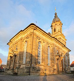
Bindlach

Last updated
Bindlach
Bindlach Bartholomauskirche D-4-72-119-9 .JPG
Church of Saint Bartholomew
Wappen Bindlach.svg
Location of Bindlach within Bayreuth district
Bindlach in BT.svgPrüllWarmensteinacher Forst-NordWaidacher ForstWaidacher ForstNeubauer Forst-NordHeinersreuther ForstGlashüttener ForstForst Neustädtlein am ForstGemeindefreies Gebiet FichtelbergHaagMistelbachGlashüttenPegnitzFichtelbergBischofsgrüner ForstPottenstein
Germany adm location map.svg
Red pog.svg
Bindlach
Bavaria location map.svg
Red pog.svg
Bindlach
Coordinates: 49°58′N11°36′E / 49.967°N 11.600°E / 49.967; 11.600 Coordinates: 49°58′N11°36′E / 49.967°N 11.600°E / 49.967; 11.600
Country Germany
State Bavaria
Admin. region Oberfranken
District Bayreuth
Subdivisions7 Ortsteile
Government
   Mayor (202026) Christian Brunner [1] (CSU)
Area
  Total37.60 km2 (14.52 sq mi)
Elevation
362 m (1,188 ft)
Population
 (2020-12-31) [2]
  Total7,320
  Density190/km2 (500/sq mi)
Time zone UTC+01:00 (CET)
  Summer (DST) UTC+02:00 (CEST)
Postal codes
95463
Dialling codes 09208
Vehicle registration BT
Website www.bindlach.de

Bindlach is a municipality in the district of Bayreuth in Upper Franconia in Bavaria, Germany. The town is adjacent immediately north of the town of Bayreuth. The population count of December 2006 was 7197 inhabitants.

Contents

History

The name Bindlach is derived from the Slavic Pnetluky containing the verb tlouki which means "to chop". Thus Bindlach can be translated with "Village of the people chopping trunks" [3] as the village is situated in an area rich with woods and a clearance had to be created prior to settlement.

More recent research traces the name back to the Old Saxon word Binutlaka meaning "Small, standing lake overgrown with juncus". Charlemagne supposedly resettled deported Saxons in the area.

Archaeological excavations have produced Celtic leftovers as well as remains from the Urnfield culture and the Bronze Age giving proof of settlement as early as 1300 BC.

The first official mentioning in modern times occurred in a private charter [4] on April 6, 1178 as bintlvke.

Being part of the Prussian Principality of Bayreuth, Bindlach was ceded to France in 1807 following the Treaties of Tilsit. In 1810 it became part of the Kingdom of Bavaria. The town as it is known today was formed in 1818.

Culture

Bindlach's Protestant church St. Bartholomew was built in the baroque style between 1766 and 1768 by Carl Phillip von Gontard and Rudolf Heinrich Richter. The altar with integrated pulpit and the organ are of extraordinary beauty.

Economy

The German clothing discount store chain NKD (retailer) is headquartered in Bindlach.

Infrastructure

Bindlach is situated on the Bayreuth–Neuenmarkt-Wirsberg line and is served by local trains. The Autobahn A9 crosses through Bindlach at the western edge of the old part of the town, separating it from the newer parts built in the 1950s, 60s and 70s. Bundesstraße 2 runs through the old part of the town linking Bayreuth and Bad Berneck. Bayreuth Airport is on top of the hills on the eastern side of town; despite the name on Bindlach territory.

Military

Overlooking Bindlach from the east, a large American military base was maintained on top of the hills east of Bindlach (Bindlacher Berg). Its official name was Christensen Barracks but it was jocularly called The Rock by the soldiers stationed there. The main function of the base was securing the borders to the GDR and Czechoslovakia, both borders being only 70 km (43 mls) away. This was home to the 1st Squadron, 2nd ACR, (2nd Cavalry Regiment (United States)) from the late 1950s into the 1990s. The base closed down in the early 1990s after German reunification and the opening of the borders to the east.

Sources

  1. Liste der ersten Bürgermeister/Oberbürgermeister in kreisangehörigen Gemeinden, Bayerisches Landesamt für Statistik, 15 July 2021.
  2. "Tabellenblatt "Daten 2", Statistischer Bericht A1200C 202041 Einwohnerzahlen der Gemeinden, Kreise und Regierungsbezirke". Bayerisches Landesamt für Statistik (in German). June 2021.
  3. Haas, Helmut: Bindlacher Chronik, Bindlach 1983, herausgegeben von der Gemeinde Bindlach anlässlich der Rathauseinweihung im Jahre 1983 und der 800-Jahr-Feier.
  4. Urkunde HU Bamberg 335 - Hauptstaatsarchiv München

Related Research Articles

<span class="mw-page-title-main">Kemnath</span> Town in Bavaria, Germany

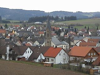
Kemnath is a small town in the district of Tirschenreuth, in Bavaria, Germany. It is situated near the Fichtelgebirge, 24 km southeast of Bayreuth. The town's motto is "das Tor zur Oberpfalz," which translates into English as "The Door to the Upper Palatinate."

<span class="mw-page-title-main">Tirschenreuth</span> Town in Bavaria, Germany

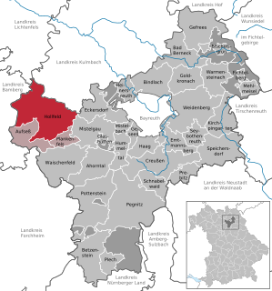
Tirschenreuth is the capital city of the district of Tirschenreuth. It is located in the northeast of Bavaria, very close to the Czech-Bavarian border.

<span class="mw-page-title-main">Geroldsgrün</span> Municipality in Hof, Bavaria, Germany

Geroldsgrün is a municipality in the Hof district of Bavaria, Germany.

<span class="mw-page-title-main">Marktredwitz</span> Town in Bavaria, Germany

Marktredwitz is a town in the district of Wunsiedel, in Bavaria, Germany, close to the Czech border. It is situated 22 km west of Cheb, 50 km east of Bayreuth and 50 km south of Hof/Saale. Marktredwitz station is at the junction of the Nuremberg–Cheb railway and the Munich–Hof railway.

<span class="mw-page-title-main">Dorfen</span> River in Germany

Dorfen is a town in the district of Erding, in Bavaria, Germany. It is situated 50 km east of Munich and 29 km south of Landshut.

<span class="mw-page-title-main">Bad Berneck im Fichtelgebirge</span> Place in Bavaria, Germany

Bad Berneck is a spa town in the district of Bayreuth, in Bavaria, Germany. It is situated on the White Main river, in the Fichtelgebirge mountains, 13 km northeast of Bayreuth. Its official title is Bad Berneck im Fichtelgebirge. It lies in the northern part of the Bavarian province of Upper Franconia. Since 1857 it has been a spa, initially based on its climate and whey products. In 1930 it became a Kneipp spa and, in 1950, a Kneipp health spa.

<span class="mw-page-title-main">Betzenstein</span> Town in Bavaria, Germany

Betzenstein is a town in the district of Bayreuth, in Bavaria, Germany. It is situated in the Franconian Switzerland, 35 km northeast of Nuremberg.

<span class="mw-page-title-main">Bischofsheim in der Rhön</span> Town in Bavaria, Germany

Bischofsheim in der Rhön is a town in the district Rhön-Grabfeld, in Bavaria, Germany. It is situated in the Rhön Mountains, 29 km southeast of Fulda.

<span class="mw-page-title-main">Creußen</span> Town in Bavaria, Germany

Creußen is a town in the district of Bayreuth in Bavaria, Germany. It is situated on the Red Main river, 13 km southeast of Bayreuth.

<span class="mw-page-title-main">Eschenbach in der Oberpfalz</span> Town in Bavaria, Germany

Eschenbach in der Oberpfalz is a town in the district of Neustadt an der Waldnaab, in Bavaria, Germany. It is situated 25 km west of Neustadt an der Waldnaab, 30 km west of Weiden in der Oberpfalz, and 28 km southeast of Bayreuth. It is also about 1 km north of the large US military base in Grafenwöhr. The church is the most popular site, the carving dedicated to the daughter-in-law of Charles XI of Sweden, Anna Svetl, who drowned in the Rhine in 1752, the carving reading, "Here Lies our Mother: Anna Svetl who died in the waters of the Rhine in the year seventeen hundred and fifty two. Even when the Death angel came for her, she said her final words, "A man shall perish but his memories shant for the rest of the Earth" Bless Her."

<span class="mw-page-title-main">Gefrees</span> Town in Bavaria, Germany

Gefrees is a town in the district of Bayreuth, in Bavaria, Germany. It is situated in the Fichtelgebirge, 21 km northeast of Bayreuth. It was the site of a battle during the Napoleonic Wars.

<span class="mw-page-title-main">Goldkronach</span> Town in Bavaria, Germany

Goldkronach is a town in the district of Bayreuth, in Bavaria, Germany. It is situated near the Fichtelgebirge, 12 km northeast of Bayreuth.

<span class="mw-page-title-main">Hollfeld</span> Town in Bavaria, Germany

Hollfeld is a town in the district of Bayreuth, in Bavaria, Germany.

<span class="mw-page-title-main">Ludwigsstadt</span> Town in Bavaria, Germany

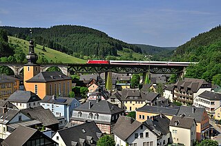
Ludwigsstadt is a town in the district of Kronach, in the Upper Franconian region of Bavaria, Germany.

<span class="mw-page-title-main">Neustadt am Kulm</span> Town in Bavaria, Germany

Neustadt am Kulm is a municipality in the district of Neustadt an der Waldnaab, in Bavaria, Germany. It is situated 29 km northwest of Weiden in der Oberpfalz, and 23 km southeast of Bayreuth. Neustadt am Kulm is situated directly west of the Rauher Kulm.

<span class="mw-page-title-main">Waischenfeld</span> Town in Bavaria, Germany

Waischenfeld is a town in the district of Bayreuth, in Bavaria, Germany. It is situated in Franconian Switzerland, 20 km southwest of Bayreuth.

<span class="mw-page-title-main">Eckersdorf</span> Municipality in Bavaria, Germany

Eckersdorf is a municipality in the district of Bayreuth in Bavaria in Germany.

<span class="mw-page-title-main">Speichersdorf</span> Municipality in Bavaria, Germany

Speichersdorf is a municipality in the district of Bayreuth in Bavaria in Germany. It is situated near the Fichtelgebirge, 18 km eastern of Bayreuth. It has a population of about 6,200.

<span class="mw-page-title-main">Eching am Ammersee</span> Municipality in Bavaria, Germany

Eching am Ammersee is a municipality in the district of Landsberg in Bavaria in Germany. It has a size of 6.15km2.

<span class="mw-page-title-main">Pfronten</span> Municipality in Bavaria, Germany

Pfronten is a municipality in the district of Ostallgäu in Bavaria in Germany.